Galleria foto
- Lenght
- 92.90 km
- Ascent elevation gain
- 7015 m
- Descent elevation loss
- 6573 m
- Difficulty
- Difficult Hiking
- Itinerary index
- Yes
Informazioni
Punto di partenza
Cursolo
28827 Valle Cannobina VB
Italy
Punto di arrivo
Campello Monti
28897 Campello Monti VB
Italy
Come arrivare
Descrizione
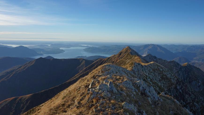
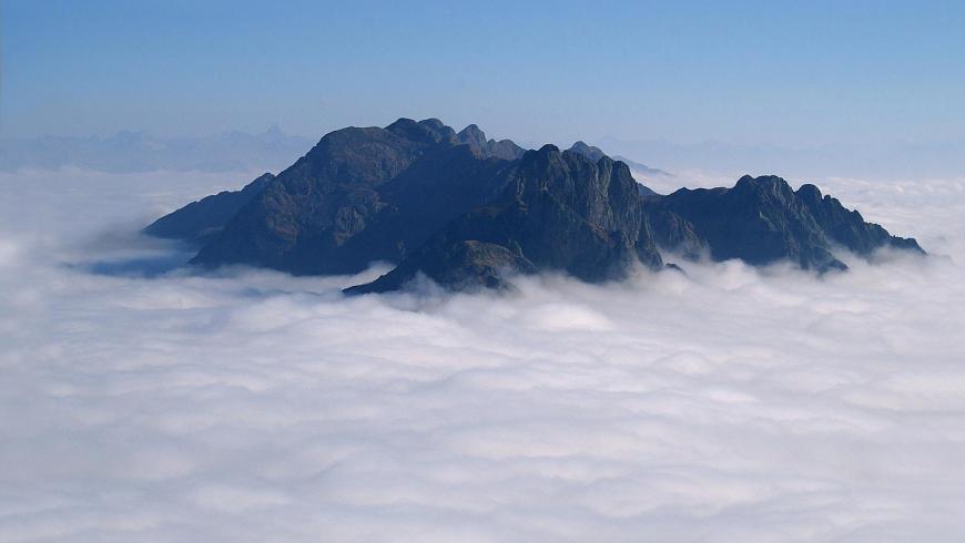
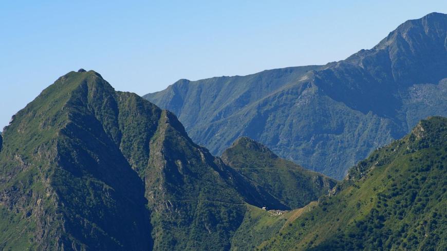
The Via Geoalpina of the Val Grande National Park is part of an international project that aims at spreading knowledge about earth sciences, such as geology, geomorphology, hydrology, natural hazards or the exploitation of stone through marked trails, which arouse the interest of tourists and hikers about the history of the formation of the Alps and the secrets of the earth. The itinerary strengthens and enhances, on the one hand, the network of historical and environmental routes that innerve the hiking system in the area between Verbano-Cusio-Ossola and Upper Novara and, on the other hand, the north-eastern ridge of the Sesia Val Grande Unesco Global Geopark, which crosses the territory of the National Park and the surrounding areas from the Italian-Swiss border to Campello Monti in Strona Valley. Walking along the Via Geoalpina, in addition to enjoying an extraordinary variety of landscapes and mountain environments, the hiker will also find two important sections of geological interest (equipped with didactic panels), such as the Pogallo Line, in the homonymous valley, and the so-called "Serie dei Laghi" along the ridge of the Cadorna Line from Pian Cavallo to Zeda. The itinerary then joins both the departure point of Falmenta-Gurro and the arrival point of Campello Monti on the legs of the Great Crossing of the Alps in the Piedmont region and can represent an alternative of extraordinary interest to reach Lake Maggiore from Sesia Valley.
Accessible to people with disabilities
Dettagli
Profilo altimetrico
Dati tecnici
- Code
- VGP
- Classification
- Provincial - Mid and Low Altitude
- Cell phone coverage
Partial
- Country
- Italy
- Region
- Piemonte
- Province
- Verbania
- Devotional relevance
- No
- Historical relevance
- No
- Ultima data di aggiornamento
- 15/12/2023
Tappe
Tappe attività
-
-
1Via geoalpina: leg 1 cursolo ? refuge of pian vadàLunghezza19.40 kmTempo7 hoursDifficoltàHiking
-
1AVia geoalpina: leg 1a piancavallo - pian vadàLunghezza13.90 kmTempo4 hours 10 minutesDifficoltàHiking
-
2Via geoalpina: leg 2 refuge of pian vadà - alpe curgeiLunghezza8.50 kmTempo3 hoursDifficoltàDifficult Hiking
-
3Via geoalpina: leg 3 alpe curgei - alpe pian di boitLunghezza10.70 kmTempo4 hours 15 minutesDifficoltàHiking
-
4Via geoalpina: leg 4 alpe pian di boit - alpe scarediLunghezza9.50 kmTempo6 hours 45 minutesDifficoltàHiking
-
5Via geoalpina: leg 5 alpe scaredi - alpe la colmaLunghezza12.10 kmTempo7 hours 45 minutesDifficoltàHiking
-
6Via geoalpina: leg 6 alpe la colma ? vogognaLunghezza13.10 kmTempo4 hoursDifficoltàHiking
-
7Via geoalpina: leg 7 vogogna - campello montiLunghezza19.60 kmTempo7 hours 30 minutesDifficoltàHiking