Galleria foto
- Lenght
- 10.70 km
- Tempo
- 4 hours 15 minutes
- Tappa
Elenco risultati
- Ascent elevation gain
- 675 m
- Descent elevation loss
- 885 m
- Difficulty
- Hiking
- Itinerary index
- No
Informazioni
Punto di partenza
Alpe Curgei
28817 Miazzina VB
Italy
Punto di arrivo
Alpe Pian di Boit
28817 Miazzina VB
Italy
Come arrivare
Only on foot
Descrizione
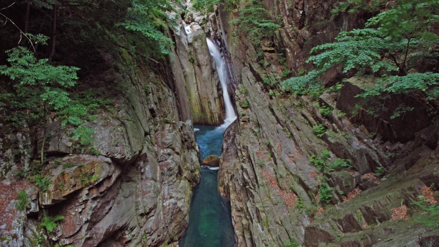
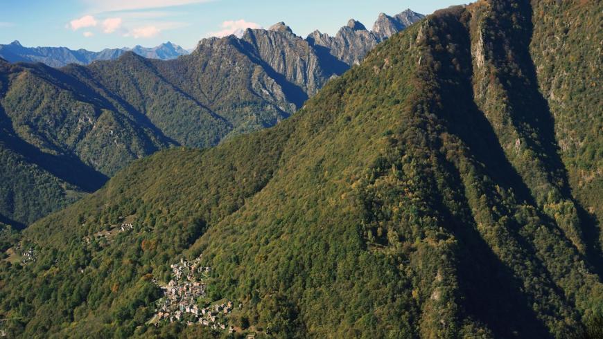
From the bivouac of Alpe Curgei, go down towards Cicogna along trail VBAP06, a track that is not always visible. From Curgei, at an altitude of 1338 m, to Varola, at an altitude of 921 m, the trail runs along the ridge that closes the ancient glacial formation of the Fornale of Val Pobbiè to the south-west, moving mainly through the beech forest and crossing pastures and mowed meadows that once opened around mountain pasture lands and short fallow meadows, which have now become wild and disappear, populated by fern, broom and birch. From Varola, the trail descends again along the ridge to an altitude of about 750 m, then it turns left southwards and reaches, with an easy crossing, Corte di Premiago (695 m). From here, along a steep mule track, you lose altitude in a natural watershed and, after going past a hump, you reach the gorge of the Pogallo stream, which you cross at the Ponte della Buia (463 m). Beyond the bridge, the trail climbs up steeply on a mule track that preserves, for long sections, the ancient stepped cobblestones and reaches, a little downstream of the village of Cicogna, trail VBP00 that climbs up to the gorge of the Pogallo stream, from Cicogna to Pogallo. Take trail VBP00 to the right, towards Pogallo, along the majestic Sutermeister road, a historic stone-paved road, which runs high above the stream on the western side of the valley, passing a lot of small valleys, gullies and ravines, supported by dry stone walls and, in some sections, cantilevered on the gorge. With the continuous up and down of about 150 m, in an hour and a half you can reach the wide meadow of Pogallo. After crossing the meadow, before reaching the village, follow trail VBAP12 to the right along the edge of the meadow until you take the stone mule track that, hidden by the forest, goes down steeply towards the gorge of the Ghina stream you can cross on a stone bridge. The trail goes up alternating orographic left and right sections, crossing the pastures of C.le dei Galli, Alpe Preda di Qua and Alpe Preda di Là, up to Alpe Pian di Boit (1128 m), where the homonymous bivouac of the Park is located, which concludes the leg of the itinerary. The bivouac, unattended and always open, provides about 8 beds on wood flooring in the area below the roof, it is heated with a fireplace and has a water fountain in the pertinent area. For information, please call the Park Authority at 0324/87540.
Recommended period
Accessible to people with disabilities
Support points
Bivouac of Curgei– Hostel in Cicogna – Bivouac of Pian di Boit
Interest points
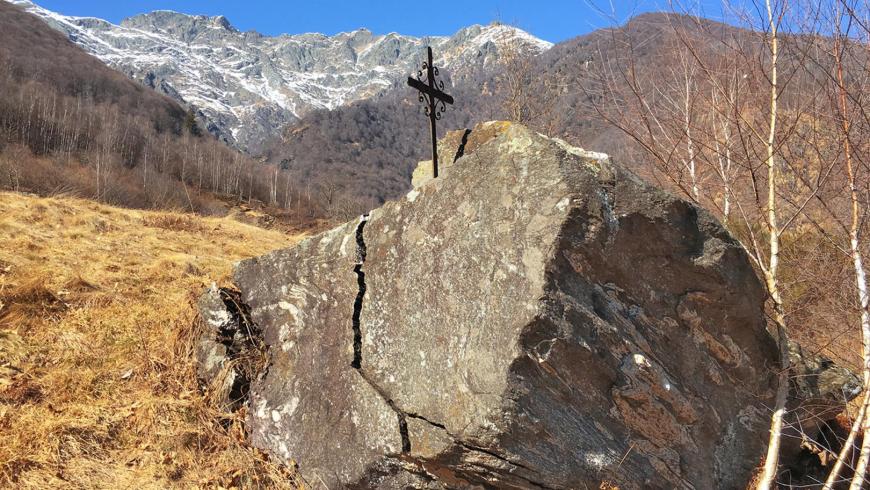
Between Cicogna and Pogallo the itinerary is equipped with didactic panels dealing with geological and naturalistic themes. The geological route, known as the “Pogallo Line”, represents a deeper exploration of the “Via GeoAlpina”. The route follows the Sutermeister Trail and mostly develops within metamorphic rocks of the geological unit called Strona-Ceneri area. It consists of two types of paragneiss, metamorphic rocks of sedimentary origin: the Gneiss Minuti (stop 1) and the Gneiss Ceneri (stop 2), both with Cambrian deposition age. They are interspersed with orthogneiss lenses (stop 3) deriving from granites intruded in the Ordovician period. All these rocks were transformed, around 340 million years ago, by the metamorphism associated with the Hercynian orogenesis when they descended to depths of at least 20 km and were affected by temperatures above 500° C. In the following Permian period (270 Mya) a strong magmatic activity led to the infiltration of granites into these formations, which were not involved in the events that later (about 90 Mya) led to the formation of the Alps. After crossing the wooden walkway (stop 4) the mylonites emerge: they are rocks produced by friction during the movement that took place along the Pogallo fault. In the last section before Pogallo, you cross kinzigiti (stop 5), rocks which are also metamorphic, nevertheless they do not belong to the “Serie dei Laghi”, but to the adjacent Ivrea-Verbano area.
Dettagli
Profilo altimetrico
Dati tecnici
- Code
- VGP
- Classification
- Provincial - Mid and Low Altitude
- Cell phone coverage
Partial/Not available
- Country
- Italy
- Region
- Piemonte
- Province
- Verbania
- Devotional relevance
- No
- Historical relevance
- No
- Ultima data di aggiornamento
- 15/12/2023
Altre info
Accommodation facilities

Tappe
Tappe attività
-
-
1Via geoalpina: leg 1 cursolo ? refuge of pian vadàLunghezza19.40 kmTempo7 hoursDifficoltàHiking
-
1AVia geoalpina: leg 1a piancavallo - pian vadàLunghezza13.90 kmTempo4 hours 10 minutesDifficoltàHiking
-
2Via geoalpina: leg 2 refuge of pian vadà - alpe curgeiLunghezza8.50 kmTempo3 hoursDifficoltàDifficult Hiking
-
3Via geoalpina: leg 3 alpe curgei - alpe pian di boitLunghezza10.70 kmTempo4 hours 15 minutesDifficoltàHiking
-
4Via geoalpina: leg 4 alpe pian di boit - alpe scarediLunghezza9.50 kmTempo6 hours 45 minutesDifficoltàHiking
-
5Via geoalpina: leg 5 alpe scaredi - alpe la colmaLunghezza12.10 kmTempo7 hours 45 minutesDifficoltàHiking
-
6Via geoalpina: leg 6 alpe la colma ? vogognaLunghezza13.10 kmTempo4 hoursDifficoltàHiking
-
7Via geoalpina: leg 7 vogogna - campello montiLunghezza19.60 kmTempo7 hours 30 minutesDifficoltàHiking