Galleria foto
- Lenght
- 8.50 km
- Tempo
- 3 hours
- Tappa
Elenco risultati
- Ascent elevation gain
- 370 m
- Descent elevation loss
- 730 m
- Difficulty
- Difficult Hiking
- Itinerary index
- No
Informazioni
Punto di partenza
Rifugio di Pian Vadà
28812 Aurano VB
Italy
Punto di arrivo
Alpe Curgei
28817 Miazzina VB
Italy
Come arrivare
Only on foot
Descrizione
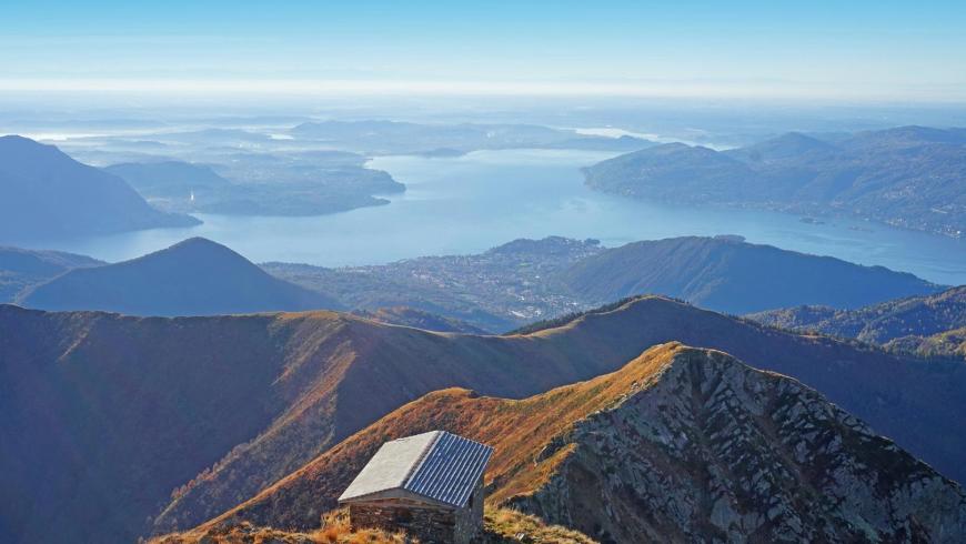
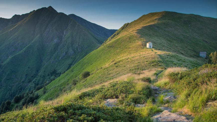
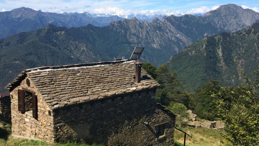
From the bivouac of Pian Vadà (1711 m), go up towards Monte Zeda along trail VBAR20, which runs along the Cadorna military road up to an altitude of 1701 m and then, on a clearly visible track, it follows the ridge. At an altitude of 1701 m, after about forty minutes of walking, take trail VBAR03A, which branches to the left and cuts the south-eastern side of Monte Zeda. Follow it, gaining elevation until joining trail VBAR03 along the watershed ridge between Intrasca Valley and Val Pogallo, just before Pizzo Marona (2000 m). Follow trail VBAR03 along the ridge until you reach Pizzo Marona (2050 m), the highest point of the itinerary, and continue further downhill to get to the homonymous chapel. Continue along trail VBAR03, go down, again along the ridge, towards the southern side up to an altitude of 2006 m; go around Cima Cugnacorta, running along the eastern side facing Intrasca Valley. You are again on the ridge at Colle della Forcola (1519 m); cross the western side of Monte Todano and, at the end of the most alpine section of the leg, you get to the pass of Pian Cavallone and the homonymous chapel (1546 m). The chapel represents an important crossroads of the trails that climb the orographic left side of Intrasca Valley and a key access to the Val Grande Park through Val Pogallo. Go on downhill along the ridge, again along trail VBAR03, until you reach the junction for trail VBAP06, at the foot of the climb that leads to Pizzo Pernice. From the ridge, take trail VBAP06 to the right, which goes down towards Cicogna (hamlet of the municipality of Cossogno and starting point of SP No. 90 Rovegro-Cicogna). After 10 minutes of slope, on a clearly visible track into a beech forest, you reach Alpe Curgei and the homonymous bivouac, managed by the Pro Loco Association of Miazzina. The bivouac, unattended and always open, provides about 8 beds, it is heated with a wood-burning stove and has a fountain in the pertinent area. For information call 0323/494101. Alternatively, in Cappella del Pian Cavallone, you can go down along trail VBAR07 to the CAI refuge in Pian Cavallone. The facility offers about 25 beds in rooms for 4-6-8 people, refreshment area, electricity supplied by a generator. It is open every weekend, on public holidays from June to October and every day from the last week of July to the end of August. For information, call the refuge (0323 407482) or the manager, see the references on the CAI website www.caiverbano.it
Recommended period
Accessible to people with disabilities
Support points
Bivouac of Pian Vadà– Bivouac of Curgei
Dettagli
Profilo altimetrico
Dati tecnici
- Code
- VGP
- Classification
- Provincial - Mid and Low Altitude
- Cell phone coverage
Partial
- Country
- Italy
- Region
- Piemonte
- Province
- Verbania
- Devotional relevance
- No
- Historical relevance
- No
- Ultima data di aggiornamento
- 15/12/2023
Altre info

Tappe
Tappe attività
-
-
1Via geoalpina: leg 1 cursolo ? refuge of pian vadàLunghezza19.40 kmTempo7 hoursDifficoltàHiking
-
1AVia geoalpina: leg 1a piancavallo - pian vadàLunghezza13.90 kmTempo4 hours 10 minutesDifficoltàHiking
-
2Via geoalpina: leg 2 refuge of pian vadà - alpe curgeiLunghezza8.50 kmTempo3 hoursDifficoltàDifficult Hiking
-
3Via geoalpina: leg 3 alpe curgei - alpe pian di boitLunghezza10.70 kmTempo4 hours 15 minutesDifficoltàHiking
-
4Via geoalpina: leg 4 alpe pian di boit - alpe scarediLunghezza9.50 kmTempo6 hours 45 minutesDifficoltàHiking
-
5Via geoalpina: leg 5 alpe scaredi - alpe la colmaLunghezza12.10 kmTempo7 hours 45 minutesDifficoltàHiking
-
6Via geoalpina: leg 6 alpe la colma ? vogognaLunghezza13.10 kmTempo4 hoursDifficoltàHiking
-
7Via geoalpina: leg 7 vogogna - campello montiLunghezza19.60 kmTempo7 hours 30 minutesDifficoltàHiking