Galleria foto
- Lenght
- 13.90 km
- Tempo
- 4 hours 10 minutes
- Tappa
Elenco risultati
- Ascent elevation gain
- 470 m
- Descent elevation loss
- 75 m
- Difficulty
- Hiking
- Itinerary index
- No
Informazioni
Punto di partenza
Piancavallo
28824 Oggebbio VB
Italy
Punto di arrivo
Pian Vadà
28812 Aurano VB
Italy
Come arrivare
Piancavallo can be reached by car and by bus
Descrizione
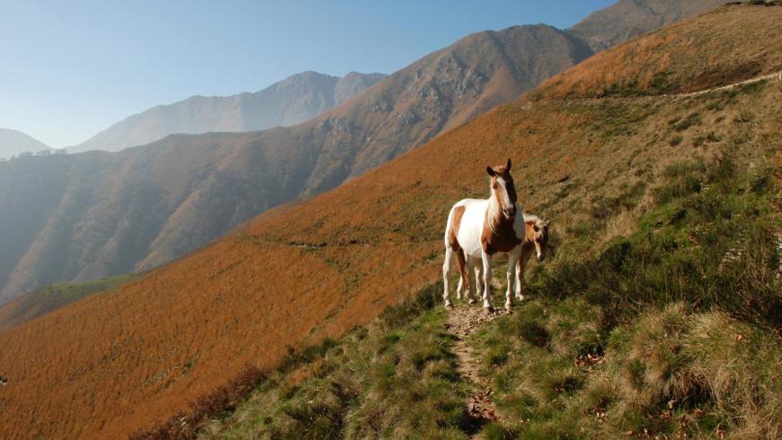
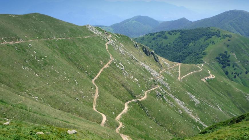
This leg represents an alternative departure of the itinerary from Verbano. You depart from the car parking of the panoramic viewpoint in the municipality of Oggebbio at the intersection of SP 133 of Piancavallo and SP 56 Premeno-Colle. From there, along the Premeno-Colle road (already route VBAR10), you reach the entrance to the Cadorna military road leading to Monte Morissolo, just beyond the Auxological Institute of Pian Cavallo; follow it to Colle. From Colle, again along the Cadorna military road, continue towards Passo Folungo, going past Pian d'Arla and Pian Puzzo, remaining along route VBAR10 on the orographic left side of the upper Intrasca Valley, facing Lake Maggiore. From Passo Folungo, go up towards Pian Vadà, again along the Cadorna military road identified as route VBAR20. The route climbs a slope of more than 350 m with six easy hairpin bends and gets to Pian Vadà where the leg ends. In Pian Vadà you can stay overnight in a non-managed refuge or in a bivouac. Both facilities belong to the Park Authority. The refuge provides 14 beds in a large room, it is heated with a wood-burning stove and has electricity produced by a photovoltaic system. For the overnight stay, reservations are required at no. 0324-87540 of the Park Authority. The bivouac, unattended and always open, provides 3 beds on wood flooring and it is not heated. There is a water fountain in the pertinent area of the buildings.
Recommended period
Accessible to people with disabilities
Support points
bivouac of Pian Vadà
Interest points
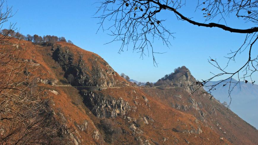
From Pian Cavallo to Pian Vadà and Zeda you walk along cart tracks, paths and fortifications belonging to the "Cadorna Line" that was built during the First World War as a war road and is now a precious resource for mountain hiking. The route is already equipped with a series of didactic panels that were set up during a wide conservative restoration project of the Cadorna Line artefacts, which was implemented by the Park and the Municipality of Aurano with funds from the Ministry of the Environment and Interreg. The strategic geographical location of the defensive lines, together with the orographic location of the fortified positions, today offers great landscape opportunities and astonishing views up to the Apennines, Monviso and the Insubric lakes below. The geological theme offers an extraordinary opportunity to read about the phenomena of the birth of a continent and the alpine orogeny related to the so-called "Serie dei Laghi". The chosen itinerary, with the scientific support of the University of Milan, is perfectly suitable to illustrate the complex geological phenomena that lead to the formation and growth of the continental crust. In fact, the ground clearly shows the evidence of a succession of events that took place over about 300 million years and that are connected to the global tectonics of the planet. Through the restoration project, the sites that best respond to the enhancement of the studied lithological and geomorphological components have been identified and the most suitable points for the arrangement of 13 explanatory panels/reading stands have been selected.
Dettagli
Profilo altimetrico
Dati tecnici
- Code
- VGP
- Classification
- Provincial - Mid and Low Altitude
- Cell phone coverage
Partial
- Country
- Italy
- Region
- Piemonte
- Province
- Verbania
- Devotional relevance
- No
- Historical relevance
- No
- Ultima data di aggiornamento
- 15/12/2023
Altre info
Accommodation facilities

Structure qualification
La dislocanda
Località
OGGEBBIO (VB)
Structure qualification
Canetta
Località
PREMENO (VB)
Structure qualification
Hotel moderno
Località
PREMENO (VB)
Structure qualification
Premeno
Località
PREMENO (VB)
Structure qualification
Villa rosy
Località
PREMENO (VB)
Structure qualification
Villa rosy depandance
Località
PREMENO (VB)
Structure qualification
Vittoria
Località
PREMENO (VB)
Tappe
Tappe attività
-
-
1Via geoalpina: leg 1 cursolo ? refuge of pian vadàLunghezza19.40 kmTempo7 hoursDifficoltàHiking
-
1AVia geoalpina: leg 1a piancavallo - pian vadàLunghezza13.90 kmTempo4 hours 10 minutesDifficoltàHiking
-
2Via geoalpina: leg 2 refuge of pian vadà - alpe curgeiLunghezza8.50 kmTempo3 hoursDifficoltàDifficult Hiking
-
3Via geoalpina: leg 3 alpe curgei - alpe pian di boitLunghezza10.70 kmTempo4 hours 15 minutesDifficoltàHiking
-
4Via geoalpina: leg 4 alpe pian di boit - alpe scarediLunghezza9.50 kmTempo6 hours 45 minutesDifficoltàHiking
-
5Via geoalpina: leg 5 alpe scaredi - alpe la colmaLunghezza12.10 kmTempo7 hours 45 minutesDifficoltàHiking
-
6Via geoalpina: leg 6 alpe la colma ? vogognaLunghezza13.10 kmTempo4 hoursDifficoltàHiking
-
7Via geoalpina: leg 7 vogogna - campello montiLunghezza19.60 kmTempo7 hours 30 minutesDifficoltàHiking