Galleria foto
- Lenght
- 19.40 km
- Tempo
- 7 hours
- Tappa
Elenco risultati
- Ascent elevation gain
- 1630 m
- Descent elevation loss
- 800 m
- Difficulty
- Hiking
- Itinerary index
- No
Informazioni
Punto di partenza
Cursolo
28827 Valle Cannobina VB
Italy
Punto di arrivo
Rifugio di Pian Vadà
28812 Aurano VB
Italy
Come arrivare
Cursolo, in the municipality of Cannobina Valley, can be reached by car from Domodossola or Cannobio
Descrizione
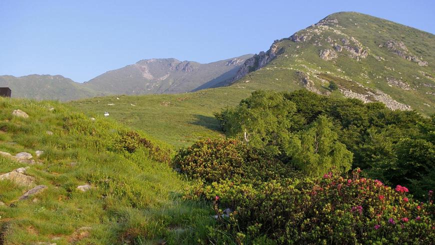
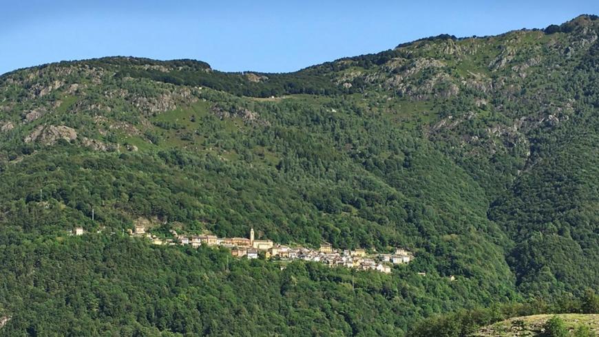
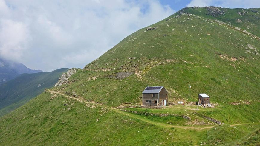
The departure from Cannobina Valley allows the cross-border connection of the itinerary. Start from Cursolo, from the square of the Town Hall and, along an easy trail through a broadleaf forest, climb up to Monte Vecchio, the historic alpine pasture of the village of Orasso. You can descend to Orasso along a mule track through one of the most representative chestnut forests in the province of Verbania, with big chestnut trees, now abandoned and gradually swallowed up by the forest. From Orasso, along a flat mule track, go back to Cursolo and, without entering the village, go past the Eira stream (with interesting geomorphological features) and immediately after an old mill, take the mule track on the left that goes down to the hamlet of Aretta. From here, go towards Finero for about 600 m along SP 75 of Cannobina Valley until you find the trail on the left that descends steeply to Ponte Teia, over the Cannobino stream, in a deep and suggestive gorge deriving from the river erosion. The trail continues in the gorge, among forests of linden and alder, it crosses a tributary of the Cannobino and then it goes back to Gurro, climbing a slope of about 350 m. Upon reaching the village, with the parish church behind you, keep to the left, take via Falmenta and reach the small valley located in the south of the village by keeping again to the left on a flat track. After a chapel and leaving the last houses, the trail ascends and reaches Passo della Mergugna, climbing a slope of about 200 m. From Mergugna the trail, losing about 300 m of elevation, descends to Falmenta and reaches the village just above the church of San Lorenzo. After reaching the church square, walk along the first segment of Via Roma and turn left, going down towards the Town Hall and going out of the village. From the Town Hall, take the trail that goes down to the valley, up to the bridge over the Falmenta stream, becoming a steep and twisting staircase; the trail continues on the opposite side, climbing up the valley to Crealla, with an easier slope in the last segment at 600 m altitude and coming out in the square of the church dedicated to St. Peter. From the centre of Crealla, the itinerary goes in the direction of Monti Barro, along an old mule track, which branches to the left and climbs up through a steep beech forest, slightly touching the left edge of the pastures, until it reaches a pass from which you can see Monte Zeda. From here, continue on the left and gain elevation up to the meadows of Ortighedo (1401 m). Leave Ortighedo and follow the trail that runs along the north-eastern side of Monte Vadà, going past the head of the valley of Crealla with numerous ascents and descents. After a short segment through the beech forest you arrive at the eastern ridge that descends from Vadà, close to a water collection basin (1430 m). Take the right and go up the ridge along trail VBAR19, on a clearly visible and steep track, first through pastures, then on difficult but not dangerous passages on rocks, until you reach the last hairpin bend of the Cadorna military road that connects Passo Folungo to Pian Vadà. Here the itinerary continues along the military road to Pian Vadà (1711 m). In Pian Vadà you can stay overnight in a non-managed closed refuge or in a bivouac. Both facilities belong to the Park Authority. The refuge provides 14 beds in a large room, it is heated with a wood-burning stove and has electricity produced by a photovoltaic system. For the overnight stay, reservation is required at No. 0324-87540 of the Park Authority. The bivouac, unattended and always open, provides 3 beds on wood flooring and it is not heated. In the pertinent area of the buildings there is a water fountain.
Recommended period
Accessible to people with disabilities
Support points
bivouac and Refuge of Pian Vadà
Interest points
In Gurro there is the geological museum/workshop of the Valley. Between Cursolo, Orasso, Spoccia and Gurro, there are three hiking routes of geological interest, along which you can carry out, throughout a day, specific observations with the help of didactic panels. From Alpe Monte Vecchio you can reach Monte Torriggia (geological route no. 3 of Cannobina Valley) and the cross-border connection along the Alpe Pluni (VBAS14) - Alpino (VBAS18) - Swiss border (VBAM22A) - Camedo route. The Cursolo-Monte Vecchio segment also belongs to the itinerary called Sentiero Chiovini that, from Fondotoce to Switzerland, runs again along the trails used by the partisans to escape the Nazi-fascist attack of June 1944 in Val Grande. The Cursolo-Monte Vecchio-Orasso-Cursolo hiking ring shows a lot of testimonies of rural civilization, enhanced by the thematic route known as Circuito di Monte Vecchio. The Cursolo-P.te Teia-Gurro section belongs to the geological route no. 2 of Cannobina Valley. The Orasso – Cursolo-P.te Teia – Gurro – Falmenta-Crealla routes belong to the itinerary called Circuito San Carlo, which runs again along the old merchant road of the valley (12th century), later called Strada Borromea (in memory of the pastoral visit of Cardinal Borromeo, Bishop of Milan, which took place in 1574) and identifies and enhances valuable architectural and artistic structures (churches and chapels, often frescoed) together with the evidence of the working activities that once took place in the valley (hemp processing, forest care, terraced agriculture, ...).
Dettagli
Profilo altimetrico
Dati tecnici
- Code
- VGP
- Classification
- Provincial - Mid and Low Altitude
- Cell phone coverage
Partial
- Country
- Italy
- Region
- Piemonte
- Province
- Verbania
- Devotional relevance
- No
- Historical relevance
- No
- Ultima data di aggiornamento
- 15/12/2023
Altre info

Tappe
Tappe attività
-
-
1Via geoalpina: leg 1 cursolo ? refuge of pian vadàLunghezza19.40 kmTempo7 hoursDifficoltàHiking
-
1AVia geoalpina: leg 1a piancavallo - pian vadàLunghezza13.90 kmTempo4 hours 10 minutesDifficoltàHiking
-
2Via geoalpina: leg 2 refuge of pian vadà - alpe curgeiLunghezza8.50 kmTempo3 hoursDifficoltàDifficult Hiking
-
3Via geoalpina: leg 3 alpe curgei - alpe pian di boitLunghezza10.70 kmTempo4 hours 15 minutesDifficoltàHiking
-
4Via geoalpina: leg 4 alpe pian di boit - alpe scarediLunghezza9.50 kmTempo6 hours 45 minutesDifficoltàHiking
-
5Via geoalpina: leg 5 alpe scaredi - alpe la colmaLunghezza12.10 kmTempo7 hours 45 minutesDifficoltàHiking
-
6Via geoalpina: leg 6 alpe la colma ? vogognaLunghezza13.10 kmTempo4 hoursDifficoltàHiking
-
7Via geoalpina: leg 7 vogogna - campello montiLunghezza19.60 kmTempo7 hours 30 minutesDifficoltàHiking