Galleria foto
- Lenght
- 12.10 km
- Tempo
- 7 hours 45 minutes
- Tappa
Elenco risultati
- Ascent elevation gain
- 768 m
- Descent elevation loss
- 880 m
- Difficulty
- Hiking
- Itinerary index
- No
Informazioni
Punto di partenza
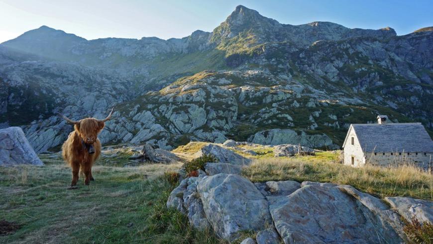
Alpe Scaredi
28854 Malesco VB
Italy
Punto di arrivo
Alpe La Colma
28803 Premosello Chiovenda VB
Italy
Come arrivare
Only on foot
Descrizione
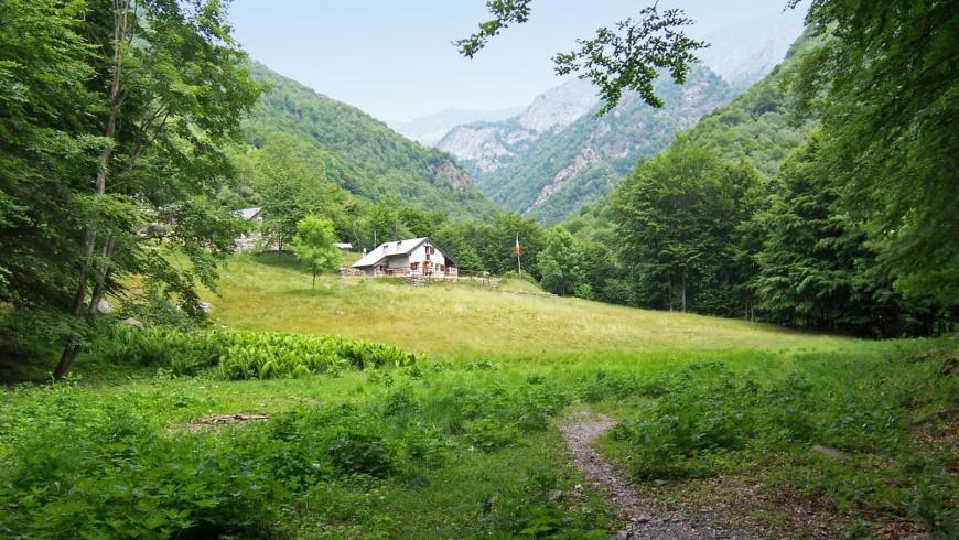
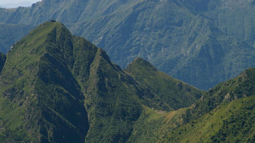
From the bivouac of Alpe Scaredi (1841 m), go down along trail VBAP00A towards Alpe In La Piana, first through alpine pastures, then through a beech forest, crossing the pastures of La Balma (1544 m), Boschelli (1420 m) and Portaiola (1288 m). A series of long hairpin bends in the forest lead to the Fiorina stream (920 m), which you cross on a footbridge, and after a few minutes along a short section in the forest you arrive at Alpe In La Piana (936 m). The place is an important intersection of the routes that connect the northern area of the protected zone. The pasture land hosts three bivouacs of the Park and the station of the State Forestry Corps. The bivouacs, unattended and always open, provide space for 25 beds on wood flooring in their respective areas below the roof and are heated with a stove; the mountain pasture has a water fountain in the pertinent area. For information, please refer to the Park Authority at 0324/87540. The route continues towards Val Gabbio-La Colma di Premosello. From Alpe In La Piana, follow trail VBAP00A that enters into the beech forest towards the south-west side and, going around the slopes of Monte Mottac, it takes and climbs Val Gabbio up to the bridge over the stream (949 m). Again along trail VBAP00A, after crossing the stream, you go up the orographic right side with a steep zigzag to Colletta (1270 m); then, on an easy track, continue in Val Serena towards the Val Serena stream. After crossing the stream, the route climbs up Alpe Serena and then continues uphill, on a visible track, up to Alpe La Colma (1728 m), the site of the homonymous bivouac of the Park, which concludes the leg of the itinerary. The bivouac, unattended and always open, offers space for about 10 beds on wood flooring in the area below the roof, it is heated with a stove and has a water fountain in the pertinent area. For information, please refer to the Park Authority at 0324/87540.
Recommended period
Accessible to people with disabilities
Support points
Bivouac of Scaredi– Bivouac of In La Piana– Bivouac of Colma di Premosello
Interest points
Soapstone Archaeological Museum in Malesco (https://ecomuseomalesco.it/)
Dettagli
Profilo altimetrico
Dati tecnici
- Code
- VGP
- Classification
- Provincial - Mid and Low Altitude
- Cell phone coverage
Not available
- Country
- Italy
- Region
- Piemonte
- Province
- Verbania
- Devotional relevance
- No
- Historical relevance
- No
- Ultima data di aggiornamento
- 15/12/2023
Altre info
Accommodation facilities

Structure qualification
Alpino
Località
MALESCO (VB)
Structure qualification
Arvinei
Località
MALESCO (VB)
Structure qualification
Colonia pio xii
Località
MALESCO (VB)
Structure qualification
Il faggio
Località
MALESCO (VB)
Structure qualification
Il mulino
Località
MALESCO (VB)
Structure qualification
S. Maria mazzarello
Località
MALESCO (VB)
Structure qualification
Nigritella
Località
MALESCO (VB)
Structure qualification
Panorama
Località
MALESCO (VB)
Structure qualification
Ramo verde
Località
MALESCO (VB)
Structure qualification
Val grande
Località
MALESCO (VB)
Structure qualification
Bosco tenso
Località
PREMOSELLO-CHIOVENDA (VB)
Structure qualification
Ca' dal preu
Località
PREMOSELLO-CHIOVENDA (VB)
Structure qualification
Proman
Località
PREMOSELLO-CHIOVENDA (VB)
Tappe
Tappe attività
-
-
1Via geoalpina: leg 1 cursolo ? refuge of pian vadàLunghezza19.40 kmTempo7 hoursDifficoltàHiking
-
1AVia geoalpina: leg 1a piancavallo - pian vadàLunghezza13.90 kmTempo4 hours 10 minutesDifficoltàHiking
-
2Via geoalpina: leg 2 refuge of pian vadà - alpe curgeiLunghezza8.50 kmTempo3 hoursDifficoltàDifficult Hiking
-
3Via geoalpina: leg 3 alpe curgei - alpe pian di boitLunghezza10.70 kmTempo4 hours 15 minutesDifficoltàHiking
-
4Via geoalpina: leg 4 alpe pian di boit - alpe scarediLunghezza9.50 kmTempo6 hours 45 minutesDifficoltàHiking
-
5Via geoalpina: leg 5 alpe scaredi - alpe la colmaLunghezza12.10 kmTempo7 hours 45 minutesDifficoltàHiking
-
6Via geoalpina: leg 6 alpe la colma ? vogognaLunghezza13.10 kmTempo4 hoursDifficoltàHiking
-
7Via geoalpina: leg 7 vogogna - campello montiLunghezza19.60 kmTempo7 hours 30 minutesDifficoltàHiking