Galleria foto
- Lenght
- 9.50 km
- Tempo
- 6 hours 45 minutes
- Tappa
Elenco risultati
- Ascent elevation gain
- 1642 m
- Descent elevation loss
- 928 m
- Difficulty
- Hiking
- Itinerary index
- No
Informazioni
Punto di partenza
Alpe Pian di Boit
28817 Miazzina VB
Italy
Punto di arrivo
Alpe Scaredi
28854 Malesco VB
Italy
Come arrivare
Only on foot
Descrizione
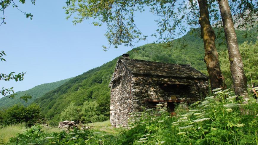
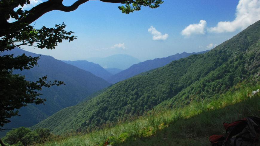
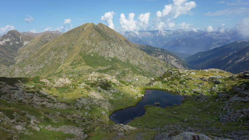
From the bivouac of Pian di Boit, climb up on a steep track to Bocchetta di Terza along trail VBAP12, first through the beech forest up to Alpe Terza (1428 m), then through wild pastures, populated by broom, alder and rhododendron. When you reach Bocchetta di Terza (1836 m), go down to Cannobina Valley, along trail VBAS27 that, on a clearly visible track, gets to Alpe Val Viccio (1440 m) on the upper side of the beech forest and, after crossing it, it intersects trail VBAS99. At the crossroads, take trail VBAS99 on the left that climbs to Alpe Cortechiuso. Walk through the upper Cannobina Valley going past Alpe Uovo (1308 m) and Alpe Zucchero (1407 m), cross the Cannobino stream at an altitude of about 1460 m and continue uphill, on a visible track, along the north-eastern ridge of Cimone di Cortechiuso, up to the homonymous mountain pasture at an altitude of 1883 meters.
One of the rural buildings of Alpe Cortechiuso is used as a bivouac. The facility, unattended and always open, provides about 8 beds, living space and water fountain in the pertinent area. For information please refer to the Municipality of Malesco at 0324/92261. From Alpe Cortechiuso, the leg of the itinerary continues along trail VBAS29, climbing up to Bocchetta di Cortechiuso at an altitude of approximately 2066 m. After leaving Cannobina Valley, continue in the upper Loana Valley along trail VBAM14, until reaching Alpe Scaredi, on a long and not always well marked track, as well as the homonymous bivouac of the Park, which concludes the leg of the itinerary. The bivouac, unattended and always open, provides space for about 10 beds on wood flooring in the area below the roof, it is heated with a stove and has a water fountain in the pertinent area. Additional beds on wood flooring are available in the large adjacent shed. For information, please refer to the Park Authority at 0324/87540.
Recommended period
Accessible to people with disabilities
Support points
Bivacco di Pian di Boit - Bivacco di Cortechiuso - Bivacco di Scaredi
Dettagli
Profilo altimetrico
Dati tecnici
- Code
- VGP
- Classification
- Provincial - Mid and Low Altitude
- Cell phone coverage
Assente
- Country
- Italy
- Region
- Piemonte
- Province
- Verbania
- Devotional relevance
- No
- Historical relevance
- No
- Ultima data di aggiornamento
- 15/12/2023
Tappe
Tappe attività
-
-
1Via geoalpina: leg 1 cursolo ? refuge of pian vadàLunghezza19.40 kmTempo7 hoursDifficoltàHiking
-
1AVia geoalpina: leg 1a piancavallo - pian vadàLunghezza13.90 kmTempo4 hours 10 minutesDifficoltàHiking
-
2Via geoalpina: leg 2 refuge of pian vadà - alpe curgeiLunghezza8.50 kmTempo3 hoursDifficoltàDifficult Hiking
-
3Via geoalpina: leg 3 alpe curgei - alpe pian di boitLunghezza10.70 kmTempo4 hours 15 minutesDifficoltàHiking
-
4Via geoalpina: leg 4 alpe pian di boit - alpe scarediLunghezza9.50 kmTempo6 hours 45 minutesDifficoltàHiking
-
5Via geoalpina: leg 5 alpe scaredi - alpe la colmaLunghezza12.10 kmTempo7 hours 45 minutesDifficoltàHiking
-
6Via geoalpina: leg 6 alpe la colma ? vogognaLunghezza13.10 kmTempo4 hoursDifficoltàHiking
-
7Via geoalpina: leg 7 vogogna - campello montiLunghezza19.60 kmTempo7 hours 30 minutesDifficoltàHiking