- Lenght
- 21.20 km
- Tempo
- 7 hours
- Tappa
- Max altitude
- 2800 m
- Ascent elevation gain
- 760 m
- Descent elevation loss
- 1380 m
- Difficulty
- Hiking
- Itinerary index
- No
Informazioni
Punto di partenza
San Giacomo di Entracque
12010 Entracque CN
Italy
Punto di arrivo
Rifugio Ellena-Soria
Pian del Praiet
12010 Entracque CN
Italy
Come arrivare
Descrizione
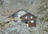
As a variant, you can reach Rif. Soria via Rif. Pagarì. From S. Giacomo you reach the junction for Rif. Moncalieri. A section of mule track with a good gradient takes you over the Muraion Pass at 2,050 m. A little further on, the track runs flatter and reaches the abandoned Gias Muraion soprano, 2,090 m. Towards an altitude of 2,200 m, leave the turnoff for Lago Bianco dell'Agnel on the left and continue with a series of twists and turns to the refuge.
From here, we set off again towards the Rif. Ellena Soria on a demanding track that crosses the M. Gelas glacier, passing the Lago Bianco del Gelas (2,549m) and the Passo dei Ghiacciai where the Moncalieri bivouac is located (2,750m). We then pass the Pera del Fener Pass (2,698m) and descend to the Soria-Ellena refuge (1,840m).
Recommended period
Accessible to people with disabilities
Dettagli
Profilo altimetrico
Dati tecnici
- Code
- AVU
- Classification
- Provincial - Mid and Low Altitude
- Country
- Italy
- Region
- Piemonte
- Province
- Cuneo
- Devotional relevance
- No
- Historical relevance
- No
- Ultima data di aggiornamento
- 15/12/2023
Altre info
Tappe
Tappe attività
-
0AVU - Alta Via dei LupiLunghezza206.00 kmTempo2 days 8 hours 30 minutesDifficoltàDifficult Hiking
-
1AVU Stage 1: Pian delle Gorre - Rifugio MondovìLunghezza12.00 kmTempo6 hoursDifficoltàHiking
-
1AAVU Stage 1A: Pian delle Gorre - Gias Soprano SestreraLunghezza3.50 kmTempo2 hours 30 minutesDifficoltàHiking
-
2AVU Stage 2: Rifugio Mondovì - Rifugio Don BarberaLunghezza14.50 kmTempo5 hoursDifficoltàHiking
-
2AAVU Stage 2A: Tetti delle Donzelle - Rifugio Havis De Giorgio - MondovìLunghezza4.00 kmTempo2 hoursDifficoltàHiking
-
3AVU Stage 3: Rifugio Don Barbera - LimonettoLunghezza20.50 kmTempo7 hoursDifficoltàHiking
-
3AAVU Stage 3A: crossroad stage 03 - Vallone del SaltoLunghezza13.60 kmTempo5 hoursDifficoltàHiking
-
4AVU Tappa 4: Limonetto - PalanfrèLunghezza11.00 kmTempo4 hoursDifficoltàHiking
-
4AAVU Stage 4A: Limone Piemonte - LimonettoLunghezza4.40 kmTempo1 hour 15 minutesDifficoltàTouristic
-
5AVU Stage 5: Palanfrè - TrinitàLunghezza11.40 kmTempo5 hoursDifficoltàHiking
-
5AAVU Stage 5A: Palanfrè - VernanteLunghezza11.90 kmTempo3 hoursDifficoltàHiking
-
5BAVU Stage 5B: Trinità - Colle Ovest del SabbioneLunghezza13.20 kmTempo6 hoursDifficoltàDifficult Hiking
-
5CAVU Stage 5C: Gias Valera Sottano - Lago degli AlberghiLunghezza4.60 kmTempo3 hoursDifficoltàDifficult Hiking
-
6AVU Stage 6: Trinità - San Giacomo di EntracqueLunghezza13.50 kmTempo4 hoursDifficoltàHiking
-
7AVU Stage 7: San Giacomo di Entracque - Rifugio Ellena-SoriaLunghezza6.10 kmTempo2 hours 30 minutesDifficoltàHiking
-
7AAVU Stage 7A: San Giacomo di Entracque - Rifugio Ellena-SoriaLunghezza21.20 kmTempo7 hoursDifficoltàHiking
-
8AVU Stage 8: Rifugio Ellena-Soria - Rifugio Genova-FigariLunghezza8.10 kmTempo4 hoursDifficoltàHiking
-
8AAVU Stage 8A: Lago Brocan - Terme di ValdieriLunghezza14.30 kmTempo6 hours 30 minutesDifficoltàHiking
-
9AVU Stage 9: Rifugio Genova-Figari - Rifugio Franco RemondinoLunghezza5.10 kmTempo4 hoursDifficoltàDifficult Hiking
-
9AAVU Stage 9A: crossroad near Colle Brocan - Colle Est del MercantourLunghezza1.60 kmTempo30 minutesDifficoltàDifficult Hiking
-
10AVU Stage 10: Rifugio Franco Remondino - Terme di ValdieriLunghezza9.58 kmTempo2 hours 31 minutesDifficoltàHiking

