AVU Stage 7: San Giacomo di Entracque - Rifugio Ellena-Soria

Galleria foto
Activity type
Escursionismo
no
Lenght
6.10 km
Tempo
2 hours 30 minutes
Tappa
Quota massima
1790 m
Dislivello salita
600 m
Dislivello discesa
0 m
Difficoltà
Hiking
Indice itinerario
No
    Informazioni

    Punto di partenza

    Indirizzo

    San Giacomo di Entracque
    12010 Entracque CN
    Italy

    Quota
    1226 m
    {"type":"Point","coordinates":[7.38699,44.17647]}

    Punto di arrivo

    Indirizzo di arrivo

    Rifugio Ellena-Soria
    Pian del Praiet
    12010 Entracque CN
    Italy

    Quota di arrivo
    1840 m
    {"type":"Point","coordinates":[7.36236,44.1416]}

    Come arrivare

    Accesso con mezzi pubblici
    No

    Descrizione

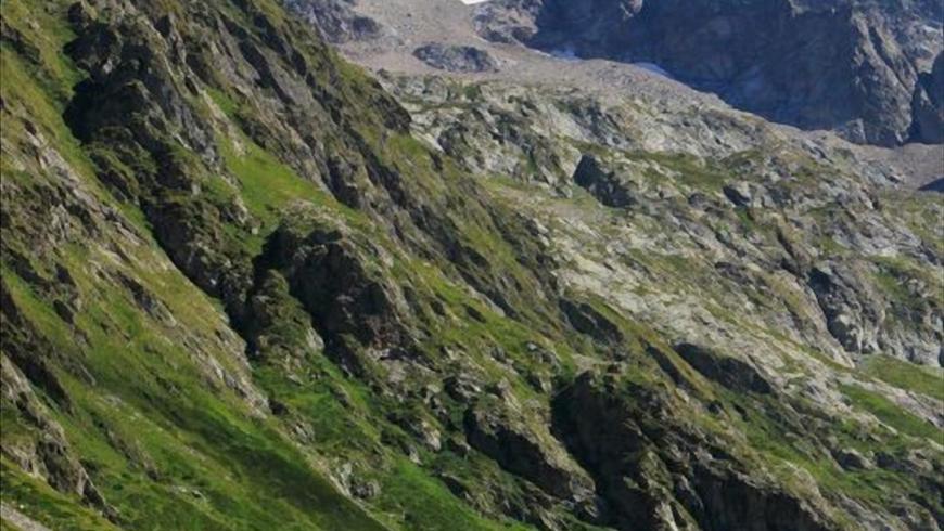
    From San Giacomo di Entracque, just beyond the Park's excursion hut, the road (marker M11) becomes a dirt track and begins to climb the Vallone della Barra in a beautiful beech grove. The beech trees quickly thin out and the landscape takes on the appearance of rich pastures dotted with sparse shrubs (red elder, etc.). Leaving the Gias Isterpis on the left, we continue along the easy dirt track at the bottom of the valley. Go past the so-called Piazzale dei Cannoni and, a little further on, turn left off the grassy dirt track that descends to the Gias della Siula. At the next hairpin bend to the right, a track that branches off to the left and rejoins the dirt track further uphill, allowing the route to be shortened. Around q. 1650, at the base of the rocky drop known as the Peirastretta Passage, another small path on the left, quite evident, avoids a few bends in the dirt track before rejoining it. After the fork on the right for the Colle di Fenestrelle (marker M10), which is left out, the dirt track fords the Torrente Gesso della Barra stream. On foot, instead, cross the stream on the wooden footbridge positioned to the left a few metres before the ford. Immediately beyond the footbridge is a junction, still to the left, with the steep but short track that climbs directly to the refuge. The off-road track, on the other hand, stretches towards the S in the wide pastureland basin of the Piano del Praiet until it meets a branch of the stream again, just at the fork to the right for the Colle di Finestra (marker M11) and the Pera de Fener (marker M18). The road fords the stream and, bending now towards the N, gains the high ground on which the Soria hut stands.

    Luglio, agosto, settembre

    Accessible to people with disabilities

    No

    Profilo altimetrico

    Dati tecnici

    Codice
    AVU
    Nazione
    Italy
    Regione
    Piemonte
    Provincia
    Cuneo
    Interesse devozionale
    No
    Interesse storico
    No
    {"type":"LineString","coordinates":[[7.38699,44.17648],[7.38679,44.17657],[7.3865,44.17669],[7.38612,44.17679],[7.38574,44.17686],[7.38574,44.17671],[7.38574,44.17652],[7.38589,44.17627],[7.38606,44.17591],[7.38621,44.17563],[7.38625,44.17538],[7.38621,44.17524],[7.38621,44.1752],[7.38621,44.1752],[7.38624,44.17502],[7.3862,44.17492],[7.38609,44.17482],[7.38598,44.17468],[7.38595,44.17457],[7.38597,44.17447],[7.38602,44.17438],[7.38614,44.1742],[7.38622,44.17408],[7.38627,44.17386],[7.38621,44.17365],[7.38617,44.1735],[7.38605,44.17338],[7.38584,44.17318],[7.38576,44.17307],[7.38575,44.17299],[7.38574,44.17289],[7.38582,44.17283],[7.38586,44.17277],[7.38587,44.17263],[7.38578,44.17233],[7.38581,44.17196],[7.38582,44.17172],[7.38593,44.17153],[7.38611,44.17134],[7.38623,44.17118],[7.38629,44.17093],[7.38624,44.17074],[7.38614,44.17057],[7.38599,44.17034],[7.38594,44.17014],[7.38592,44.16995],[7.38595,44.16982],[7.38605,44.16965],[7.38615,44.16948],[7.3861,44.16935],[7.38596,44.16925],[7.3858,44.1692],[7.38562,44.16905],[7.38549,44.16889],[7.38538,44.16871],[7.38522,44.16852],[7.38509,44.16833],[7.38498,44.16815],[7.38493,44.16798],[7.38494,44.1678],[7.38484,44.1675],[7.38476,44.16716],[7.38472,44.16688],[7.38467,44.1666],[7.38466,44.16644],[7.3847,44.16626],[7.3846,44.16609],[7.38453,44.16596],[7.3844,44.16572],[7.38425,44.16552],[7.3841,44.16533],[7.38403,44.16521],[7.38396,44.16499],[7.38383,44.16473],[7.38374,44.16451],[7.38367,44.16426],[7.38358,44.16408],[7.38351,44.16394],[7.38348,44.1637],[7.38337,44.16372],[7.38329,44.16381],[7.38328,44.164],[7.38331,44.1641],[7.38329,44.16422],[7.38326,44.16436],[7.38318,44.16455],[7.38319,44.16471],[7.38305,44.16501],[7.38297,44.16503],[7.38292,44.16495],[7.38292,44.1647],[7.38283,44.16436],[7.38279,44.16429],[7.38278,44.16417],[7.38275,44.16403],[7.38275,44.1639],[7.38272,44.16376],[7.38267,44.16362],[7.38253,44.16349],[7.38249,44.16335],[7.38237,44.16313],[7.38222,44.16276],[7.38199,44.16214],[7.38189,44.16204],[7.38178,44.16199],[7.38162,44.16192],[7.38149,44.16183],[7.38138,44.1617],[7.38137,44.16148],[7.38134,44.16139],[7.38123,44.16125],[7.38104,44.16109],[7.38094,44.16086],[7.38093,44.16053],[7.38099,44.16025],[7.38097,44.16005],[7.38095,44.15994],[7.38101,44.1598],[7.38104,44.15969],[7.381,44.1595],[7.38098,44.15935],[7.38099,44.15924],[7.38094,44.15914],[7.38086,44.15906],[7.3809,44.15891],[7.38078,44.1588],[7.3807,44.15857],[7.3806,44.15842],[7.38041,44.15829],[7.38027,44.15821],[7.38016,44.15806],[7.38004,44.15794],[7.37989,44.15778],[7.37977,44.15772],[7.37966,44.15768],[7.37969,44.15753],[7.3795,44.1574],[7.37935,44.15734],[7.37891,44.15724],[7.37868,44.15715],[7.37851,44.15695],[7.37827,44.15658],[7.37812,44.15631],[7.37806,44.15609],[7.37798,44.15589],[7.37796,44.15573],[7.37798,44.15554],[7.37803,44.15536],[7.37795,44.15514],[7.37783,44.15496],[7.37765,44.15478],[7.3775,44.15453],[7.37741,44.15441],[7.3773,44.15434],[7.37717,44.15429],[7.37708,44.15417],[7.37684,44.15395],[7.37664,44.15372],[7.37655,44.15358],[7.37648,44.15349],[7.37648,44.15336],[7.37639,44.15323],[7.37622,44.15309],[7.37602,44.15293],[7.37594,44.15283],[7.37594,44.15274],[7.37593,44.15263],[7.37582,44.15246],[7.37578,44.15238],[7.37568,44.15239],[7.37562,44.1525],[7.37554,44.15265],[7.37549,44.15287],[7.3755,44.15302],[7.37563,44.15313],[7.37577,44.15325],[7.37587,44.15334],[7.3758,44.1534],[7.37571,44.15332],[7.37558,44.15327],[7.37543,44.15321],[7.37531,44.15312],[7.37506,44.15284],[7.37478,44.15257],[7.3746,44.15236],[7.37448,44.15219],[7.37443,44.15203],[7.37434,44.1519],[7.37422,44.15177],[7.37403,44.15159],[7.37391,44.15153],[7.37378,44.1515],[7.37366,44.15136],[7.3734,44.15101],[7.37326,44.15082],[7.37311,44.15064],[7.37304,44.15057],[7.37293,44.15051],[7.37289,44.15044],[7.37292,44.15029],[7.37284,44.15016],[7.37284,44.15005],[7.37281,44.14993],[7.37275,44.14981],[7.37266,44.14975],[7.37258,44.14973],[7.37256,44.1498],[7.37263,44.14984],[7.37254,44.14998],[7.37253,44.15004],[7.37254,44.15012],[7.3725,44.15023],[7.37252,44.1504],[7.37249,44.15049],[7.37242,44.15047],[7.37239,44.15036],[7.37231,44.15028],[7.37232,44.15014],[7.37228,44.15004],[7.37224,44.14994],[7.37223,44.14987],[7.37218,44.1498],[7.3721,44.14975],[7.37206,44.14968],[7.37196,44.14963],[7.37184,44.14954],[7.37182,44.14953],[7.37167,44.14942],[7.37152,44.14928],[7.3716,44.14918],[7.37163,44.14917],[7.37166,44.14916],[7.37173,44.14912],[7.37177,44.14907],[7.37174,44.14897],[7.37166,44.14887],[7.37159,44.14885],[7.37154,44.14888],[7.37155,44.14897],[7.37153,44.14901],[7.37147,44.14903],[7.37144,44.14899],[7.37144,44.14888],[7.37138,44.14886],[7.37133,44.14891],[7.37132,44.14898],[7.37125,44.14899],[7.37122,44.14894],[7.37123,44.14885],[7.37121,44.14879],[7.37115,44.14872],[7.37096,44.14859],[7.37089,44.14852],[7.37084,44.14849],[7.3708,44.14847],[7.37077,44.14851],[7.3708,44.14856],[7.37086,44.14861],[7.37083,44.14864],[7.37076,44.14865],[7.37069,44.14854],[7.37061,44.14846],[7.37048,44.14842],[7.37038,44.1484],[7.3703,44.14839],[7.37021,44.14834],[7.37011,44.1483],[7.37002,44.14826],[7.36994,44.14819],[7.36987,44.14813],[7.36978,44.14803],[7.36971,44.14796],[7.36962,44.14788],[7.36955,44.14786],[7.36953,44.14791],[7.36959,44.14796],[7.36958,44.14801],[7.36952,44.14799],[7.36935,44.14791],[7.36923,44.14783],[7.3691,44.14779],[7.36886,44.14778],[7.36864,44.14776],[7.36843,44.14773],[7.36824,44.14767],[7.36809,44.14761],[7.36798,44.14752],[7.36792,44.14742],[7.36784,44.14705],[7.3678,44.14698],[7.36775,44.14693],[7.36767,44.14684],[7.36742,44.14646],[7.3672,44.14619],[7.36705,44.14598],[7.36677,44.14577],[7.36663,44.14564],[7.36657,44.14543],[7.36647,44.14539],[7.36639,44.14536],[7.36632,44.14539],[7.36631,44.14548],[7.36643,44.14569],[7.36647,44.14575],[7.36664,44.1463],[7.36664,44.14641],[7.36661,44.14643],[7.36657,44.14641],[7.36657,44.14632],[7.36641,44.14616],[7.36637,44.14612],[7.36635,44.1461],[7.36619,44.14601],[7.36591,44.14578],[7.36539,44.14539],[7.36514,44.14531],[7.365,44.14525],[7.36484,44.14524],[7.36477,44.14521],[7.36478,44.14501],[7.36487,44.14472],[7.36492,44.14457],[7.36496,44.14444],[7.36499,44.14435],[7.365,44.1442],[7.36498,44.14414],[7.3649,44.14416],[7.36471,44.14436],[7.36452,44.14454],[7.36444,44.14458],[7.36435,44.14461],[7.36429,44.14457],[7.36431,44.14451],[7.36438,44.14437],[7.36457,44.14409],[7.36483,44.14373],[7.36495,44.14358],[7.36499,44.1435],[7.36503,44.14347],[7.36504,44.14341],[7.36497,44.1433],[7.36491,44.14328],[7.3648,44.14321],[7.36473,44.14312],[7.36468,44.14306],[7.36462,44.14301],[7.36456,44.14294],[7.36444,44.14293],[7.36435,44.14291],[7.36429,44.1429],[7.36424,44.14287],[7.36417,44.1428],[7.36411,44.14274],[7.36401,44.14271],[7.3639,44.14272],[7.36375,44.14269],[7.36362,44.14265],[7.3635,44.14261],[7.36345,44.1426],[7.36334,44.14255],[7.36334,44.14247],[7.36328,44.14243],[7.36309,44.1423],[7.36301,44.14224],[7.363,44.14217],[7.36299,44.14208],[7.36293,44.14202],[7.36285,44.14196],[7.36269,44.14187],[7.36257,44.14172],[7.36244,44.14163],[7.36236,44.1416]]}
    Ultima data di aggiornamento
    15/12/2023

    Strutture ricettive

    Qualifica struttura
    Rifugio Escursionistico

    Foresteria san giacomo

    Località

    ENTRACQUE (CN)

    Qualifica struttura
    Rifugio Alpino

    Soria - ellena

    Località

    ENTRACQUE (CN)

    Tappe attività