Galleria foto

- Lenght
- 206.00 km
- Tempo
- 2 days 8 hours 30 minutes
- Max altitude
- 2890 m
- Ascent elevation gain
- 11600 m
- Descent elevation loss
- 11300 m
- Difficulty
- Difficult Hiking
- Itinerary index
- Yes
Informazioni
Punto di partenza
Pian delle Gorre
Località Certosa
12013 Chiusa Di Pesio CN
Italy
Punto di arrivo
Terme di Valdieri
Regione Terme, 1 bis
12010 Valdieri CN
Italy
Come arrivare
Descrizione
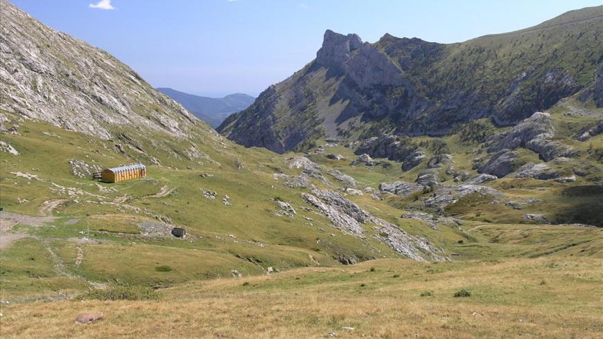
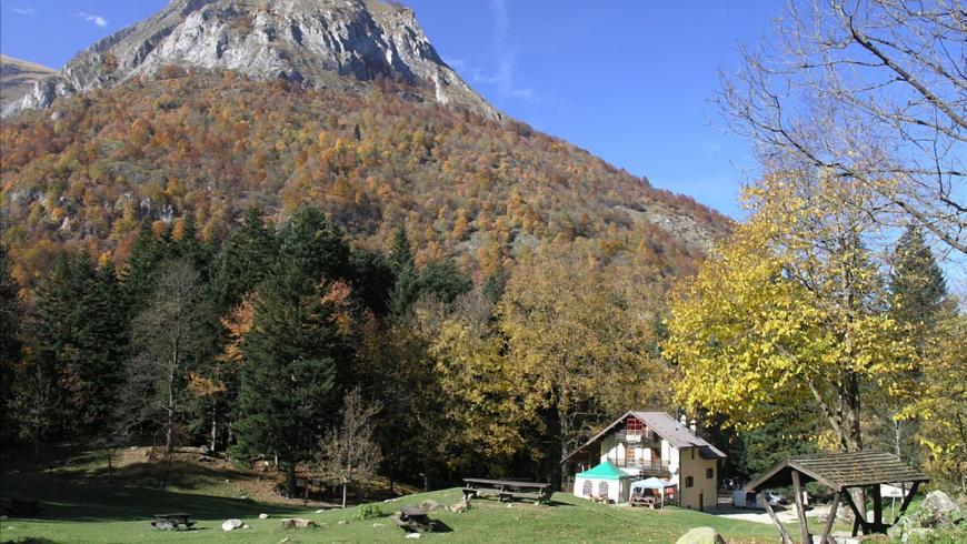
The Alta via dei lupi (High Route of the Wolves) itinerary (AVU) winds its way in 10 stages (and 10 variants) through the higher altitudes of the Maritime Alps Protected Area, from Pian delle Gorre di Chiusa Pesio (in the Marguareis) to Terme di Valdieri, taking in the municipalities of Chiusa Pesio, Roccaforte Mondovì, Ormea, Briga Alta, Limone Piemonte, Vernante, Entracque and Valdieri.
The high-altitude route, suggestive for its incredible landscape and natural elements, connects various important refuges in the Maritime Alps such as Rifugio Mondovì, Don Barbera, Ellena-Soria, Pagarì, Genova, Morelli and Remondino.
The route, also thanks to its variants, then offers the possibility of descending and reaching Alpine villages of interest such as San Giacomo di Entracque, Palanfrè, Vernante, Limone Piemonte and Limonetto.
Recommended period
Accessible to people with disabilities
Dettagli
Profilo altimetrico
Dati tecnici
- Code
- AVU
- Classification
- Provincial - Mid and Low Altitude
- Country
- Italy
- France
- Region
- Piemonte
- Province
- Cuneo
- Devotional relevance
- No
- Historical relevance
- No
- Ultima data di aggiornamento
- 15/12/2023
Tappe
Tappe attività
-
0AVU - Alta Via dei LupiLunghezza206.00 kmTempo2 days 8 hours 30 minutesDifficoltàDifficult Hiking
-
1AVU Stage 1: Pian delle Gorre - Rifugio MondovìLunghezza12.00 kmTempo6 hoursDifficoltàHiking
-
1AAVU Stage 1A: Pian delle Gorre - Gias Soprano SestreraLunghezza3.50 kmTempo2 hours 30 minutesDifficoltàHiking
-
2AVU Stage 2: Rifugio Mondovì - Rifugio Don BarberaLunghezza14.50 kmTempo5 hoursDifficoltàHiking
-
2AAVU Stage 2A: Tetti delle Donzelle - Rifugio Havis De Giorgio - MondovìLunghezza4.00 kmTempo2 hoursDifficoltàHiking
-
3AVU Stage 3: Rifugio Don Barbera - LimonettoLunghezza20.50 kmTempo7 hoursDifficoltàHiking
-
3AAVU Stage 3A: crossroad stage 03 - Vallone del SaltoLunghezza13.60 kmTempo5 hoursDifficoltàHiking
-
4AVU Tappa 4: Limonetto - PalanfrèLunghezza11.00 kmTempo4 hoursDifficoltàHiking
-
4AAVU Stage 4A: Limone Piemonte - LimonettoLunghezza4.40 kmTempo1 hour 15 minutesDifficoltàTouristic
-
5AVU Stage 5: Palanfrè - TrinitàLunghezza11.40 kmTempo5 hoursDifficoltàHiking
-
5AAVU Stage 5A: Palanfrè - VernanteLunghezza11.90 kmTempo3 hoursDifficoltàHiking
-
5BAVU Stage 5B: Trinità - Colle Ovest del SabbioneLunghezza13.20 kmTempo6 hoursDifficoltàDifficult Hiking
-
5CAVU Stage 5C: Gias Valera Sottano - Lago degli AlberghiLunghezza4.60 kmTempo3 hoursDifficoltàDifficult Hiking
-
6AVU Stage 6: Trinità - San Giacomo di EntracqueLunghezza13.50 kmTempo4 hoursDifficoltàHiking
-
7AVU Stage 7: San Giacomo di Entracque - Rifugio Ellena-SoriaLunghezza6.10 kmTempo2 hours 30 minutesDifficoltàHiking
-
7AAVU Stage 7A: San Giacomo di Entracque - Rifugio Ellena-SoriaLunghezza21.20 kmTempo7 hoursDifficoltàHiking
-
8AVU Stage 8: Rifugio Ellena-Soria - Rifugio Genova-FigariLunghezza8.10 kmTempo4 hoursDifficoltàHiking
-
8AAVU Stage 8A: Lago Brocan - Terme di ValdieriLunghezza14.30 kmTempo6 hours 30 minutesDifficoltàHiking
-
9AVU Stage 9: Rifugio Genova-Figari - Rifugio Franco RemondinoLunghezza5.10 kmTempo4 hoursDifficoltàDifficult Hiking
-
9AAVU Stage 9A: crossroad near Colle Brocan - Colle Est del MercantourLunghezza1.60 kmTempo30 minutesDifficoltàDifficult Hiking
-
10AVU Stage 10: Rifugio Franco Remondino - Terme di ValdieriLunghezza9.58 kmTempo2 hours 31 minutesDifficoltàHiking