- Lenght
- 10.78 km
- Tempo
- 3 hours
- Tappa
- Max altitude
- 1257 m
- Ascent elevation gain
- 580 m
- Descent elevation loss
- 620 m
- Difficulty
- Hiking
- Itinerary index
- No
Informazioni
Punto di partenza
Frazione Pagliero di San Damiano Macra
12020 San Damiano Macra CN
Italy
Punto di arrivo
Frazione Camoglieres
12020 Macra CN
Italy
Come arrivare
Descrizione
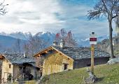
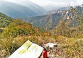
From Pagliero, avoid climbing up the valley that culminates along the slopes of Mount Birrone, following the ups and downs in the direction of the hamlets of Scombe, Paolini and Fracchie, first on asphalt, then on the forest track. You cross Fracchie hamlet, and, once you leave the village, avoid turning at the first junction towards the Droneretto valley. Follow the asphalt downhill for a short distance and take the slow and shady path on the right that leads to Robbio Superiore and Inferiore (Upper and Lower) hamlets. Here you must pay particular attention to identify, on the right, the panoramic path that cuts the slopes of Monte Rubbio halfway up the hill. The particularly sunny exposure of the first part of the path contrasts with the shady and wooded descent on Camoglieres. Before arriving at the end of the stage, the small chapel of San Bernardo appears unexpectedly.
Recommended period
Accessible to people with disabilities
Dettagli
Profilo altimetrico
Dati tecnici
- Code
- POC
- Classification
- Provincial - Mid and Low Altitude
- Country
- Italy
- Region
- Piemonte
- Province
- Cuneo
- Devotional relevance
- No
- Historical relevance
- No
- Ultima data di aggiornamento
- 15/12/2023
Altre info
Accommodation facilities

Il campo della quercia
- Località
SAN DAMIANO MACRA (CN)

Locanda del silenzio
- Località
MACRA (CN)

Ciaminar
- Località
MACRA (CN)

Appartamenti vacanza borgata podio
- Località
SAN DAMIANO MACRA (CN)

La baucio
- Località
SAN DAMIANO MACRA (CN)

La chabrochanto
- Località
SAN DAMIANO MACRA (CN)
Tappe
Tappe attività
-
0POC - Percorsi occitaniLunghezza175.50 kmTempo2 days 10 hours 30 minutesDifficoltàHiking
-
1POC Tappa 1: Ciciu di Villar - Frazione Sant'Anna di RoccabrunaLunghezza16.05 kmTempo5 hoursDifficoltàHiking
-
2Percorsi Occitani: Tappa 2 Frazione Sant'Anna di Roccabruna - Frazione Pagliero di San Damiano MacraLunghezza8.54 kmTempo2 hours 45 minutesDifficoltàHiking
-
3Percorsi Occitani: Tappa 3 Frazione Pagliero di San Damiano Macra - Frazione CamoglieresLunghezza10.78 kmTempo3 hoursDifficoltàHiking
-
4Percorsi Occitani: Tappa 4 Frazione Camoglieres - San Martino InferioreLunghezza16.93 kmTempo5 hours 30 minutesDifficoltàHiking
-
5Percorsi Occitan: Tappa 5 San Martino Inferiore - ElvaLunghezza6.91 kmTempo2 hours 30 minutesDifficoltàHiking
-
6Percorsi Occitani: Tappa 6 Elva - San Michele di PrazzoLunghezza9.74 kmTempo3 hours 40 minutesDifficoltàHiking
-
7Percorsi Occitani: Tappa 7 San Michele di Prazzo - Borgata UssoloLunghezza5.94 kmTempo4 hoursDifficoltàHiking
-
8Percorsi Occitani: Tappa 8 Borgata Ussolo - Borgata ChiapperaLunghezza14.66 kmTempo4 hours 30 minutesDifficoltàHiking
-
9Percorsi Occitani: Tappa 9 Borgata Chiappera - Borgata ChialvettaLunghezza14.87 kmTempo4 hours 40 minutesDifficoltàHiking
-
10Percorsi Occitani: Tappa 10 Borgata Chialvetta - Rifugio della GardettaLunghezza7.55 kmTempo4 hours 15 minutesDifficoltàHiking
-
11Percorsi Occitani: Tappa 11 Rifugio della Gardetta - Borgata ArataLunghezza20.16 kmTempo6 hours 30 minutesDifficoltàHiking
-
12Percorsi Occitani: Tappa 12 Borgata Arata - Borgata PalentLunghezza9.12 kmTempo4 hours 10 minutesDifficoltàHiking
-
13Percorsi Occitani: Tappa 13 Borgata Palent - Borgata ChiesaLunghezza9.27 kmTempo2 hours 40 minutesDifficoltàHiking
-
14Percorsi Occitani: Tappa 14 Borgata Chiesa - CartignanoLunghezza19.60 kmTempo6 hours 10 minutesDifficoltàHiking
-
15Percorsi Occitani: Tappa 15 Cartignano - DroneroLunghezza7.87 kmTempo1 hour 40 minutesDifficoltàHiking


