- Lenght
- 9.12 km
- Tempo
- 4 hours 10 minutes
- Tappa
- Max altitude
- 1701 m
- Ascent elevation gain
- 560 m
- Descent elevation loss
- 470 m
- Difficulty
- Hiking
- Itinerary index
- No
Informazioni
Punto di partenza
Borgata Arata
12020 Marmora CN
Italy
Punto di arrivo
Borgata Palent
12020 Macra CN
Italy
Come arrivare
Descrizione
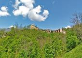
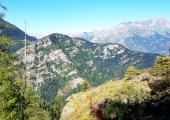
The twelfth stage reaches, uphill, Parish of Marmora hamlet (1546 m) with the ancient church of San Massimo that houses, outside, the last frescoes by Tommaso Biasacci (XIV-XV century), memory of the late Middle Ages and a Gothic bell tower. A little further on, near the upper hamlet, leave the asphalt and take what is known as the "Napoleonica": a long hillside path that cuts the slopes of Mount Buch in the shadow of thick mixed forest, reaches the Colli dell'Encucetta Inferiore (Lower) (where you must avoid the deviation on the left for Stroppo Bassura) and Superiore (Upper) and arrives at Albaretto, an ancient village that today belongs to Macra. Downhill on a comfortable forest track you reach Palent (1479 m), a characteristic village nestled in the Comba d'Aramola, known for the cultivation of medicinal herbs for the production of liqueurs.
Recommended period
Accessible to people with disabilities
Interest points
Ponte medievale sul Maira.
Dettagli
Profilo altimetrico
Dati tecnici
- Code
- POC
- Classification
- Provincial - Mid and Low Altitude
- Local Tourist Agency (LTA) reference
- ATL del Cuneese - valli alpine e città d'arte
- Country
- Italy
- Region
- Piemonte
- Province
- Cuneo
- Devotional relevance
- No
- Historical relevance
- Yes
- Ultima data di aggiornamento
- 15/12/2023
Altre info
Accommodation facilities

Camping lou dahu
- Località
MARMORA (CN)

Bella vista marmora
- Località
MARMORA (CN)

Lou bia
- Località
MARMORA (CN)

Il camino
- Località
MARMORA (CN)

Il cuore
- Località
MARMORA (CN)

Locanda lou pitavin
- Località
MARMORA (CN)

Lou pitavin
- Località
MARMORA (CN)

Serra sergio
- Località
MARMORA (CN)
Tappe
Tappe attività
-
0POC - Percorsi occitaniLunghezza175.50 kmTempo2 days 10 hours 30 minutesDifficoltàHiking
-
1POC Tappa 1: Ciciu di Villar - Frazione Sant'Anna di RoccabrunaLunghezza16.05 kmTempo5 hoursDifficoltàHiking
-
2Percorsi Occitani: Tappa 2 Frazione Sant'Anna di Roccabruna - Frazione Pagliero di San Damiano MacraLunghezza8.54 kmTempo2 hours 45 minutesDifficoltàHiking
-
3Percorsi Occitani: Tappa 3 Frazione Pagliero di San Damiano Macra - Frazione CamoglieresLunghezza10.78 kmTempo3 hoursDifficoltàHiking
-
4Percorsi Occitani: Tappa 4 Frazione Camoglieres - San Martino InferioreLunghezza16.93 kmTempo5 hours 30 minutesDifficoltàHiking
-
5Percorsi Occitan: Tappa 5 San Martino Inferiore - ElvaLunghezza6.91 kmTempo2 hours 30 minutesDifficoltàHiking
-
6Percorsi Occitani: Tappa 6 Elva - San Michele di PrazzoLunghezza9.74 kmTempo3 hours 40 minutesDifficoltàHiking
-
7Percorsi Occitani: Tappa 7 San Michele di Prazzo - Borgata UssoloLunghezza5.94 kmTempo4 hoursDifficoltàHiking
-
8Percorsi Occitani: Tappa 8 Borgata Ussolo - Borgata ChiapperaLunghezza14.66 kmTempo4 hours 30 minutesDifficoltàHiking
-
9Percorsi Occitani: Tappa 9 Borgata Chiappera - Borgata ChialvettaLunghezza14.87 kmTempo4 hours 40 minutesDifficoltàHiking
-
10Percorsi Occitani: Tappa 10 Borgata Chialvetta - Rifugio della GardettaLunghezza7.55 kmTempo4 hours 15 minutesDifficoltàHiking
-
11Percorsi Occitani: Tappa 11 Rifugio della Gardetta - Borgata ArataLunghezza20.16 kmTempo6 hours 30 minutesDifficoltàHiking
-
12Percorsi Occitani: Tappa 12 Borgata Arata - Borgata PalentLunghezza9.12 kmTempo4 hours 10 minutesDifficoltàHiking
-
13Percorsi Occitani: Tappa 13 Borgata Palent - Borgata ChiesaLunghezza9.27 kmTempo2 hours 40 minutesDifficoltàHiking
-
14Percorsi Occitani: Tappa 14 Borgata Chiesa - CartignanoLunghezza19.60 kmTempo6 hours 10 minutesDifficoltàHiking
-
15Percorsi Occitani: Tappa 15 Cartignano - DroneroLunghezza7.87 kmTempo1 hour 40 minutesDifficoltàHiking


