- Lenght
- 13.50 km
- Tempo
- 3 hours 10 minutes
- Tappa
- Max altitude
- 315 m
- Ascent elevation gain
- 5 m
- Difficulty
- Easy
- Itinerary index
- No
Informazioni
Punto di partenza
Scurzolengo
14030 Scurzolengo AT
Italy
Punto di arrivo
Calliano
14031 Calliano AT
Italy
Come arrivare
Descrizione
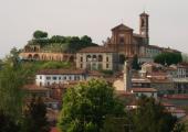
The route is 13 km long and connects Scurzolengo with Calliano. Estimated travel time: 3 hours. The difference in level is 4 m.
Scurzolengo is one of the cities awarded with the Bronze Medal for Military Value for its partisan activity during World War II.
The point of departure of this stop is located in the centre of the village. Take Via Marconi, then turn right into Via Martiri della Libertà, where you can see the chapel of San Giuseppe on the right. Go down that road for about 800 m until you reach another chapel in San Defendente. Go past it, turn right into a grove and go straight for about 800 m, until you reach an intersection. From here, go down the valley of Pissapola. Then, go north along the valley until getting to Regione Torre and the intersection with Strada Provinciale 37.
Pass through Viale Dusio Piero, named after him because he was born in Scurzolengo in 1899. He was an entrepreneur, sport manager, car driver and also President of Juventus football club from 1942 to 1947. Go past the open space on the left and take the dirt road on the right. After 750 m in a path of fields, it intersects with Strada Provinciale 94. Turn right, go along the farmhouse, and take the dirt road that passes through fields and groves. After about 600 m you come to an intersection. Turn left into the fields, go straight ahead for about 800 m, until the road intersects with Via Scurzolengo (Strada Provinciale 38). Turn right and go up the slope towards the municipality of San Desiderio of Calliano. After 500 m, you will see the inhabited area of the municipality. Keep going until the road intersects with Via Vittorio Emanuele II, where you have to turn left. The route continues along the main street of the municipality passing through the historic centre and going straight for about 1 km.
After 500 m you will see the church of San Desiderio on the left. Keep going until you reach the intersection with Via Valle Riti, near to the restaurant called “Santisè” that offers the typical cuisine of Piedmont.
Turn left and go straight for about 400 m until you come to a fork. Turn right, pass through Valle del Rio, until reaching Località Sassia after about 1 km. At the intersection with Strada Castelletto, turn right and go straight ahead on the path along Valle del Gorgo with a beautiful landscape of vineyards and farmlands. Passing over the cemetery, you get to Calliano. This village is known for its typical dishes based on donkey meat such as agnolotti pasta and salami.
Recommended period
Accessible to people with disabilities
Dettagli
Profilo altimetrico
Dati tecnici
- Code
- CCC
- Classification
- Provincial
- Country
- Italy
- Region
- Piemonte
- Province
- Asti
- Devotional relevance
- No
- Historical relevance
- No
- Ultima data di aggiornamento
- 24/10/2024
Altre info
Accommodation facilities

Relais san desiderio
- Località
CALLIANO MONFERRATO (AT)
Tappe
Tappe attività
-
0Cammini delle alte colline ombrose e delle colline chiare (CCC)Lunghezza160.50 kmTempo1 day 13 hours 30 minutesDifficoltàEasy
-
1Cammini delle alte colline ombrose e delle colline chiare: Stage 1: Chiesa della Natività di Frinco - Chiusano d'AstiLunghezza9.70 kmTempo2 hours 15 minutesDifficoltàEasy
-
2Cammini delle alte colline ombrose e delle colline chiare: Stage 2: Chiusano d'Asti - SoglioLunghezza13.90 kmTempo3 hours 20 minutesDifficoltàEasy
-
3Cammini delle alte colline ombrose e delle colline chiare: Stage 3: Soglio - CorsioneLunghezza11.20 kmTempo2 hours 40 minutesDifficoltàEasy
-
4Cammini delle alte colline ombrose e delle colline chiare: Stage 4: Corsione - ToncoLunghezza11.50 kmTempo2 hours 50 minutesDifficoltàEasy
-
5Cammini delle alte colline ombrose e delle colline chiare: Stage 5: Tonco - Frazione SanicoLunghezza11.80 kmTempo2 hours 45 minutesDifficoltàEasy
-
6Cammini delle alte colline ombrose e delle colline chiare: Stage 6: Frazione Sanico - MoncalvoLunghezza8.10 kmTempo2 hoursDifficoltàEasy
-
6ACammini delle alte colline ombrose e delle colline chiare: Stage 6A: Stazione di Penango - Grana, bivio Tappa 07Lunghezza6.60 kmTempo1 hour 35 minutesDifficoltàEasy
-
7Cammini delle alte colline ombrose e delle colline chiare: Stage 7: Moncalvo - GranaLunghezza14.60 kmTempo3 hours 30 minutesDifficoltàEasy
-
8Cammini delle alte colline ombrose e delle colline chiare: Stage 8: Grana - CasorzoLunghezza11.10 kmTempo2 hours 40 minutesDifficoltàEasy
-
9Cammini delle alte colline ombrose e delle colline chiare: Stage 9: Casorzo - ViarigiLunghezza6.70 kmTempo1 hour 45 minutesDifficoltàEasy
-
9ACammini delle alte colline ombrose e delle colline chiare: Stage 9A: Viarigi - Cuccaro MonferratoLunghezza13.30 kmTempo3 hours 10 minutesDifficoltàEasy
-
10Cammini delle alte colline ombrose e delle colline chiare: Stage 10: Viarigi - ScurzolengoLunghezza13.00 kmTempo2 hours 50 minutesDifficoltàEasy
-
11Cammini delle alte colline ombrose e delle colline chiare: Stage 11: Scurzolengo - CallianoLunghezza13.50 kmTempo3 hours 10 minutesDifficoltàEasy
-
12Cammini delle alte colline ombrose e delle colline chiare: Stage 12: Calliano - Castell'AlferoLunghezza9.60 kmTempo2 hours 20 minutesDifficoltàEasy
-
13Cammini delle alte colline ombrose e delle colline chiare: Tappa 13: Castell'Alfero - Chiesa della Natività di FrincoLunghezza5.90 kmTempo1 hour 40 minutesDifficoltàFacile
