- Lenght
- 8.10 km
- Tempo
- 2 hours
- Tappa
- Max altitude
- 315 m
- Ascent elevation gain
- 70 m
- Difficulty
- Easy
- Itinerary index
- No
Informazioni
Punto di partenza
Frazione Sanico
15021 Alfiano Natta AL
Italy
Punto di arrivo
Moncalvo
Piazza Garibaldi
14036 Moncalvo AT
Italy
Come arrivare
Descrizione
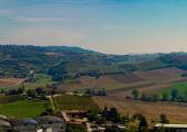
The route connects the municipality of Sanico, Alfiano Natta, with Moncalvo. It is 8.5 km long. Estimated travel time: 2 hours and 5 minutes. The difference in level is 70 m.
When you are in Sanico go down Via San Pietro for about 90 m, then take the first dirt road on the left. After 250 m turn right and pass through the farmlands for about 600 m. At the intersection keep the left until you reach the paved road. After 80 m turn left. Go straight ahead on the dirt road for about 1,5 km. Go along the company “Fassa Bortolo” building in Località Gessi.
Go past the building, go straight ahead until you reach an intersection. Keep going down on Strada Provinciale 13.
After less than a kilometer you come to an intersection again. Turn right into Strada Provinciale 57d.
The route continues on Strada Provinciale that also goes through farmlands, then Via Roma in Moncalvo, where the appeal of the medieval city meets a unique landscape of hills. Moncalvo, which is the smallest city of Italy, has been the capital of the Marquisate of Monferrato for a long time and it is now one of the main municipalities of this area. Situated to the northeast of Asti, right on the border of the Province of Alessandria, it stands on a hill of 305 m above sea level.
Its castle had one the strongest fortification in the area: large towers and massive walls can be seen in the big Carlo Alberto square.
Moncalvo has been home to a flourishing Jewish community until 1939. Today only small traces of the synagogue and the ghetto, which was on Via General Montanari and Via IV Marzo, are visible. The cemetery, on the way to Alessandria, has ancient tombs, mostly from the 18th century.
The main artistic heritage of the city is represented by the so-called “Il Moncalvo” Guglielmo Caccia and his daughter Orsola Maddalena. In fact, their masterpieces enrich the church of St Francesco, with its museum, and the church of Sant’Antonio Abate. It is also important to mention the church of Madonna delle Grazie, built in the 16th century and designed by Magnocavalli; and the ruins of the castle with tunnels that hosted guards ready to prevent looting and enemy attacks for years.
Nowadays, the ruins of the castle of Moncalvo together with its tunnels represent a quite unique feature for the city that has become a pole of cultural excellence.
Recommended period
Accessible to people with disabilities
Dettagli
Profilo altimetrico
Dati tecnici
- Code
- CCC
- Classification
- Provincial
- Country
- Italy
- Region
- Piemonte
- Province
- Alessandria
- Asti
- Devotional relevance
- No
- Historical relevance
- No
- Ultima data di aggiornamento
- 24/10/2024
Altre info
Accommodation facilities

B&b casa rovelli
- Località
ALFIANO NATTA (AL)

Casa degli artisti
- Località
ALFIANO NATTA (AL)

Casa rovelli
- Località
ALFIANO NATTA (AL)

Casale osvalda
- Località
ALFIANO NATTA (AL)

Crealto
- Località
ALFIANO NATTA (AL)

Da nonna carla
- Località
ALFIANO NATTA (AL)

I mandorli
- Località
ALFIANO NATTA (AL)

Relais castello di razzano
- Località
ALFIANO NATTA (AL)

Cascina orsolina
- Località
MONCALVO (AT)

Cascina spinerola
- Località
MONCALVO (AT)

Cascina valeggia
- Località
MONCALVO (AT)

La corte
- Località
MONCALVO (AT)

La locanda del melograno
- Località
MONCALVO (AT)

La quercia rossa
- Località
MONCALVO (AT)

Rooms
- Località
MONCALVO (AT)

Samarcanda
- Località
MONCALVO (AT)

Sottocastello
- Località
MONCALVO (AT)

Villaggio cascinot
- Località
MONCALVO (AT)
Tappe
Tappe attività
-
0Cammini delle alte colline ombrose e delle colline chiare (CCC)Lunghezza160.50 kmTempo1 day 13 hours 30 minutesDifficoltàEasy
-
1Cammini delle alte colline ombrose e delle colline chiare: Stage 1: Chiesa della Natività di Frinco - Chiusano d'AstiLunghezza9.70 kmTempo2 hours 15 minutesDifficoltàEasy
-
2Cammini delle alte colline ombrose e delle colline chiare: Stage 2: Chiusano d'Asti - SoglioLunghezza13.90 kmTempo3 hours 20 minutesDifficoltàEasy
-
3Cammini delle alte colline ombrose e delle colline chiare: Stage 3: Soglio - CorsioneLunghezza11.20 kmTempo2 hours 40 minutesDifficoltàEasy
-
4Cammini delle alte colline ombrose e delle colline chiare: Stage 4: Corsione - ToncoLunghezza11.50 kmTempo2 hours 50 minutesDifficoltàEasy
-
5Cammini delle alte colline ombrose e delle colline chiare: Stage 5: Tonco - Frazione SanicoLunghezza11.80 kmTempo2 hours 45 minutesDifficoltàEasy
-
6Cammini delle alte colline ombrose e delle colline chiare: Stage 6: Frazione Sanico - MoncalvoLunghezza8.10 kmTempo2 hoursDifficoltàEasy
-
6ACammini delle alte colline ombrose e delle colline chiare: Stage 6A: Stazione di Penango - Grana, bivio Tappa 07Lunghezza6.60 kmTempo1 hour 35 minutesDifficoltàEasy
-
7Cammini delle alte colline ombrose e delle colline chiare: Stage 7: Moncalvo - GranaLunghezza14.60 kmTempo3 hours 30 minutesDifficoltàEasy
-
8Cammini delle alte colline ombrose e delle colline chiare: Stage 8: Grana - CasorzoLunghezza11.10 kmTempo2 hours 40 minutesDifficoltàEasy
-
9Cammini delle alte colline ombrose e delle colline chiare: Stage 9: Casorzo - ViarigiLunghezza6.70 kmTempo1 hour 45 minutesDifficoltàEasy
-
9ACammini delle alte colline ombrose e delle colline chiare: Stage 9A: Viarigi - Cuccaro MonferratoLunghezza13.30 kmTempo3 hours 10 minutesDifficoltàEasy
-
10Cammini delle alte colline ombrose e delle colline chiare: Stage 10: Viarigi - ScurzolengoLunghezza13.00 kmTempo2 hours 50 minutesDifficoltàEasy
-
11Cammini delle alte colline ombrose e delle colline chiare: Stage 11: Scurzolengo - CallianoLunghezza13.50 kmTempo3 hours 10 minutesDifficoltàEasy
-
12Cammini delle alte colline ombrose e delle colline chiare: Stage 12: Calliano - Castell'AlferoLunghezza9.60 kmTempo2 hours 20 minutesDifficoltàEasy
-
13Cammini delle alte colline ombrose e delle colline chiare: Tappa 13: Castell'Alfero - Chiesa della Natività di FrincoLunghezza5.90 kmTempo1 hour 40 minutesDifficoltàFacile
