- Lenght
- 9.60 km
- Tempo
- 2 hours 20 minutes
- Tappa
- Max altitude
- 315 m
- Descent elevation loss
- 24 m
- Difficulty
- Easy
- Itinerary index
- No
Informazioni
Punto di partenza
Calliano
14031 Calliano AT
Italy
Punto di arrivo
Castell'Alfero
14033 Castell'Alfero AT
Italy
Come arrivare
Descrizione
The route is 10 km long and connects Calliano with Castell’Alfero. Estimated travel time: 2 hours and 15 minutes. The difference in level is 25 m.
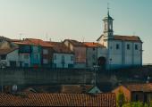
The municipality of Calliano separates Valle Versa from Valle Grana; on its territory are present remarkable architectural monuments such as the romanic church of San Pietro dating back to 11th century and the parish church complex that hosts many paintings. Some events are organized throughout the year, such as Palio degli Asini (donkey race) each October, and festivals related to the typical local products – as for example, agnolotti pasta filled with donkey meat, donkey stew, and donkey sausage.
The point of depature of this stop is located outside the inhabited area of the village, next to the cemetery. Go to Valle della Pirenta along the hillside that leads to Cascine Pietra. Go past Strada provinciale 457, then take the road that passes behind the company “Fassa Bortolo”. Now you are very close to “La Pirenta”, a sulphur spring known for its depurative and curative properties.
Behind the company, the route continues along fields and farmlands for about 3 km and passes through the municipality of Perrona, until it intersects with Via Montiglio. Take it and then take the small street that leads to Valle di Castell’Alfero. On the way you will see Gioia Lake where it is possible to do sport fishing. Go past the lake, keep going for about 400 m until you reach a small bridge where Valle river flows underneath. Go down Via Valle for about 300 m until it intersects with Via Casale. Turn right, go straight, and turn left after 100 m. You are in one of the industrial areas of Borgo Stazione of Castell’Alfero.
Keep the right and go past the industries. Go down the dirt road that passes through the fields, until you come to the intersection with Via Asti (Strada Provinciale 57 A). Turn right, and shortly after turn left into a road that leads to località Contessi.
After about 150 m, turn right into a road that goes up for about 1 km. At the intersection with Via Robino, turn right and go up for about 500 m in order to get to the historic centre of Castell’Alfero. Christian martyr Giovanni Battista De Rolandis was born in this village. He is the one who conceived the Italian flag, together with Luigi Zamboni from Bologna.
The historic centre of the village is known for Piazza Castello, where the castle belonging to Earls Amico is home to the City Hall, a wine bar, and a guest room. In its tunnels there is a museum of peasant life named “Il Ciar”, which can be visited with prior booking. This square is adorned by public gardens with breathtaking views of Monferrato hills.
Recommended period
Accessible to people with disabilities
Dettagli
Profilo altimetrico
Dati tecnici
- Code
- CCC
- Classification
- Provincial
- Country
- Italy
- Region
- Piemonte
- Province
- Asti
- Devotional relevance
- No
- Historical relevance
- No
- Ultima data di aggiornamento
- 24/10/2024
Altre info
Accommodation facilities

Relais san desiderio
- Località
CALLIANO MONFERRATO (AT)

Casa dei ciliegi
- Località
CASTELL'ALFERO (AT)

Cascina castagneto
- Località
CASTELL'ALFERO (AT)

La foresteria del castello
- Località
CASTELL'ALFERO (AT)
Tappe
Tappe attività
-
0Cammini delle alte colline ombrose e delle colline chiare (CCC)Lunghezza160.50 kmTempo1 day 13 hours 30 minutesDifficoltàEasy
-
1Cammini delle alte colline ombrose e delle colline chiare: Stage 1: Chiesa della Natività di Frinco - Chiusano d'AstiLunghezza9.70 kmTempo2 hours 15 minutesDifficoltàEasy
-
2Cammini delle alte colline ombrose e delle colline chiare: Stage 2: Chiusano d'Asti - SoglioLunghezza13.90 kmTempo3 hours 20 minutesDifficoltàEasy
-
3Cammini delle alte colline ombrose e delle colline chiare: Stage 3: Soglio - CorsioneLunghezza11.20 kmTempo2 hours 40 minutesDifficoltàEasy
-
4Cammini delle alte colline ombrose e delle colline chiare: Stage 4: Corsione - ToncoLunghezza11.50 kmTempo2 hours 50 minutesDifficoltàEasy
-
5Cammini delle alte colline ombrose e delle colline chiare: Stage 5: Tonco - Frazione SanicoLunghezza11.80 kmTempo2 hours 45 minutesDifficoltàEasy
-
6Cammini delle alte colline ombrose e delle colline chiare: Stage 6: Frazione Sanico - MoncalvoLunghezza8.10 kmTempo2 hoursDifficoltàEasy
-
6ACammini delle alte colline ombrose e delle colline chiare: Stage 6A: Stazione di Penango - Grana, bivio Tappa 07Lunghezza6.60 kmTempo1 hour 35 minutesDifficoltàEasy
-
7Cammini delle alte colline ombrose e delle colline chiare: Stage 7: Moncalvo - GranaLunghezza14.60 kmTempo3 hours 30 minutesDifficoltàEasy
-
8Cammini delle alte colline ombrose e delle colline chiare: Stage 8: Grana - CasorzoLunghezza11.10 kmTempo2 hours 40 minutesDifficoltàEasy
-
9Cammini delle alte colline ombrose e delle colline chiare: Stage 9: Casorzo - ViarigiLunghezza6.70 kmTempo1 hour 45 minutesDifficoltàEasy
-
9ACammini delle alte colline ombrose e delle colline chiare: Stage 9A: Viarigi - Cuccaro MonferratoLunghezza13.30 kmTempo3 hours 10 minutesDifficoltàEasy
-
10Cammini delle alte colline ombrose e delle colline chiare: Stage 10: Viarigi - ScurzolengoLunghezza13.00 kmTempo2 hours 50 minutesDifficoltàEasy
-
11Cammini delle alte colline ombrose e delle colline chiare: Stage 11: Scurzolengo - CallianoLunghezza13.50 kmTempo3 hours 10 minutesDifficoltàEasy
-
12Cammini delle alte colline ombrose e delle colline chiare: Stage 12: Calliano - Castell'AlferoLunghezza9.60 kmTempo2 hours 20 minutesDifficoltàEasy
-
13Cammini delle alte colline ombrose e delle colline chiare: Tappa 13: Castell'Alfero - Chiesa della Natività di FrincoLunghezza5.90 kmTempo1 hour 40 minutesDifficoltàFacile
