- Lenght
- 11.80 km
- Tempo
- 2 hours 45 minutes
- Tappa
- Max altitude
- 315 m
- Descent elevation loss
- 5 m
- Difficulty
- Easy
- Itinerary index
- No
Informazioni
Punto di partenza
Tonco
Via Asti
14039 Tonco AT
Italy
Punto di arrivo
Frazione Sanico
15021 Alfiano Natta AL
Italy
Come arrivare
Descrizione
The route, which goes from Tonco to Sanico, is 10.5 km long. Estimated travel time: 2 hours and 35 minutes. The difference in level is 5 m.
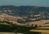
The first part of the route is on the road that goes from Tonco to Valle del Rio of Tonco. The landscape is characterized by the presence of big farmlands together with small farmhouses.
Along the way you can find the castle of Razzano, located in one of the best spots of Monferrato and surrounded by beautiful scenery. Its origins date back to medieval times when it was used as a fortified house and belonged to Natta family. The castle has been rebuilt and has become tourist accomodation in 2006. It is surrounded by 20 hectares of vineyards.
Nowadays it is possible to visit the museum “ArteVino” of Razzano, opened in October 2009, and located at the centre of the castle courtyard. In this thematic museum art meets wine culture.
Go past the castle, turn right after 200 m, pass through the farmlands for about 900 m until you reach Alfiano Natta.
You get to the village taking Strada Provinciale 13 for a short stretch of 100 m until reaching an intersection.
At the intersection, take the second road on the left.
After 80 m the route continues through woods for about 250 m. Get out of the woods and go straight ahead until you reach Strada di Monte. Turn left and go along Cardona direction, this road becomes dirt and goes through woods once again.
All around there is a unique landscape of quarries that were used for supplying construction materials during the past.
From Via Umberto you get to Cardona, go down this road for about 300 m, then turn right into Strada Crealto. The route continues through Parco Naturale Ex cave di Cardona for about 3 km, until reaching Strada Santo Spirito that leads to Alfiano Natta.
When you get to the village, go straight ahead, then turn right into Strada Crosio and pass through the farmlands for 800 m.
The dirt road diverts on the right and after 150 m it intersects with Via Vittorio Emanuele. Turn left and go straight ahead for 190 m until it intersects with Strada Provinciale.
At the intersection take the first dirt road on the right whose name is Via Parrocchia after 200 m. From Via Parrocchia you will get to Sanico.
Recommended period
Accessible to people with disabilities
Dettagli
Profilo altimetrico
Dati tecnici
- Code
- CCC
- Classification
- Provincial
- Country
- Italy
- Region
- Piemonte
- Province
- Alessandria
- Asti
- Devotional relevance
- No
- Historical relevance
- No
- Ultima data di aggiornamento
- 24/10/2024
Altre info
Accommodation facilities

La corte di gerardo
- Località
TONCO (AT)

Le ginestre
- Località
TONCO (AT)

Villa belforte
- Località
TONCO (AT)

B&b casa rovelli
- Località
ALFIANO NATTA (AL)

Casa degli artisti
- Località
ALFIANO NATTA (AL)

Casa rovelli
- Località
ALFIANO NATTA (AL)

Casale osvalda
- Località
ALFIANO NATTA (AL)

Crealto
- Località
ALFIANO NATTA (AL)

Da nonna carla
- Località
ALFIANO NATTA (AL)

I mandorli
- Località
ALFIANO NATTA (AL)

Relais castello di razzano
- Località
ALFIANO NATTA (AL)
Tappe
Tappe attività
-
0Cammini delle alte colline ombrose e delle colline chiare (CCC)Lunghezza160.50 kmTempo1 day 13 hours 30 minutesDifficoltàEasy
-
1Cammini delle alte colline ombrose e delle colline chiare: Stage 1: Chiesa della Natività di Frinco - Chiusano d'AstiLunghezza9.70 kmTempo2 hours 15 minutesDifficoltàEasy
-
2Cammini delle alte colline ombrose e delle colline chiare: Stage 2: Chiusano d'Asti - SoglioLunghezza13.90 kmTempo3 hours 20 minutesDifficoltàEasy
-
3Cammini delle alte colline ombrose e delle colline chiare: Stage 3: Soglio - CorsioneLunghezza11.20 kmTempo2 hours 40 minutesDifficoltàEasy
-
4Cammini delle alte colline ombrose e delle colline chiare: Stage 4: Corsione - ToncoLunghezza11.50 kmTempo2 hours 50 minutesDifficoltàEasy
-
5Cammini delle alte colline ombrose e delle colline chiare: Stage 5: Tonco - Frazione SanicoLunghezza11.80 kmTempo2 hours 45 minutesDifficoltàEasy
-
6Cammini delle alte colline ombrose e delle colline chiare: Stage 6: Frazione Sanico - MoncalvoLunghezza8.10 kmTempo2 hoursDifficoltàEasy
-
6ACammini delle alte colline ombrose e delle colline chiare: Stage 6A: Stazione di Penango - Grana, bivio Tappa 07Lunghezza6.60 kmTempo1 hour 35 minutesDifficoltàEasy
-
7Cammini delle alte colline ombrose e delle colline chiare: Stage 7: Moncalvo - GranaLunghezza14.60 kmTempo3 hours 30 minutesDifficoltàEasy
-
8Cammini delle alte colline ombrose e delle colline chiare: Stage 8: Grana - CasorzoLunghezza11.10 kmTempo2 hours 40 minutesDifficoltàEasy
-
9Cammini delle alte colline ombrose e delle colline chiare: Stage 9: Casorzo - ViarigiLunghezza6.70 kmTempo1 hour 45 minutesDifficoltàEasy
-
9ACammini delle alte colline ombrose e delle colline chiare: Stage 9A: Viarigi - Cuccaro MonferratoLunghezza13.30 kmTempo3 hours 10 minutesDifficoltàEasy
-
10Cammini delle alte colline ombrose e delle colline chiare: Stage 10: Viarigi - ScurzolengoLunghezza13.00 kmTempo2 hours 50 minutesDifficoltàEasy
-
11Cammini delle alte colline ombrose e delle colline chiare: Stage 11: Scurzolengo - CallianoLunghezza13.50 kmTempo3 hours 10 minutesDifficoltàEasy
-
12Cammini delle alte colline ombrose e delle colline chiare: Stage 12: Calliano - Castell'AlferoLunghezza9.60 kmTempo2 hours 20 minutesDifficoltàEasy
-
13Cammini delle alte colline ombrose e delle colline chiare: Tappa 13: Castell'Alfero - Chiesa della Natività di FrincoLunghezza5.90 kmTempo1 hour 40 minutesDifficoltàFacile
