Galleria foto
- Lenght
- 9.16 km
- Tempo
- 4 hours 25 minutes
- Tappa
Elenco risultati
- Max altitude
- 2635 m
- Ascent elevation gain
- 756 m
- Descent elevation loss
- 707 m
- Difficulty
- Difficult Hiking
- Itinerary index
- No
Informazioni
Punto di partenza
Rifugio Balma
località Alpe della Balma
10050 Coazze TO
Italy
Punto di arrivo
Rifugio Selleries
Località Alpe Selleries
10060 Roure TO
Italy
Come arrivare
Rifugio Balma can be reached from the hamlet of Molè in the municipality of Coazze along path 415. Alternatively, from the village of Forno di Coazze it is possible to continue by car towards Pian Neiretto and reach Cara 'd Taiè (1179 m.). Take path 415 D which leads into a birch and beech forest. Once near to the Balma stream, cross and reach the moraine on the left bank, joining path 415 coming from Molè.
Descrizione
From Rifugio Balma, follow path 415 , which climbs towards Monte Robinet and climbs up to the Fontana del Lupo , or Fontana del Diavolo (2360 m), the last guaranteed opportunity to replenish drinking water.
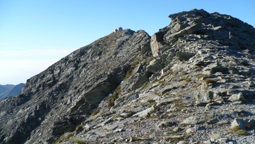
The path continues up a gentle slope, under the steep walls of the summit of Robinet, up to a series of narrow hairpin bends that lead to Colletto del Robinet (2635 m).
From Colletto del Robinet, the itinerary continues along path 341 which descends Val Chisone, until the wide glacial terrace (seasonal spring water nearby) and tackles the rocky step below (Graded “For Expert Hikers Only”, section equipped with chains).
In the middle of the gully, after a small pool fed by the runoff from a faint stream, the path forks: leave trail 341 on the left, which descends to Prato del Colle, and continue on route 366 , which still descends into the gully and then turns right to follow the flat valley floor of Vallone di Rouen .
After a climb and a long, high traverse, the path descends rapidly along the crest of Costa di Glantin.
Leaving the crest, cross the Vallone delle Vallette and head past the two forks for the hamlet of Seleiraut and Colle di Prà Reale (2529 m). Then proceed northwards, still on path 366, which affords splendid views of the valley floor of Val Chisone, the ridge of Val Germanasca and Monviso in the distance. The trail then climbs slightly to Lago Laus (2274 m), where there is a small building, which serves as a park warden’s hut and a bivouac hut open all year. From here, descend along path 339A, which then merges into path 339, and reach Rifugio Selleries, surrounded by alpine meadows that are also home to a number of bergerie (alpine dairies) where the renowned Plaisentif cheese is produced.
Recommended period
Accessible to people with disabilities
Support points
Bivacco fisso al Lago Laus (2274 m)
Interest points
Dal Colletto del Robinet, in direzione sud, parte il sentiero che porta, in pochi minuti, alla vetta del monte Robinet, dove si trovano la cappella e un bivacco; in direzione nord, parte il sentiero che rimonta il pendio detritico e, in 30 minuti, conduce alla punta orientale del monte Rocciavrè.
Dettagli
Profilo altimetrico
Dati tecnici
- Code
- GDO
- Classification
- Provincial - High altitude
- Cell phone coverage
Presente ma con punti non serviti
- Country
- Italy
- Region
- Piemonte
- Province
- Torino
- Attachments
- GO-20Italiano-20v2018_1.pdf
- Devotional relevance
- No
- Historical relevance
- No
- Ultima data di aggiornamento
- 15/12/2023
Altre info

Tappe
Tappe attività
-
0The Giro dell'Orsiera G.O. TrailLunghezza55.96 kmTempo6 daysDifficoltàHiking
-
1The Giro dell'Orsiera G.O. Trail Stage 1: Molè - Rifugio BalmaLunghezza4.50 kmTempo2 hours 40 minutesDifficoltàHiking
-
2The Giro dell'Orsiera G.O. Trail Stage 2: Rifugio Balma - Rifugio SelleriesLunghezza9.16 kmTempo4 hours 25 minutesDifficoltàDifficult Hiking
-
3The Giro dell'Orsiera G.O. Trail Stage 3: Rifugio Selleries - Rifugio ToescaLunghezza6.71 kmTempo3 hours 10 minutesDifficoltàHiking
-
4The Giro dell'Orsiera G.O. Trail Stage 4: Rifugio Toesca - Rifugio AmprimoLunghezza13.13 kmTempo4 hours 20 minutesDifficoltàHiking
-
5The Giro dell'Orsiera G.O. Trail Stage 5: Rifugio Amprimo - Rifugio GEAT Val GravioLunghezza7.93 kmTempo2 hours 20 minutesDifficoltàHiking
-
6The Giro dell'Orsiera G.O. Trail Stage 6: Rifugio GEAT Val Gravio - MolèLunghezza14.53 kmTempo5 hours 20 minutesDifficoltàHiking