- Lenght
- 7.93 km
- Tempo
- 2 hours 20 minutes
- Tappa
- Ascent elevation gain
- 305 m
- Descent elevation loss
- 306 m
- Difficulty
- Hiking
- Itinerary index
- No
Informazioni
Punto di partenza
Rifugio Amprimo
Località Rio Secco
10053 Bussoleno TO
Italy
Punto di arrivo
Rifugio Geat Val Gravio
Località Pianetti
10050 San Giorio di Susa TO
Italy
Come arrivare
Rifugio Amprimo (Bussoleno) can be reached via two routes: 1) from San Giorio take the paved road that reaches the hamlet of Città. Continue along a stretch of dirt road to the Cortavetto car park and from here take the 513 hiking trail that leads to Rifugio Amprimo in about 40 minutes; 2) from Bussoleno reach the Sagnette car park on a paved road (with a stretch of dirt road) then take path 510 which leads to Rifugio Amprimo in 20 minutes.
Descrizione
From Rifugio Amprimo follow path 513 (Sentiero dei Franchi), then at the junction with path 513A leave the Sentiero dei Franchi Trail and descend to the left to the lake of Paradiso delle Rane (Frogs’ Paradise).
Then continue on the path that heads down to the car park and head down next to the cart track towards the hamlet of Città. Once you reach the hamlet, continue for less than a kilometre on the road that leads to the hamlet of Adret . Near the church, take path 524 in the direction of the Certosa di Montebenedetto and Pian dell'Orso.
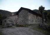
The itinerary then crosses the Gravio stream, ascends the right side of the valley up a short slope and overlooks the pastures surrounding the Certosa di Montebenedetto (a former Carthusian Monastery), which is reached after a few hundred meters on a dirt road.
After stopping to visit the ex-Monastery, retrace your steps a short distance on the unpaved access road, until you reach trail 506 on the left. After an initial steep climb, the path continues up a moderate gradient between larch trees and after about an hour you reach Rifugio GEAT Val Gravio.
This stage lends itself to some variants along connecting paths:
upstream from the Paradiso delle Rane lake, going down from the Amprimo hut on the path 513, it is possible to take the junction of the path 513A which goes eastwards through a conifer wood and heads up to the hamlet of Travers a Mont. After crossing the hamlet, the path continues, flanked for much of its length by dry stone walls. Pass the uninhabited villages of Pois and Passet. You then reach the junction with path 512 which comes up from the hamlet of Adret and follow this. After passing a rocky spur, the trail leaves the broad-leaved forest to enter a larch wood alternating with clearings and pastures and continues up a moderate slope to the refuge.
If you take path 512 you still have the chance to reach the Certosa di Montebenedetto: after entering the first clearing and having followed a short descent you will find the junction with path 512A, a connecting path that allows horses to ford the Gravio stream safely and then descend towards Montebenedetto.
Recommended period
Accessible to people with disabilities
Support points
Foresteria della Certosa di Montebenedetto (1149 m)
Interest points
La Certosa di Montebenedetto, edificata nel 1198-1200, è l’unico esempio di certosa “primitiva”, ossia che conserva ancora parti originali di costruzione medioevale e che non ha subito pesanti trasformazioni strutturali.
Il complesso ospita anche un alpeggio e una casa per ferie gestita dal Parco.
In prossimità del rifugio GEAT Val Gravio il torrente Gravio crea la stupenda cascata del Gran Gouarf.
Dettagli
Profilo altimetrico
Dati tecnici
- Code
- GDO
- Classification
- Provincial - High altitude
- Cell phone coverage
Presente ma con punti non serviti
- Country
- Italy
- Region
- Piemonte
- Province
- Torino
- Attachments
- Devotional relevance
- No
- Historical relevance
- Yes
- Ultima data di aggiornamento
- 15/12/2023
Altre info
Tappe
Tappe attività
-
0The Giro dell'Orsiera G.O. TrailLunghezza55.96 kmTempo6 daysDifficoltàHiking
-
1The Giro dell'Orsiera G.O. Trail Stage 1: Molè - Rifugio BalmaLunghezza4.50 kmTempo2 hours 40 minutesDifficoltàHiking
-
2The Giro dell'Orsiera G.O. Trail Stage 2: Rifugio Balma - Rifugio SelleriesLunghezza9.16 kmTempo4 hours 25 minutesDifficoltàDifficult Hiking
-
3The Giro dell'Orsiera G.O. Trail Stage 3: Rifugio Selleries - Rifugio ToescaLunghezza6.71 kmTempo3 hours 10 minutesDifficoltàHiking
-
4The Giro dell'Orsiera G.O. Trail Stage 4: Rifugio Toesca - Rifugio AmprimoLunghezza13.13 kmTempo4 hours 20 minutesDifficoltàHiking
-
5The Giro dell'Orsiera G.O. Trail Stage 5: Rifugio Amprimo - Rifugio GEAT Val GravioLunghezza7.93 kmTempo2 hours 20 minutesDifficoltàHiking
-
6The Giro dell'Orsiera G.O. Trail Stage 6: Rifugio GEAT Val Gravio - MolèLunghezza14.53 kmTempo5 hours 20 minutesDifficoltàHiking

