- Lenght
- 19.30 km
- Tempo
- 3 hours
- Tappa
- Ascent elevation gain
- 775 m
- Descent elevation loss
- 1165 m
- Difficulty
- Hiking
- Itinerary index
- No
Informazioni
Punto di partenza
Riale
28863 Formazza VB
Italy
Punto di arrivo
Ulrichen CH)
Stazione ferroviaria
6076 Obergoms
Switzerland
Come arrivare
A26 motorway to Gravellona Toce, then Supestrada SS33 del Sempione exit for Valle Antigorio Formazza. After a long tunnel continue along the Strada Statale 659 della Valle Antigorio Formazza until Riale.
Ulrichen (CH) can be reached from Brig by road 19 of the Goms Valley direction Furkapass and Grimselpass
Railway station of interest: Domodossola. Bus stop: Riale, Domodossola - Cascata del Toce line (Autoservizi Comazzi Tel. 0324 240333 www.comazzibus.com)
In Ulrichen there is a railway station of the Furka-Oberalp railway line (www.matterhorngotthardbahn.ch) with which it is possible to return to Brig and from here to Domodossola through the Simplon tunnel (www.bls.ch). A Swiss bus line connects Ulrichen to the Nufenen Pass (www.postauto.ch/It/Timetable)
Descrizione
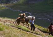
We follow the small road which goes up to the Morasco Dam and coasts the Lake. From the start of the cableway a path begins with some still original stone-paved tracts which take us up to the Bettelmatt Alp in the area of production of the Bettelmatt cheese. From the Alp a rather steep path takes us to the Gries Mountain Pass. From here we proceed along the mountainside coasting the Gries Lake up to the Dam where a small service road begins and continues with two hairpin bends leading to a well-traced downhill path crossing Stoche, Altstafel, and Ladstafel. From here onwards we cross a torrent and coast it keeping on its left up to the Aarenäst bridge where we keep on its right for a small tract until we cross back to the other side on a bridge at 1592 m above sea level, thus following onwards on one last track leading us to the village of Ulrichen in the Goms Valley.
Recommended period
Accessible to people with disabilities
Support points
An emergency bivouac always open at Passo del Gries
A Swiss bus line connects Ulrichen to the Nufenen Pass
Interest points
Morasco Lake, Bettelmatt Plain, Gries Mountain Pass, Walser culture and architecture in Goms Valley
Dettagli
Profilo altimetrico
Dati tecnici
- Code
- VSB
- Classification
- Provincial - Mid and Low Altitude
- Local Tourist Agency (LTA) reference
- ATL Distretto Turistico dei Laghi
- Cell phone coverage
Ok
- Country
- Italy
- Switzerland
- Region
- Piemonte
- Canton du Valais
- Province
- Verbania
- Other
Different accommodation options in the valley of Goms www.obergoms.ch
- Devotional relevance
- No
- Historical relevance
- Yes
- Ultima data di aggiornamento
- 15/12/2023
Altre info
Tappe
Tappe attività
-
0Via Sbrinz - Via del GriesLunghezza61.00 kmTempo18 hours 20 minutesDifficoltàHiking
-
1Via Sbrinz - Via del Gries Stage 1: Crevoladossola - BacenoLunghezza15.00 kmTempo4 hours 20 minutesDifficoltàHiking
-
1AVia dello Sbrinz - Via del Gries Variante Tappa 1A: Montecrestese - PontemaglioLunghezza5.00 kmTempo1 hour 30 minutesDifficoltàHiking
-
1BVSB Tappa 1B: Crevoladossola - OiraLunghezza2.80 kmTempo30 minutesDifficoltàEscursionistico
-
1CVSB Tappa 1C: Fraz. Casanova - Bivio tappa 1Lunghezza1.00 kmTempo20 minutesDifficoltàEscursionistico
-
2Via Sbrinz - Via del Gries Stage 2: Baceno - PonteLunghezza20.00 kmTempo5 hours 30 minutesDifficoltàHiking
-
3Via Sbrinz - Via del Gries Stage 3: Ponte - RialeLunghezza6.70 kmTempo2 hours 30 minutesDifficoltàHiking
-
3AVSB Tappa 3A: Ponte - Bivio tappa 3 presso FruaLunghezza2.80 kmTempo40 minutesDifficoltàEscursionistico
-
4Via Sbrinz - Via del Gries Stage 4: Riale - Ulrichen (CH)Lunghezza19.30 kmTempo3 hoursDifficoltàHiking


