- Lenght
- 20.00 km
- Tempo
- 5 hours 30 minutes
- Tappa
- Ascent elevation gain
- 755 m
- Descent elevation loss
- 125 m
- Difficulty
- Hiking
- Itinerary index
- No
Informazioni
Punto di partenza
Baceno
28861 Baceno VB
Italy
Punto di arrivo
Ponte
28863 Formazza VB
Italy
Come arrivare
A26 motorway to Gravellona Toce, then Supestrada SS33 del Sempione, exit for the Antigorio Formazza Valley. After a long tunnel continue along the Strada Statale 659 della Valle Antigorio Formazza to Baceno or Formazza
Railway station: Domodossola. Bus stop: Baceno, Domodossola - Cascata del Toce line (Autoservizi Comazzi Tel. 0324 240333 www.comazzibus.com)
Descrizione
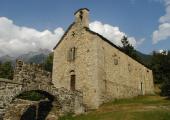
From the municipal square we take the staircase in front of the newsagent and go up till we cross the main road. Not much beyond this we take a (marked) trail which goes up along the mountainside uphill from the road and reaches a nice votive chapel. From here we continue along the mountainside up to Pioda. Following along small roads we reach sports fields and thus, among nice mule tracts alternating with paved tracts on inner roads, we come to Rozzaro, Piazza, and Rodis from where we get to the small municipal square of Premia. From the parking lot in front of the municipal building we take a mule track in the plain which in a brief amount of time comes to the intersection with the road towards the Cingio rural community. We go down to the main road in correspondence of a nice chapel (known as the Dal Self Chapel). Here a nice stone staircase begins taking up down to a bridge crossing the Toce River and thus taking us up to Cagiogno. We take the paved road up to the great stable before a bridge (which we must not cross), and remaining on the left-hand-side of the river we take a right, following the track marks marked Goo and then take a sheep track that proceeds coasting the artificial lake of Piedilago. From the end of the lake we get back up on a paved road which continues flatly passing below the rural community of Cristo and follow along the river. Further on, the track comes back to being unpaved and runs beautifully among well-kept meadows up to reaching a bridge just in front of the Premia Thermal Waters. Instead of going towards the bridge we follow the directions of the Gries Way and then follow along the fields coasting the Toce river for yet another tract presenting a slight upwards slope up to arriving to the Cini Home. Having crossed the rural community we continue along the sheep track which coasts the river up to the intersection with a quarry track. We cross the Toce river in correspondence of the ford (in case of water we make use of the bridge at Cini Homes (Case Cini)) and get to the main road which takes us up to Chioso and Foppiano. From the Foppiano town centre the mule path keeps on running parallel at the bottom of the road up to getting to a road bridge. From there onwards we follow the main road but instead of entering the tunnel we take a right and follow the old encased hairpin bends (and there are also the small paths that cut through these) which are no longer crossed by cars up to reaching the Fondovalle area. Here we cross the bridge on the Toce River and take the agricultural road, a long mostly flat small road which takes us back to the left-hand-side of the river (keep on following the Gries Way directions), taking us down to Valdo. Here we once again cross the Toce River and go up towards the beginning of the chairlift but just before arriving we follow straight on along the pedestrian way which coasts the river, crossing the bridge that crosses the Toce River and coming up to a small square of the Formazza Municipal Building around Ponte.
Recommended period
Accessible to people with disabilities
Support points
Possibilità di ristoro a Premia, Cadarese, San Rocco, Fondovalle e Valdo
Possibilità di alloggio a Premia, Cadarese e Valdo
Tutti i paesi sono collegati dalla Linea Bus Domodossola – Cascata del Toce (Autoservizi Comazzi Tel. 0324 240333 www.comazzibus.com)
Interest points
Orridi di Uriezzo, Hospice of San Bernardo, Parish Church of Premia, Mineralogical Museum of Premia, Terme di Premia and Borgo di Cadarese, Walser culture and architecture in Formazza, Casa Forte in Ponte
Dettagli
Profilo altimetrico
Dati tecnici
- Code
- VSB
- Classification
- Provincial - Mid and Low Altitude
- Local Tourist Agency (LTA) reference
- ATL Distretto Turistico dei Laghi
- Cell phone coverage
Ok
- Country
- Italy
- Region
- Piemonte
- Province
- Verbania
- Devotional relevance
- No
- Historical relevance
- Yes
- Ultima data di aggiornamento
- 15/12/2023
Altre info
Accommodation facilities

Vecchio scarpone
- Località
BACENO (VB)

Valentini
- Località
BACENO (VB)

Casa fattorini
- Località
BACENO (VB)

Edelweiss
- Località
FORMAZZA (VB)

Rotenthal
- Località
FORMAZZA (VB)
Tappe
Tappe attività
-
0Via Sbrinz - Via del GriesLunghezza61.00 kmTempo18 hours 20 minutesDifficoltàHiking
-
1Via Sbrinz - Via del Gries Stage 1: Crevoladossola - BacenoLunghezza15.00 kmTempo4 hours 20 minutesDifficoltàHiking
-
1AVia dello Sbrinz - Via del Gries Variante Tappa 1A: Montecrestese - PontemaglioLunghezza5.00 kmTempo1 hour 30 minutesDifficoltàHiking
-
1BVSB Tappa 1B: Crevoladossola - OiraLunghezza2.80 kmTempo30 minutesDifficoltàEscursionistico
-
1CVSB Tappa 1C: Fraz. Casanova - Bivio tappa 1Lunghezza1.00 kmTempo20 minutesDifficoltàEscursionistico
-
2Via Sbrinz - Via del Gries Stage 2: Baceno - PonteLunghezza20.00 kmTempo5 hours 30 minutesDifficoltàHiking
-
3Via Sbrinz - Via del Gries Stage 3: Ponte - RialeLunghezza6.70 kmTempo2 hours 30 minutesDifficoltàHiking
-
3AVSB Tappa 3A: Ponte - Bivio tappa 3 presso FruaLunghezza2.80 kmTempo40 minutesDifficoltàEscursionistico
-
4Via Sbrinz - Via del Gries Stage 4: Riale - Ulrichen (CH)Lunghezza19.30 kmTempo3 hoursDifficoltàHiking

