- Lenght
- 17.00 km
- Tempo
- 3 hours 50 minutes
- Tappa
- Descent elevation loss
- 24 m
- Difficulty
- Touristic
- Itinerary index
- No
Informazioni
Punto di partenza
Bivio Tappa 1
14015 San Damiano d'Asti AT
Italy
Punto di arrivo
Frazione San Pancrazio
Strada Provinciale 13A
14010 Celle Enomondo AT
Italy
Come arrivare
Descrizione
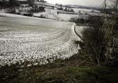
Starting from the Via dei Santi, we take a trail that leads us to the top of the hill, through cultivated fields, at the townshp of Morgnano. From here we go on in the SP8, admiring the valleys until we reach the land of Antignano, whose first information dates back to a list of the year 870 d.C. about the possessions of the emperor of the Holy Roman Empire, Lodovico II. There are numerous variations of ownership of the concentric in the history, as well as numerous testimonies, especially churches. About these, we remember the parish church of Beata Vergine del Carmine, the church of Santo Stefano and the one of San Giovanni Battista. We leave the concentric, continuing along the SP8, we cross the village of San Nicola, from which we can go down to the park at the Tanaro's riverbanks. We continue northwards, taking the road in the valley, beautiful viewpoint on Revigliasco d'Asti, that we are crossing. We walk through a very particular area characterized by woods and cultivated fields, and also by the presence of the nearby Tanaro river. Then, we reach the end of the stage, going up the hill and arriving in the concentric of Celle Enomondo, where another trail rejoins the stage.
Accessible to people with disabilities
Dettagli
Profilo altimetrico
Dati tecnici
- Code
- VDS
- Classification
- Provincial - Mid and Low Altitude
- Country
- Italy
- Region
- Piemonte
- Province
- Asti
- Devotional relevance
- No
- Historical relevance
- No
- Ultima data di aggiornamento
- 15/12/2023
Altre info
Accommodation facilities
Tappe
Tappe attività
-
0Via dei SantiLunghezza30.70 kmTempo10 hours 15 minutesDifficoltàTouristic
-
1Via dei Santi: Tappa 1 San Martino Alfieri - Celle Enomondo Fraz. San PancrazioLunghezza6.90 kmTempo2 hours 15 minutesDifficoltàTouristic
-
1AVia dei Santi: Tappa 1A San Martino Alfieri - Ponte sul TanaroLunghezza2.80 kmTempo55 minutesDifficoltàTouristic
-
1BVia dei Santi: Tappa 1B Bivio Tappa 1 presso Rio Cravina - Celle Enomondo Fraz. San PancrazioLunghezza17.00 kmTempo3 hours 50 minutesDifficoltàTouristic
-
1CVia dei Santi: Tappa 1C Lavezzole - San Damiano d'AstiLunghezza2.80 kmTempo55 minutesDifficoltàTouristic
-
2Via dei Santi: Tappa 2 Celle Enomondo San Pancrazio - Tigliole Fraz. San CarloLunghezza10.30 kmTempo2 hours 30 minutesDifficoltàTouristic
-
2AVia dei Santi: Tappa 2A Tigliole ponte sul Triversa - Bivio Tappa 3 presso ValleandonaLunghezza5.70 kmTempo2 hoursDifficoltàTouristic
-
3Via dei Santi: Tappa 3 Tigliole Fraz. San Carlo - CortandoneLunghezza21.00 kmTempo5 hours 30 minutesDifficoltàTouristic
-
3AVia dei Santi: Tappa 3A: Baldichieri d'Asti - CastelleroLunghezza6.00 kmTempo1 hour 30 minutesDifficoltàTouristic
-
3BVia dei Santi: Tappa 3B Bivio Tappa 3 presso Rio di Monale - MonaleLunghezza1.90 kmTempo30 minutesDifficoltàTouristic
-
3CVia dei Santi: Tappa 3C Cortandone - RoattoLunghezza7.00 kmTempo1 hour 40 minutesDifficoltàTouristic


