- Lenght
- 6.90 km
- Tempo
- 2 hours 15 minutes
- Tappa
- Descent elevation loss
- 105 m
- Difficulty
- Touristic
- Itinerary index
- No
Informazioni
Punto di partenza
San Martino Alfieri
Piazza del Municipio
14010 San Martino Alfieri AT
Italy
Punto di arrivo
Frazione San Pancrazio
Strada Provinciale 13A
14010 Celle Enomondo AT
Italy
Come arrivare
Descrizione
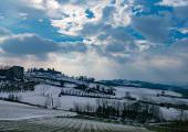
The itinerary starts from the centre of San Martino Alfieri, dominated by the majestic castle, built between 1696 and 1721, circondated by a park realized in 1815, according to the new romantic english style, commissioned by Marquis Carlo Emanuele Alfieri di Sostegno. The urban planning and the parish church were planned by the engineer Cavaliere Ernesto Melano, who had already worked in the area. About numerous hamlets of San Martino Alfieri, we remember the one of Marelli, where Monsignor Giuseppe Marello was born, proclaimed Saint in 2001. We go to the north-west, for a first stretch along the provincial road until we reach the detour to the hamlet of Firano. The way continues along Sana road, through the vineyards and lawns. Continue as far as the town hall for Lavezzole (Variant 1C). We then head north in the Borbore valley, still in the middle of meadow and pasture fields, passing under the village of Celle Enomondo, the point of arrival of the first stage.
Accessible to people with disabilities
Dettagli
Profilo altimetrico
Dati tecnici
- Code
- VDS
- Classification
- Provincial - Mid and Low Altitude
- Country
- Italy
- Region
- Piemonte
- Province
- Asti
- Devotional relevance
- No
- Historical relevance
- No
- Ultima data di aggiornamento
- 15/12/2023
Altre info
Accommodation facilities
Tappe
Tappe attività
-
0Via dei SantiLunghezza30.70 kmTempo10 hours 15 minutesDifficoltàTouristic
-
1Via dei Santi: Tappa 1 San Martino Alfieri - Celle Enomondo Fraz. San PancrazioLunghezza6.90 kmTempo2 hours 15 minutesDifficoltàTouristic
-
1AVia dei Santi: Tappa 1A San Martino Alfieri - Ponte sul TanaroLunghezza2.80 kmTempo55 minutesDifficoltàTouristic
-
1BVia dei Santi: Tappa 1B Bivio Tappa 1 presso Rio Cravina - Celle Enomondo Fraz. San PancrazioLunghezza17.00 kmTempo3 hours 50 minutesDifficoltàTouristic
-
1CVia dei Santi: Tappa 1C Lavezzole - San Damiano d'AstiLunghezza2.80 kmTempo55 minutesDifficoltàTouristic
-
2Via dei Santi: Tappa 2 Celle Enomondo San Pancrazio - Tigliole Fraz. San CarloLunghezza10.30 kmTempo2 hours 30 minutesDifficoltàTouristic
-
2AVia dei Santi: Tappa 2A Tigliole ponte sul Triversa - Bivio Tappa 3 presso ValleandonaLunghezza5.70 kmTempo2 hoursDifficoltàTouristic
-
3Via dei Santi: Tappa 3 Tigliole Fraz. San Carlo - CortandoneLunghezza21.00 kmTempo5 hours 30 minutesDifficoltàTouristic
-
3AVia dei Santi: Tappa 3A: Baldichieri d'Asti - CastelleroLunghezza6.00 kmTempo1 hour 30 minutesDifficoltàTouristic
-
3BVia dei Santi: Tappa 3B Bivio Tappa 3 presso Rio di Monale - MonaleLunghezza1.90 kmTempo30 minutesDifficoltàTouristic
-
3CVia dei Santi: Tappa 3C Cortandone - RoattoLunghezza7.00 kmTempo1 hour 40 minutesDifficoltàTouristic


