- Lenght
- 12.60 km
- Tempo
- 4 hours 40 minutes
- Tappa
- Max altitude
- 2694 m
- Ascent elevation gain
- 931 m
- Descent elevation loss
- 910 m
- Difficulty
- Hiking
- Itinerary index
- No
Informazioni
Punto di partenza
Conca del Prà
10060 Bobbio Pellice TO
Italy
Punto di arrivo
Rifugio Barbara Lowrie
10060 Bobbio Pellice TO
Italy
Come arrivare
E' possibile raggiungere il Rifugio Barbara Lowrie con mezzi propri partendo da Villar Pellice e la Conca del Prà lasciando l'auto a Villanova e percorrendo il sentiero fino alla Conca ( 2 ore circa di cammino)
Descrizione
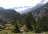
From Ciabot del Pra follow the dirt road that crosses the plain (signpost 116), across the pastures of Partia d'Amount (1743 m) and from the bottom of the valley reascend towards the peaks passing through Pian Sineive (2050 m), where there is a commemorative plaque in memory of a military plane that crashed here in 1957. Continue climbing, following the path across a stream (junction to the left to lago del Mal Consej) and tackle a steep series of zigzags up the arid ridge known as the “schiena d’asino” (donkey’s back), which gains 300 m in altitude, arriving at Rifugio “Battaglione Alpini Monte Granero” (2377 m). From here, it’s worth continuing on a short distance along path 116A to visit Lago Lungo (2356 m). Continue on path 116, which climbs eastwards, keeping to the left of a vast basin of boulders and scree, passing by the small lago Nero (2567 m) and then reaching Colle Manzol (2663 m) above. From here, the views open out onto the Carbonieri valley. From the pass take path 112 that descends to Rifugio Barbara Lowrie (1756 m), down a long scree slope characterized by the presence of large boulders, and continues on a mule track that makes an almost flat high traverse acroos the hillside above a beautiful grassy valley. The path crosses various branches of a stream in a small valley, makes a high traverse across the hillside through larches and reaches a saddle. From here, descend a grassy slope with hairpin bends and finally reach a waterfall and Grange del Pis (1768 m). Rifugio Granero and lago Lungo also represent a worthwhile destination for day hikers not embarked on the long-distance trail (4 hr 15 m ascent from Villanova).
Recommended period
Accessible to people with disabilities
Support points
Rifugio Willy Jervis, Rifugio Ciabot del Prà, Agriturismo Catalin, Rifugio Battaglione Alpini Monte Granero, Rifugio Barbara Lowrie
Interest points
Pian Sineive, lago Lungo, lago Nero, Colle Manzol, Cascata delle Grange del Pis
Dettagli
Profilo altimetrico
Dati tecnici
- Code
- AVV
- Classification
- Provincial - Mid and Low Altitude
- Orientation
- South
- Cell phone coverage
Scarsa copertura di tutti gli operatori
- Country
- Italy
- Region
- Piemonte
- Province
- Torino
- Devotional relevance
- No
- Historical relevance
- No
- Ultima data di aggiornamento
- 15/12/2023
Altre info
Accommodation facilities

Willy jervis
- Località
BOBBIO PELLICE (TO)

Ciabota del pra
- Località
BOBBIO PELLICE (TO)

Barbara lowrie
- Località
BOBBIO PELLICE (TO)

Monte granero
- Località
BOBBIO PELLICE (TO)
Tappe
Tappe attività
-
0The Anello delle Valli Valdesi (AVV) Trail - Val PelliceLunghezza119.00 kmTempo1 day 16 hours 45 minutesDifficoltàDifficult Hiking
-
1The Anello delle Valli Valdesi (AVV) Trail Stage 1: Torre Pellice Town Hall - Alpe VandalinoLunghezza12.20 kmTempo4 hours 30 minutesDifficoltàHiking
-
2The Anello delle Valli Valdesi (AVV) Trail Stage 2: Alpe Vandalino - Colle VacceraLunghezza15.80 kmTempo4 hours 10 minutesDifficoltàHiking
-
3The Anello delle Valli Valdesi (AVV) Trail Stage 3: Colle Vaccera - Alpe CaougisLunghezza15.30 kmTempo7 hoursDifficoltàHiking
-
4The Anello delle Valli Valdesi (AVV) Trail Stage 4: Alpe Caougis - Bergerie GiulianLunghezza17.00 kmTempo6 hours 40 minutesDifficoltàDifficult Hiking
-
5Anello delle Valli Valdesi (AVV) : Tappa 5 Bergerie Giulian - Conca del PràLunghezza13.60 kmTempo4 hoursDifficoltàEscursionistico
-
6The Anello delle Valli Valdesi (AVV) Trail Stage 6: Conca del Prà - Rifugio Barbara LowrieLunghezza12.60 kmTempo4 hours 40 minutesDifficoltàHiking
-
7Anello delle Valli Valdesi (AVV) Tappa 7: Rifugio Barbara Lowrie - La PalàLunghezza19.40 kmTempo6 hours 15 minutesDifficoltàEscursionistico
-
8The Anello delle Valli Valdesi (AVV) Trail Stage 8: La Palà - Torre Pellice Town HallLunghezza13.10 kmTempo5 hours 30 minutesDifficoltàHiking
