- Lenght
- 15.80 km
- Tempo
- 4 hours 10 minutes
- Tappa
- Max altitude
- 1778 m
- Ascent elevation gain
- 571 m
- Descent elevation loss
- 948 m
- Difficulty
- Hiking
- Itinerary index
- No
Informazioni
Punto di partenza
Alpe Vandalino
10066 Torre Pellice TO
Italy
Punto di arrivo
Colle Vaccera
10060 Angrogna TO
Italy
Come arrivare
E' possibile raggiungere con i propri mezzi la località Prà del Torno oppure il Colle Vaccera
Prà del Torno, Angrogna (983m) : punto di attestazione veicolare, fermata bus autolinea comunale, area pic nic.
Descrizione
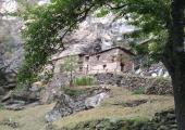
This stage is interesting from a historical and environmental perspective, as it takes in one of the most atmospheric areas of the Waldensian Valleys. The route passes through a number of sites of significant historical interest. In addition, it is linked to events that took place during the period of The Italian Resistance: The Tempio di Pradeltorno, the remains of Collegio dei Barba (used probably for religious training), and the ruins of the ancient dwellings of Barma Monastira and Barma dl'Ours (Barma being an ancient shelter or dwelling usually built into the rock).
From the Alpe Vandalino descend towards Sea di Torre, and follow signs for “Agriturismo Barfè”, trail marker 140A, to reach Prato Stella (1294m). Then take path 140. The trail continues across flat alpine pastures above the treeline overlooking Val d'Angrogna, passing a number of " cumbals " (undulations caused by runoff streams) and some foresti (tracts of abandoned wood): Cialaroccia (1336m) and Sapè (1390m) to reach Embergeria (1381m), a small, still active mountain pasture, and intersection with path 138A which leads to Rifugio “Al Sap” in about 20 min.
From Embergeria head down into the woods passing by the small hamlet of Ramà and the locality of Palai, theatre of events linked to the persecution of the Waldensians and the Italian Resistance, to reach the Lausa bridge (970m) which crosses the Angrogna stream. From here, follow the road along the valley bottom until you reach the town of Pradeltorno (1000m), a refuge of last resort during the period of the Waldensian persecutions from the 15th century to the 17th century. Continue on to the Tempio Valdese built in 1876 and the "Collegio dei Barba", where a traditional sixteenth century "schola" (school) has been reconstructed, in which itinerant Waldensian preachers (called "barbi” in local dialect) sought refuge in order to study theological texts in secret. Continuing on, you reach the forest track, Trail 141, which passes through the hamlet of Fau, set against a huge rock. Continue along a path that passes the farm settlement Turle (1150m), to reach a rock from which you can enjoy a beautiful view and which leads rapidly to the houses of Barma Monastira, built in the shelter of a large rock. The path enters the woods and reaches the ancient dwelling known as Barma dl'Ours (1183m), which in 1944 was used by partisan groups belonging to the resistance movement Giustizia e Libertà (Justice and Liberty) as a clandestine printing office. From here follow the signs for sentieri partigiani (Partisans’ trails) towards Bagnau until you reach the "Ca d'la Pais" (1422m), a structure that was bombed in January 1944 by the Nazi-Fascists during an operation to combat partisan activities. Forty years later, it was rebuilt by the Waldensian community of Angrogna to transform it into a meeting place, dedicated to peace and reconciliation among peoples. From here a dirt road, signposted 150 A, leads shortly to Colle della Vaccera (1465m).
Recommended period
Accessible to people with disabilities
Support points
Rifugio Jumarre, Rifugio vaccera, Agriturismo Monte Servin, Bivacco Alpe Vandalino, Agriturismo Barfè
Interest points
Tempio di Pradeltorno, Collegio dei Barba, Barma Monastira, Barma dl’Ours, Ca d’la Pais, Colle Vaccera
Dettagli
Profilo altimetrico
Dati tecnici
- Code
- AVV
- Classification
- Provincial - Mid and Low Altitude
- Cell phone coverage
Wind : 80% di copertura
vodafone : 66% di copertura
tim : 60% di copertura
- Country
- Italy
- Region
- Piemonte
- Province
- Torino
- Devotional relevance
- No
- Historical relevance
- Yes
- Ultima data di aggiornamento
- 15/12/2023
Altre info
Accommodation facilities

Monte servin
- Località
ANGROGNA (TO)
Tappe
Tappe attività
-
0The Anello delle Valli Valdesi (AVV) Trail - Val PelliceLunghezza119.00 kmTempo1 day 16 hours 45 minutesDifficoltàDifficult Hiking
-
1The Anello delle Valli Valdesi (AVV) Trail Stage 1: Torre Pellice Town Hall - Alpe VandalinoLunghezza12.20 kmTempo4 hours 30 minutesDifficoltàHiking
-
2The Anello delle Valli Valdesi (AVV) Trail Stage 2: Alpe Vandalino - Colle VacceraLunghezza15.80 kmTempo4 hours 10 minutesDifficoltàHiking
-
3The Anello delle Valli Valdesi (AVV) Trail Stage 3: Colle Vaccera - Alpe CaougisLunghezza15.30 kmTempo7 hoursDifficoltàHiking
-
4The Anello delle Valli Valdesi (AVV) Trail Stage 4: Alpe Caougis - Bergerie GiulianLunghezza17.00 kmTempo6 hours 40 minutesDifficoltàDifficult Hiking
-
5Anello delle Valli Valdesi (AVV) : Tappa 5 Bergerie Giulian - Conca del PràLunghezza13.60 kmTempo4 hoursDifficoltàEscursionistico
-
6The Anello delle Valli Valdesi (AVV) Trail Stage 6: Conca del Prà - Rifugio Barbara LowrieLunghezza12.60 kmTempo4 hours 40 minutesDifficoltàHiking
-
7Anello delle Valli Valdesi (AVV) Tappa 7: Rifugio Barbara Lowrie - La PalàLunghezza19.40 kmTempo6 hours 15 minutesDifficoltàEscursionistico
-
8The Anello delle Valli Valdesi (AVV) Trail Stage 8: La Palà - Torre Pellice Town HallLunghezza13.10 kmTempo5 hours 30 minutesDifficoltàHiking
