- Lenght
- 8.50 km
- Tempo
- 3 hours 30 minutes
- Tappa
- Max altitude
- 1472 m
- Ascent elevation gain
- 310 m
- Descent elevation loss
- 610 m
- Difficulty
- Hiking
- Itinerary index
- No
Informazioni
Punto di partenza
RIF. ESC. LA GALABERNA
Frazione Villa
12030 Ostana CN
Italy
Punto di arrivo
BORGATA FERRERE
12034 Paesana CN
Italy
Come arrivare
Autostrada A6 TORINO-SAVONA, uscita: casello di Marene; svoltare a sinistra ed immettersi sulla S.S. 662 in direzione Savigliano, proseguire fino a Saluzzo, seguire quindi le indicazioni da Saluzzo per la valle Po lungo la S.P. 26 o la S. P. 260;
autostrada A21 TORINO – ALESSANDRIA – PIACENZA, uscita Asti est – proseguire poi per Alba- Bra- Marene- Savigliano- Saluzzo- valle Po (S.S. 662);
da TORINO, Tangenziale, uscita Pinerolo, proseguire sulla S.P. 161 poi S.P .27 per Barge, Paesana.
Da Paesana: SP 26 in direzione di Crissolo, diramazione per Ostana.
Da Torino e Cuneo: Atibus, orari sul sito www.buscompany.it/Ati, linee Torino-Saluzzo, Cuneo-Saluzzo, Saluzzo-Paesana, .
Da Torino e Pinerolo: Autolinee Cavourese, orari sul sito www.cavourese.it, linea Torino - Barge.
Da Barge e Paesana per Ostana: Dossetto Bus, orari sul sito www.dossettobus.it, linea Barge - Paesana - Crissolo.
Descrizione
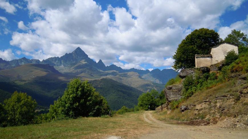
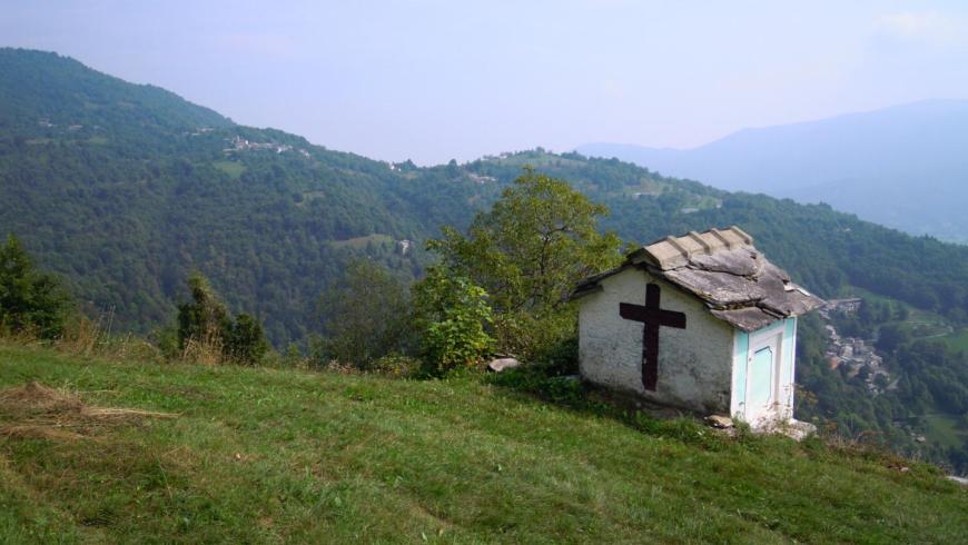
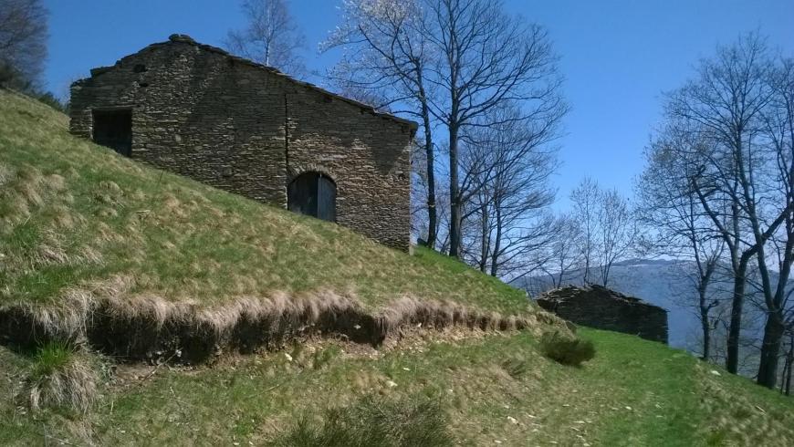
From the mountain hut go up past the town hall, towards the cemetery, then right onto the road that, past the houses, reaches the upstream fork, then right again at the chapel of San Bernardo in the homonymous hamlet. Once past the village, the path extends reaching the plain below the chapel of St. Nicolao (1420m). Now we follow La Vio di mort (The way of the dead), an ancient route that reaches a saddle called Sarlichart; continue along a hillside path downhill to the stream (Loc. Pont), then shortly, beyond the Laità Stream, to the panoramic Castel della Soma (1400m). The descent takes place directly on the opposite side reaching the dirt road near the Meire Monjoa and then the Meire dal Bric, then the mule track to the Meire of Chermoulin, beyond which you reach the dirt road. Follow it entirely until the hamlet of Ferrere, excluding the shortcut at the Cazé of Gerp.
Recommended period
Accessible to people with disabilities
Support points
Rifugio Escursionistico La Galaberna
Trasporto da organizzare verso Frazione Calcinere - Bed&breakfast Alpino (Paesana)
Interest points
Cappella di San Nicolao; lou Béc dë lh’Acasét, punto panoramico.
Dettagli
Profilo altimetrico
Dati tecnici
- Code
- OMV
- Classification
- Provincial - Mid and Low Altitude
- Local Tourist Agency (LTA) reference
- ATL del Cuneese - valli alpine e città d'arte
- Cell phone coverage
Copertura buona nei centri abitati di Ostana e Paesana; possibile minor copertura in alcuni tratti dell'itinerario.
- Country
- Italy
- Region
- Piemonte
- Province
- Cuneo
- Devotional relevance
- Sì
- Historical relevance
- Yes
- Ultima data di aggiornamento
- 15/12/2023
Altre info

Tappe
Tappe attività
-
0Orizzonte MonvisoLunghezza74.89 kmTempo1 day 2 hours 35 minutesDifficoltàHiking
-
1Stage 1: rif. esc. la via del sale - rif. esc. pian munèLunghezza15.88 kmTempo5 hours 45 minutesDifficoltàHiking
-
2Orizzonte Monviso - Tappa 2: Rif. esc. Pian Muné - Rif. esc. LossaLunghezza13.08 kmTempo3 hours 45 minutesDifficoltàHiking
-
2AStage 1a: paesana - bivio quota 1435Lunghezza8.84 kmTempo4 hours 10 minutesDifficoltàHiking
-
2BOrizzonte Monviso - Tappa 2A: Rif. Esc. Pian Muné - bivio Croce Tournour (Paesana)Lunghezza8.34 kmTempo3 hoursDifficoltàHiking
-
3Stage 3: rif. esc. lossa - crissoloLunghezza9.86 kmTempo3 hours 50 minutesDifficoltàHiking
-
4Stage 4: crissolo - rif. esc. la galabernaLunghezza5.90 kmTempo2 hours 15 minutesDifficoltàHiking
-
4AOrizzonte Monviso - Stage 4A: Crissolo - Borgo hamletLunghezza2.52 kmTempo1 hourDifficoltàHiking
-
5Stage 5: rif. esc. la galaberna - bg.ta ferrereLunghezza8.50 kmTempo3 hours 30 minutesDifficoltàHiking
-
6OMV Tappa 6: Borgata Ferrere - Località CollettaLunghezza9.81 kmTempo3 hours 20 minutesDifficoltàHiking
-
7Orizzonte Monviso - Tappa 7 Loc. Colletta - Rif. esc. La va del saleLunghezza11.86 kmTempo4 hours 10 minutesDifficoltàHiking