- Lenght
- 53.80 km
- Tempo
- 5 hours 23 minutes
- Tappa
- Max altitude
- 1169 m
- Ascent elevation gain
- 500 m
- Descent elevation loss
- 400 m
- Difficulty
- Challenging
- Itinerary index
- No
Informazioni
Punto di partenza
Rifugio Scoffera
16022 Davagna GE
Italy
Punto di arrivo
Rifugio Cascina Foi
15060 Bosio AL
Italy
Come arrivare
From Genova to Scoffera under its own power: take the SS 45 to the town of Sottocolle and then the SP 62 to Scoffera.
From Alessandria to Capanne di Marcarolo under its own power: take the SS 30 and then the SP185 to Ovada. Continue on the SP 180 and then on the 160 in the direction of Gavi, you get to voltage and turn right taking the SP 165 and going up towards Capanne di Marcarolo
To reach Scoffera by public transport, you have to take the bus service ALI (https://Www.atpesercizio.it) to Sottocolle and then continue to walk for about 1 km.
To reach the town of Capanne di marcarolo by public transport, you have to use the service Autolinee CIT (http://Www.citnovi.it/Linee_extraurbane.asp)
Per raggiungere la località di Capanne di Marcarolo con i mezzi pubblici, bisogna utilizzare il servizio Autolinee CIT (http://Www.citnovi.it/Linee_extraurbane.asp) that leads from the town of Gavi up to voltage and then reach Capanne di marcarolo on foot (about 15 km)
Descrizione
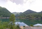
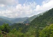
From the Passo della Scoffera following the path of the Alta Via dei Monti Liguri you reach Mount Candelozzo at an altitude of 1.036 meters, the Crocetta di Orero with a railway station along the Genova Casella railway, the Shrine of Nostra Signora della Vittoria Genova, the Passo dei Giovi, and then follows the Ligurian-Piedmont watershed through the Passo della Bocchetta, Mount Leco (1072 m), Mount delle Figne (1172 m), the lakes of Gorzente, until you reach the hamlet of Capanne di Marcarolo where the Cascina Foi refuge is located.
Accessible to people with disabilities
Support points
Rifugio Scoffera, locality Scoffera of City of Davagna (GE);
Rifugio Cascina i Foi, locality Capanne di Marcarolo, Bosio (AL)
Dettagli
Profilo altimetrico
Dati tecnici
- Code
- VDC
- Classification
- Regional
- Local Tourist Agency (LTA) reference
- ATL della provincia di Alessandria "Alexala"
- Cell phone coverage
TIM, Vodafone, 3WIND
- Country
- Italy
- Region
- Piemonte
- Liguria
- Province
- Alessandria
- Genova
- Devotional relevance
- No
- Historical relevance
- No
- Ultima data di aggiornamento
- 15/12/2023
Altre info
Tappe
Tappe attività
-
0'La Via dei Campioni' Cycle RouteLunghezza225.60 kmTempo17 hours 50 minutesDifficoltàChallenging
-
1'La Via dei Campioni' Cycle Route : STAGE 1: Costa Vescovato - Rifugio Montaldo di CosolaLunghezza67.80 kmTempo5 hours 30 minutesDifficoltàEasy
-
1A'La Via dei Campioni' Cycle Route : STAGE 1A Carezzano - Rifugio Montaldo di CosolaLunghezza63.10 kmTempo6 hours 19 minutesDifficoltàEasy
-
1B'La Via dei Campioni' Cycle Route : Stage 1B Avolasca - San Vito intersectionLunghezza3.50 kmTempo21 minutesDifficoltàEasy
-
2'La Via dei Campioni' Cycle Route : STAGE 2: Rifugio Montaldo di Cosola - Rifugio ScofferaLunghezza40.30 kmTempo4 hours 2 minutesDifficoltàChallenging
-
3'La Via dei Campioni' Cycle Route : STAGE 3 Rifugio Scoffera - Rifugio Cascina FoiLunghezza53.80 kmTempo5 hours 23 minutesDifficoltàChallenging
-
4'La Via dei Campioni' Cycle Route : STAGE 4 Rifugio Cascina Foi - CarezzanoLunghezza63.70 kmTempo6 hours 22 minutesDifficoltàEasy
-
4A'La Via dei Campioni' Cycle Route : STAGE 4A Monte Colma - Frazione RicciottiLunghezza43.03 kmTempo4 hours 18 minutesDifficoltàEasy
-
4B'La Via dei Campioni' Cycle Route : STAGE 4B Lerma - Casaleggio BoiroLunghezza1.70 kmTempo10 minutesDifficoltàVery easy
-
4CVia dei Campioni - Tappa 4C: Lerma Loc. Valle Scura - Silvano d'OrbaLunghezza8.40 kmTempo1 hour 55 minutesDifficoltàFacile
-
4E'La Via dei Campioni' Cycle Route: STAGE 4E Lerma Loc. San Cristoforo - Serravalle ScriviaLunghezza15.20 kmTempo1 hour 31 minutesDifficoltàEasy


