- Lenght
- 40.30 km
- Tempo
- 4 hours 2 minutes
- Tappa
- Max altitude
- 1674 m
- Ascent elevation gain
- 670 m
- Descent elevation loss
- 926 m
- Difficulty
- Challenging
- Itinerary index
- No
Informazioni
Punto di partenza
Rifugio Montaldo di Cosola
15060 Cabella Ligure AL
Italy
Punto di arrivo
Rifugio Scoffera
16022 Davagna GE
Italy
Come arrivare
From Tortona to Montaldo di Cosola: take superhighway A26, take the exit for superhighway A7 then exit at the Vignole Borbera toll station; from there continue along provincial highway SP 140.
From Genoa to Scoffera: take highway SS 45 to the village of Sottocolle, then SP 62 to Scoffera.
To reach Montaldo di Cosola by public transport, you need to take the Val Borbera Autolinee service (http://Www.autolineevalborbera.it/) up to Cabella Ligure and then the line for Dova Inferiore.
You can continue to walk for about 2 km.
To reach the locality of Scoffera by public transport, you need to take the ALI bus service (https://Www.atpesercizio.it), up to Sottocolle and then continue to walk for about 1 km.
Descrizione
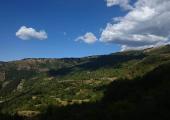
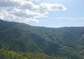
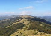
From Montaldo di Cosola the route takes a short steep climb (600 metres in 3 km) to the locality of Capanne di Cosola (1509 m), where it enters Trail 200, which travels the ridge bordering the region of Emilia Romagna, passing by the peaks of Monte Cavalmurone and Monte Legnà, until arriving at Rifugio Parco Antola (about 1 hr drive from Genoa). The itinerary then continues on the Ligurian trail network following the watershed between the Trebbia river and the Scrivia stream, up to the intersection with the Alta Via dei Monti Liguri and European path E1 (Porto Palo di Capopassero-Rotterdam), on Mount Montaldo at an altitude of 1.134 meters. From here you reach the final point of the stage at Passo della Scoffera.
Accessible to people with disabilities
Support points
Rifugio di Montaldo di Cosola, in the town of Cabella Ligure (AL);
Rifugio Antola, in the village of Propata (GE);
Rifugio di Scoffera, in the village di Davagna (GE).
Dettagli
Profilo altimetrico
Dati tecnici
- Code
- VDC
- Classification
- Regional
- Local Tourist Agency (LTA) reference
- ATL della provincia di Alessandria "Alexala"
- Cell phone coverage
TIM, Vodafone, 3WIND
- Country
- Italy
- Region
- Piemonte
- Liguria
- Province
- Alessandria
- Genova
- Attachments
- Devotional relevance
- No
- Historical relevance
- No
- Ultima data di aggiornamento
- 15/12/2023
Altre info
Accommodation facilities

Alpino
- Località
CABELLA LIGURE (AL)

Alta valle
- Località
CABELLA LIGURE (AL)

Cacciatori
- Località
CABELLA LIGURE (AL)

Capanne di cosola
- Località
CABELLA LIGURE (AL)

Maggiociondolo
- Località
CABELLA LIGURE (AL)

Ponte
- Località
CABELLA LIGURE (AL)

Posta
- Località
CABELLA LIGURE (AL)

Art bed&breakfast
- Località
CARREGA LIGURE (AL)
Tappe
Tappe attività
-
0'La Via dei Campioni' Cycle RouteLunghezza225.60 kmTempo17 hours 50 minutesDifficoltàChallenging
-
1'La Via dei Campioni' Cycle Route : STAGE 1: Costa Vescovato - Rifugio Montaldo di CosolaLunghezza67.80 kmTempo5 hours 30 minutesDifficoltàEasy
-
1A'La Via dei Campioni' Cycle Route : STAGE 1A Carezzano - Rifugio Montaldo di CosolaLunghezza63.10 kmTempo6 hours 19 minutesDifficoltàEasy
-
1B'La Via dei Campioni' Cycle Route : Stage 1B Avolasca - San Vito intersectionLunghezza3.50 kmTempo21 minutesDifficoltàEasy
-
2'La Via dei Campioni' Cycle Route : STAGE 2: Rifugio Montaldo di Cosola - Rifugio ScofferaLunghezza40.30 kmTempo4 hours 2 minutesDifficoltàChallenging
-
3'La Via dei Campioni' Cycle Route : STAGE 3 Rifugio Scoffera - Rifugio Cascina FoiLunghezza53.80 kmTempo5 hours 23 minutesDifficoltàChallenging
-
4'La Via dei Campioni' Cycle Route : STAGE 4 Rifugio Cascina Foi - CarezzanoLunghezza63.70 kmTempo6 hours 22 minutesDifficoltàEasy
-
4A'La Via dei Campioni' Cycle Route : STAGE 4A Monte Colma - Frazione RicciottiLunghezza43.03 kmTempo4 hours 18 minutesDifficoltàEasy
-
4B'La Via dei Campioni' Cycle Route : STAGE 4B Lerma - Casaleggio BoiroLunghezza1.70 kmTempo10 minutesDifficoltàVery easy
-
4CVia dei Campioni - Tappa 4C: Lerma Loc. Valle Scura - Silvano d'OrbaLunghezza8.40 kmTempo1 hour 55 minutesDifficoltàFacile
-
4E'La Via dei Campioni' Cycle Route: STAGE 4E Lerma Loc. San Cristoforo - Serravalle ScriviaLunghezza15.20 kmTempo1 hour 31 minutesDifficoltàEasy


