- Lenght
- 225.60 km
- Tempo
- 17 hours 50 minutes
- Max altitude
- 1460 m
- Ascent elevation gain
- 3285 m
- Descent elevation loss
- 3346 m
- Difficulty
- Challenging
- Itinerary index
- Yes
Informazioni
Punto di partenza
Costa Vescovato
15050 Costa Vescovato AL
Italy
Punto di arrivo
Carezzano
15051 Carezzano AL
Italy
Come arrivare
The departure at Costa Vescovato can be reached using the A21 (Tortona exit) coming from Turin and Piacenza. After leaving Tortona, take the SP 35 and after the SP 130 for Villaromagnano, after a few kilometers, you enter the town of Costa Vescovato. If you are coming from Milan you must use the A7 and exit at Tortona, while if you are coming from Genova, you must use the A7 and exit at Serravalle Scrivia. Then you must continue on the SP 35 towards Villalvernia and then take the SP 130 towards Costa Vescovato
Arriving in Costa Vescovato by public transport is possible using the railway network and arriving at the Tortona station.
Then ARFEA buses
Autobus ARFEA - Aziende Riunite Filovie ed Autolinee
http://Www.arfea.it
Descrizione
The Alessandria area boasts a long tradition of cycling, capped by the feats of multiple champions 'Constant' Girardengo and Fausto Coppi. More recently, an optimal cycle-tourism route has been identified, and services promoting the sport in general have been developed. The ‘La Via dei Campioni’ route connects the valley trails with the hills and mountains surrounding Alessandria, passing through localities once travelled by the historic Piedmont champions. The itinerary is inter-regional, composing a circle route of just over 230 km, connecting the territories of Piedmont, Lombardy, Emilia-Romagna, Liguria and the Po Valley with the Piedmont Apennines and the Ligurian Sea.
‘La Via dei Campioni tra natura e mare’ cycle route [The Route of Champions: Nature and Seaside] draws on the best of the inland and coastal territories of these four regions.
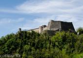
Attractions include the spectacular landscapes of the Monte Ebro Ridge and Monte Chiappo Special Protection Area (SPA IT1180025) and a series of Sites of Community Importance: Antola, Monte Carmo and Monte Legna Massif (SCI IT1180011), Val Borbera Gorge (IT1180009), Capanne di Marcarolo Natural Park (IT1180026), as well as a number of Sites of Regional Importance (SRI), in particular Rio dell'Olmo (IT1180020), Pian dei Laghi (IT 1180023), and the Guardamonte natural-archaeological area of Gremiasco. The route also includes the important historic sites of Forte di Gavi and the Roman archaeological area of Libarna.
Accessible to people with disabilities
Support points
La locanda dei vigneto
Via Montale Celli, 20
Costa Vescovato (AL)
0131 1935451
Rifugio “Piani di San Lorenzo”
Cantalupo Ligure - Val Borbera (AL)
ph. 346.3540867
http://www.lapietraverde.org/rifugio.html
Agriturismo "Il Convento”
Strada del Convento n.8 - Locality Santa Maria di Vezzano
ph. : 0131.836070 - 339.4785015
Fax: 0131.836124
15060 Carezzano
E-mail: info@conventodivezzano.com
Rifugio Parco Antola
Monte Antola street, 16027 Propata GE
phone :339 487 4872
http://www.rifugioantola.com/
Rifugio Cascina Foi
Capanne di Marcarolo
15060 Bosio (Al)
ph. : 3339865198
ph. : 3397327143
info@cascinafoi.it
http://www.cascinafoi.it/index_file/Homepage.htm
Ristorante – Pizzeria “Italia di Lerma”
Martiri della Benedicta st, 4R,
15070 Lerma
CASCINA CIRIMILLA: Agriturismo
Locality Cirimilla n° 4 - 15070 LERMA (AL)
ph. 0143 877702 / 3494255651
Agriturismo “LA SELVA”
Frazione Selvaggia 66
15010 Montaldo Bormida (AL)
ph. 0143 876069
Interest points
Parco dell'Appennino Piemontese: http://www.areeprotetteappenninopiemontese.it/
Dettagli
Profilo altimetrico
Dati tecnici
- Code
- VDC
- Classification
- Regional
- Local Tourist Agency (LTA) reference
- ATL della provincia di Alessandria "Alexala"
- Cell phone coverage
TIM, Vodafone, Wind 3
- Country
- Italy
- Region
- Liguria
- Piemonte
- Province
- Alessandria
- Genova
- Devotional relevance
- No
- Historical relevance
- No
- Ultima data di aggiornamento
- 15/12/2023
Altre info
Accommodation facilities
Tappe
Tappe attività
-
0'La Via dei Campioni' Cycle RouteLunghezza225.60 kmTempo17 hours 50 minutesDifficoltàChallenging
-
1'La Via dei Campioni' Cycle Route : STAGE 1: Costa Vescovato - Rifugio Montaldo di CosolaLunghezza67.80 kmTempo5 hours 30 minutesDifficoltàEasy
-
1A'La Via dei Campioni' Cycle Route : STAGE 1A Carezzano - Rifugio Montaldo di CosolaLunghezza63.10 kmTempo6 hours 19 minutesDifficoltàEasy
-
1B'La Via dei Campioni' Cycle Route : Stage 1B Avolasca - San Vito intersectionLunghezza3.50 kmTempo21 minutesDifficoltàEasy
-
2'La Via dei Campioni' Cycle Route : STAGE 2: Rifugio Montaldo di Cosola - Rifugio ScofferaLunghezza40.30 kmTempo4 hours 2 minutesDifficoltàChallenging
-
3'La Via dei Campioni' Cycle Route : STAGE 3 Rifugio Scoffera - Rifugio Cascina FoiLunghezza53.80 kmTempo5 hours 23 minutesDifficoltàChallenging
-
4'La Via dei Campioni' Cycle Route : STAGE 4 Rifugio Cascina Foi - CarezzanoLunghezza63.70 kmTempo6 hours 22 minutesDifficoltàEasy
-
4A'La Via dei Campioni' Cycle Route : STAGE 4A Monte Colma - Frazione RicciottiLunghezza43.03 kmTempo4 hours 18 minutesDifficoltàEasy
-
4B'La Via dei Campioni' Cycle Route : STAGE 4B Lerma - Casaleggio BoiroLunghezza1.70 kmTempo10 minutesDifficoltàVery easy
-
4CVia dei Campioni - Tappa 4C: Lerma Loc. Valle Scura - Silvano d'OrbaLunghezza8.40 kmTempo1 hour 55 minutesDifficoltàFacile
-
4E'La Via dei Campioni' Cycle Route: STAGE 4E Lerma Loc. San Cristoforo - Serravalle ScriviaLunghezza15.20 kmTempo1 hour 31 minutesDifficoltàEasy


