Galleria foto
- Lenght
- 13.80 km
- Tempo
- 5 hours 20 minutes
- Tappa
Elenco risultati
- Ascent elevation gain
- 704 m
- Difficulty
- Hiking
- Itinerary index
- No
Informazioni
Punto di partenza
Balangero
10070 Balangero TO
Italy
Punto di arrivo
Vallo Torinese
10070 Vallo Torinese TO
Italy
Come arrivare
Descrizione
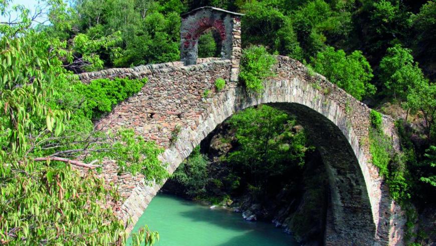
Starting from the center of Balangero (430 m) or from the railway station, take the cyclo-route that from S. Anna, along track n. 402, goes along the left bank of the river Stura di Lanzo through rural road in the greenery. After having passed the Centro Sportivo Lanzese, you reach the village center and, through a short stretch of asphalted road, you arrive at the entrance of Ponte del Diavolo Park (477 m). From this point, hiking route starts along the trail n. 101C that goes up to the North crest of Monte Corno. It encounters short stretches of rural tracks, where the track n. 101A starts, and passes the Grange Blina (832 m) and the Grange Foieri up to Roc del Merlo (1036 m) peak. Keeping the way on the crest among the vegetation, you reach Monte Corno (1226 m), the peak of this stage. From here you can enjoy a formidable panorama both in the direction of the alpine arc and towards the plain. In clear days, you can see even the profiles of the Lombardy Alps in east-north-east direction. Following the ridge, you will find a stretch of forest road through which you reach the top of Monte Turu (1355 m). Here there is a large repeater tower. Beginning the descent you will immediately cross the nearby Passo della Croce (1254 m), a famous historic partisan crossing between Turin and the Viù valley, during the years of Resistenza. Here, in addition to the large metal and wood cross, and the statue of the Virgin, there is an open shelter where you can stop enjoying a beautiful panorama. The descent runs along path n. 090, with several hairpin bends, and finally along the aqueduct service road. It arrives at Vallo Torinese, near the Chapel of San Rocco (594 m). From the church, you go down to the village where you can find the stage place in private accommodations.
Recommended period
Accessible to people with disabilities
Itinerary suitable for disabled people.
Support points
B&B La Piccola Reggia di Vallo Piazza XXII Marzo 1954, 10070 Vallo Torinese +39 339 7578100 www.lareggiadivallo.it.
Dettagli
Profilo altimetrico
Dati tecnici
- Code
- ANC
- Classification
- Provincial - Mid and Low Altitude
- Country
- Italy
- Region
- Piemonte
- Province
- Torino
- Devotional relevance
- No
- Historical relevance
- Yes
- Ultima data di aggiornamento
- 15/12/2023
Tappe
Tappe attività
-
0Anello Ceronda (AC)Lunghezza69.05 kmTempo1 day 2 hoursDifficoltàHiking
-
1Anello Ceronda: Stage 1 Balangero - Vallo TorineseLunghezza13.80 kmTempo5 hours 20 minutesDifficoltàHiking
-
2Anello Ceronda: Stage 2 Vallo Torinese - Colle del LysLunghezza16.88 kmTempo7 hours 35 minutesDifficoltàHiking
-
3Anello Ceronda: Stage 3 Col del Lys - Borgata LuccoLunghezza6.86 kmTempo3 hours 15 minutesDifficoltàHiking
-
4Anello Ceronda: Stage 4 Borgata Lucco - Cascina San GiovanniLunghezza17.24 kmTempo4 hours 30 minutesDifficoltàHiking
-
5Anello Ceronda: Stage 5 Cascina San Giovanni - Ponte del DiavoloLunghezza17.59 kmTempo5 hours 25 minutesDifficoltàHiking