- Lenght
- 17.24 km
- Tempo
- 4 hours 30 minutes
- Tappa
- Ascent elevation gain
- 352 m
- Difficulty
- Hiking
- Itinerary index
- No
Informazioni
Punto di partenza
Borgata Lucco
10040 Val della Torre TO
Italy
Punto di arrivo
Cascina San Giovanni
10040 La Cassa TO
Italy
Come arrivare
Descrizione
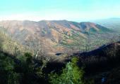
Starting from Lucco (620 m) continue on track no. 001 to Village Castello. You follow for a short stretch the asphalted road, and at Village Borlera you take path n. 001A. After the village Ciaine, you proceed northway on track n. 002B, reaching Case Fontanabruna (849 m). Following Northway path n. 002, you will cross track n. 010 which, turning right, leads half-coast at Bassa delle Sette (1158 m). From here, turning north, you will shortly reach the Chapel Madonna della Neve. This zone is a protected area because of the presence of Ephorbia Gibelliana. From this site you can enjoy a splendid view of the plain of Turin and of La Mandria Park. The tracks n. 010 and then n. 010C lead downhill to Givoletto and to the dirt road to Costa Crest. First you descend to Santa Maria Ausiliatrice (554 m) and then through path n. 005B to Village Rivasacco (402 m). The track n. 005 crosses the provincial street, and on a dirt road you arrive to the area Pralungo, then you continue to follow path n. 006A on dirt road, that ends at the stage point at Cascina San Giovanni (362 m). Otherwise, you can reach the nearby village of La Cassa where there are other accommodation facilities. As we are located near the entrance of the La Mandria Park and near the eclectic Castello della Bizzaria, it is suggested to enrich the experience with a tour of the park both on foot and by bicycle.
Recommended period
Accessible to people with disabilities
Itinerary suitable for disabled people.
Support points
B&B “Antica Quercia” Via Bussoneis 48, 10040 Val della Torre x +39 011 9681208 sonia.gibin@anticaquercia.net www.anticaquercia.net.
Bar Trattoria ‘L Fujot Piazza XVII Febbraio 5, 10062 Luserna San Giovanni +39 0121 900906.
Dettagli
Profilo altimetrico
Dati tecnici
- Code
- ANC
- Classification
- Provincial - Mid and Low Altitude
- Country
- Italy
- Region
- Piemonte
- Province
- Torino
- Devotional relevance
- No
- Historical relevance
- Yes
- Ultima data di aggiornamento
- 15/12/2023
Altre info
Accommodation facilities

'l fojot
- Località
LA CASSA (TO)
Tappe
Tappe attività
-
0Anello Ceronda (AC)Lunghezza69.05 kmTempo1 day 2 hoursDifficoltàHiking
-
1Anello Ceronda: Stage 1 Balangero - Vallo TorineseLunghezza13.80 kmTempo5 hours 20 minutesDifficoltàHiking
-
2Anello Ceronda: Stage 2 Vallo Torinese - Colle del LysLunghezza16.88 kmTempo7 hours 35 minutesDifficoltàHiking
-
3Anello Ceronda: Stage 3 Col del Lys - Borgata LuccoLunghezza6.86 kmTempo3 hours 15 minutesDifficoltàHiking
-
4Anello Ceronda: Stage 4 Borgata Lucco - Cascina San GiovanniLunghezza17.24 kmTempo4 hours 30 minutesDifficoltàHiking
-
5Anello Ceronda: Stage 5 Cascina San Giovanni - Ponte del DiavoloLunghezza17.59 kmTempo5 hours 25 minutesDifficoltàHiking
