- Lenght
- 17.59 km
- Tempo
- 5 hours 25 minutes
- Tappa
- Ascent elevation gain
- 137 m
- Difficulty
- Hiking
- Itinerary index
- No
Informazioni
Punto di partenza
Cascina San Giovanni
10040 La Cassa TO
Italy
Punto di arrivo
Ponte del Diavolo
10074 Lanzo Torinese TO
Italy
Come arrivare
Descrizione
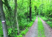
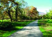
Starting from Cascina San Giovanni di La Cassa, you continue on track n. 006 in the area Basso della Cassa where you find Torrent Ceronda. You follow path n. 008C that alternates path and dirt road, and after having passed the Camping La Mattodera (395 m), you arrive to Hamlet Truc di Miola. You proceed northway on track n. 007 and take a short stretch of the street SP181. You turn left on path n. 041B, and you reach the Chapel San Biagio. Near the building, there are the ruins of the Castle of Barratonia. Then you take path n. 020 that follows the provincial road for a few hundred meters, crossing the bridge over the torrent Ceronda. Shortly after, you turn left into the road that leads to a factory, but turn immediately towards the path that enter the wood. You will cross again the provincial road, and return to the wood that runs near the Common of Fiano (428 m) on the west. On track n. 020 you will reach Monasterolo (476 m) where the route follows dirt roads among woods and meadows. Then you go downhill to Cafasse (409 m) where you will need to cross the SP1. The route n. 020, alternating asphalt and gravel, passes through the rural villages Drovetto (400 m) and Gianoglio. It runs along agricultural fields that extend up to the banks of Stura di Lanzo. Immediately after you will reach Strada della Pianca and continuing walking/riding in flat among fields and woods for some km along the banks of Stura di Lanzo. You continue northwest until crossing SP1 near Case Cordè. From here, the trail n. 020, which overlays the ancient Lanzo road, arrives at Ponte del Diavolo Park, where the circular itinerary ends.
Recommended period
Accessible to people with disabilities
Itinerary suitable for disabled people.
Support points
Bar Trattoria ‘L Fujot Piazza XVII Febbraio 5, 10062 Luserna San Giovanni +39 0121 900906.
Camping La Mattodera Strada Lanzo 2, 10040 La Cassa +39 011 9842015.
Villaggio Naturista “Le Betulle” Via Lanzo 33, 10040 La Cassa +39 011 9842819 info@lebetulle.org www.lebetulle.org.
Dettagli
Profilo altimetrico
Dati tecnici
- Code
- ANC
- Classification
- Provincial - Mid and Low Altitude
- Country
- Italy
- Region
- Piemonte
- Province
- Torino
- Devotional relevance
- No
- Historical relevance
- Yes
- Ultima data di aggiornamento
- 15/12/2023
Altre info
Tappe
Tappe attività
-
0Anello Ceronda (AC)Lunghezza69.05 kmTempo1 day 2 hoursDifficoltàHiking
-
1Anello Ceronda: Stage 1 Balangero - Vallo TorineseLunghezza13.80 kmTempo5 hours 20 minutesDifficoltàHiking
-
2Anello Ceronda: Stage 2 Vallo Torinese - Colle del LysLunghezza16.88 kmTempo7 hours 35 minutesDifficoltàHiking
-
3Anello Ceronda: Stage 3 Col del Lys - Borgata LuccoLunghezza6.86 kmTempo3 hours 15 minutesDifficoltàHiking
-
4Anello Ceronda: Stage 4 Borgata Lucco - Cascina San GiovanniLunghezza17.24 kmTempo4 hours 30 minutesDifficoltàHiking
-
5Anello Ceronda: Stage 5 Cascina San Giovanni - Ponte del DiavoloLunghezza17.59 kmTempo5 hours 25 minutesDifficoltàHiking


