- Lenght
- 11.60 km
- Tempo
- 6 hours 30 minutes
- Tappa
- Ascent elevation gain
- 1353 m
- Difficulty
- Difficult Hiking
- Itinerary index
- No
Informazioni
Punto di partenza
Rifugio Città di Ciriè
Giasset – Pian della Mussa
10070 Balme TO
Italy
Punto di arrivo
Rifugio Cibrario
Località Peraciaval
10070 Usseglio TO
Italy
Come arrivare
Descrizione
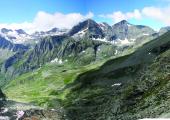
You go down from the refuge and take the dirt road on the right. After having crossed the river Stura over a wooden bridge, go along the Alpe Venoni: a characteristic bergeria protected by a curious rock. The path n. 222 continues along the lower part of the Canale delle Capre, then turn left and, with many hairpin bends, quickly takes up altitude. At 2300 m you reach the Pian dei Morti, a large grassy saddle where you have a sight on Pian della Mussa. You leave on the right path n. 223 that leads to Pian Gias and, first in diagonal, and then with wide hairpin bends, you reach the base of a small rocky wall. The path bends on the right, passes near some easy rocky jumps, which are equipped with iron foot support, and enters a wide ravine that easily leads to a pass. From here, you see the Refuge. You walk along the last flat stretch to reach in a few minutes the Refuge Gastaldi and its panoramic position on the wide basin of the Crot del Ciaussinè and the other surrounding peaks. From the Refuge follow the good path n. 222 that descends south to the basin of the stream Arnas. You then climb the detrital slopes, passing by, on the right, the Rocca Affinau. You continue that way and take path n. 222A towards a rocky wall, walking amid rocky slopes and large boulders. Remaining at the base of the rocky wall, with a last ascent, you can reach the wide plateau of Collarin Arnas 2851 m. You continue south (path n. 122) on large detrital slopes in mild ascent: You pass near Lake Collarin (2839 m), and reach the end of the rocky wall that closes north the basin of Lake Rossa. The Bivouac San Camillo stands on the left just after the crossroad with the path n. 119. Walking along a track that descends on the left, with a zigzagging not evident path, you reach the plateaus around the lake, close to the barrier. From here, follow the ENEL dam and continue on path n. 122; you walk along a first plateau full of debris and ground; then a second one. You turn left to get to the foot of a rock jump. This is carved, from right to left, by an evident stone channel. You go up until you face on the right a small detritic valley. Going onwards over debris slopes, you will arrive to Colle Altare (2901 m), evidenced by a small stone. From the pass, you go down S-E along a canyon of debris. You have to avoid, on the left, the rocky wall. You will then pass near the upper Lake of Pera Ciaval (2762 m). You continue passing through meadows spotted with lakes; you descend towards the rocky wall, which is crossed by a waterfall, and finally you arrive to Refuge Cibrario (2616 m), in Pera Ciaval.
Recommended period
Accessible to people with disabilities
Itinerary suitable for disabled people.
Support points
Rifugio Città di Ciriè Località Giasset, Pian della Mussa, 10070 Balme +39 0123 738158 - +39 329 2141782 +39 370 3329300 info@rifugiocirie.eu www.rifugiocirie.eu. Apertura: tutto l’anno. Posti letto: 24.
Rifugio Cibrario (2616 m) 10070 Usseglio +39 011 9988830 rifugiocibrario@caileini.it www.caileini.it/rifugiocibrario/ Apertura: da Giugno a Settembre. Posti letto: 42
Interest points
Caratteristiche paesaggistiche: salendo al Rifugio Gastaldi, vista sull’Uja di Ciamarella e sulla Bessanese 3640 m. Dal Collerin d’Arnas, vista sulla Punta Arnas 3563 m, con il suo ghiacciaio pensile. Dal colle Altare la Croce Rossa 3566 m.
Dettagli
Profilo altimetrico
Dati tecnici
- Code
- AVL
- Classification
- Provincial - High altitude
- Country
- Italy
- Region
- Piemonte
- Valle d'Aosta
- Province
- Torino
- Devotional relevance
- No
- Historical relevance
- Yes
- Ultima data di aggiornamento
- 15/12/2023
Altre info
Tappe
Tappe attività
-
0Alta Via delle Valli di Lanzo (AVL)Lunghezza47.10 kmTempo1 day 16 hoursDifficoltàDifficult Hiking
-
1Alta Via delle Valli di Lanzo: Stage 1 Frazione Forno Alpi Graie - Rifugio DavisoLunghezza6.10 kmTempo3 hours 30 minutesDifficoltàHiking
-
1AAlta Via delle Valli di Lanzo: Stage 1A Forno Alpi Graie - Rifugio DavisoLunghezza10.90 kmTempo7 hoursDifficoltàDifficult Hiking
-
2Alta Via delle Valli di Lanzo: Stage 2 Rifugio Daviso - Bivacco Gias NuovoLunghezza6.00 kmTempo4 hours 30 minutesDifficoltàEquipped Difficult Hiking
-
2AAlta Via delle Valli di Lanzo: Stage 2A Collegamento Bivacco Soardi-FasseroLunghezza0.80 kmTempo40 minutesDifficoltàEquipped Difficult Hiking
-
3Alta Via delle Valli di Lanzo: Stage 3 Bivacco Gias Nuovo - Rifugio Città di CirièLunghezza9.00 kmTempo6 hoursDifficoltàEquipped Difficult Hiking
-
3AAlta Via delle Valli di Lanzo: Stage 3A Bivacco Gias Nuovo - Bivacco MolinoLunghezza5.40 kmTempo5 hoursDifficoltàDifficult Hiking
-
3BAlta Via delle Valli di Lanzo: Stage 3B Bivacco Molino - Rifugio Città di CirièLunghezza9.90 kmTempo5 hoursDifficoltàDifficult Hiking
-
4Alta Via delle Valli di Lanzo: Stage 4 Rifugio Città di Ciriè - Rifugio CibrarioLunghezza11.60 kmTempo6 hours 30 minutesDifficoltàDifficult Hiking
-
5Alta Via delle Valli di Lanzo: Stage 5 Rifugio Cibrario - Rifugio TazzettiLunghezza8.00 kmTempo5 hours 30 minutesDifficoltàHiking
-
5AAlta Via delle Valli di Lanzo: Stage 5A Rifugio Tazzetti - Monte RocciameloneLunghezza13.50 kmTempo4 hoursDifficoltàDifficult Hiking
-
6Alta Via delle Valli di Lanzo: Stage 6 Rifugio Tazzetti - Lago di MalciaussiaLunghezza5.30 kmTempo3 hoursDifficoltàHiking

