- Lenght
- 9.00 km
- Tempo
- 6 hours
- Tappa
- Ascent elevation gain
- 1040 m
- Difficulty
- Equipped Difficult Hiking
- Itinerary index
- No
Informazioni
Punto di partenza
Bivacco Gias Nuovo
Località Gias Nuovo
10070 Groscavallo TO
Italy
Punto di arrivo
Rifugio Città di Ciriè
Giasset – Pian della Mussa
10070 Balme TO
Italy
Come arrivare
Descrizione
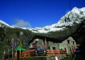
From Gias Nuovo you walk to the bottom the long plateau; you descend amid low vegetation, and reach the Alpe di Sea (1785 m). You cross the creek on the bridge and proceed on the right (path n. 309); and you follow a path that goes up amid low vegetation. You continue eastward uphill in half-coast, and leave on the left the track that arrives to Passo dell’Ometto. From here begins a difficult and exposed stretch. It is necessary to be careful because of possible detachments of stones from the wall above. In case of bad weather conditions, it is strongly recommended not to go through this passage, as it is subject to discharges of water and stones. You continue on the right (path n. 310) on the morainic terrain, in direction of the northern slope of Punta Rossa. At the foot of the rocky wall, the path turns on the right, and leads on a ledge about 2 meters wide, close to a low but steep leap. You walk along the path that cuts wall with ups and downs, and then go further on a first ridge, and then you descends and cross a canal. After having passed the second crest, the path goes through a ravine, then goes up with narrow hairpin bends, and passes a steep ramp. After this passage, the path continues and goes over two other crests, not so evident, and eventually arrives to a ridge from which it is well visible the Ghicet di Sea. After a slight descent, you start climbing again on a wide, but shallow, gorge cluttered with stones. Once reached the little valley that culminates at the pass, you go further along a narrow and less visible trace up to the cut located 2750 m, between the Punta Rossa (2910 m) South and the Albaron di Sea (3261 m) north-west. You go down south/west (path n. 226). Eventually follow the track that goes along the right of the stone channel of the Rio della Ciamarella. At the end of the canal, you lean left and reach the picturesque Piano della Ciamarella. You pass along the Ciamarella pasture, take the right (orographic left) and descend through a little valley until you reach a hut. Once passed by it, you’ll shortly arrive to the Refuge “Città di Ciriè” (1860 m).
Recommended period
Accessible to people with disabilities
Itinerary suitable for disabled people.
Support points
Bivacco Soardi Pian di Giavenot, Val Grande di Lanzo Gestore: CAI Uget Torino Apertura: tutto l’anno. Posti Letto: 12
Rifugio Città di Ciriè Località Giasset, Pian della Mussa, 10070 Balme +39 0123 738158 - +39 329 2141782 +39 370 3329300 info@rifugiocirie.eu www.rifugiocirie.eu. Apertura: tutto l’anno. Posti letto: 24
Interest points
Caratteristiche paesaggistiche: Scendendo dal Bivacco, vista sull’Uja di Mondrone (2915 m) e sulla Cima Leitosa (2868 m). Dal Ghicet di Sea, vista sul gruppo del Gran Paradiso, della parete sud/est dell’Uja di Ciamarella (3676 m). Riferimenti storici: All’inizio della cengia che porta al Ghicet di Sea, si trovano numerosi antichi graffiti: testimonianze di sagre che si svolgevano tra le popolazioni della Val Grande e della Val d’Ala.
Dettagli
Profilo altimetrico
Dati tecnici
- Code
- AVL
- Classification
- Provincial - High altitude
- Country
- Italy
- Region
- Piemonte
- Valle d'Aosta
- Province
- Torino
- Devotional relevance
- No
- Historical relevance
- Yes
- Ultima data di aggiornamento
- 15/12/2023
Altre info
Tappe
Tappe attività
-
0Alta Via delle Valli di Lanzo (AVL)Lunghezza47.10 kmTempo1 day 16 hoursDifficoltàDifficult Hiking
-
1Alta Via delle Valli di Lanzo: Stage 1 Frazione Forno Alpi Graie - Rifugio DavisoLunghezza6.10 kmTempo3 hours 30 minutesDifficoltàHiking
-
1AAlta Via delle Valli di Lanzo: Stage 1A Forno Alpi Graie - Rifugio DavisoLunghezza10.90 kmTempo7 hoursDifficoltàDifficult Hiking
-
2Alta Via delle Valli di Lanzo: Stage 2 Rifugio Daviso - Bivacco Gias NuovoLunghezza6.00 kmTempo4 hours 30 minutesDifficoltàEquipped Difficult Hiking
-
2AAlta Via delle Valli di Lanzo: Stage 2A Collegamento Bivacco Soardi-FasseroLunghezza0.80 kmTempo40 minutesDifficoltàEquipped Difficult Hiking
-
3Alta Via delle Valli di Lanzo: Stage 3 Bivacco Gias Nuovo - Rifugio Città di CirièLunghezza9.00 kmTempo6 hoursDifficoltàEquipped Difficult Hiking
-
3AAlta Via delle Valli di Lanzo: Stage 3A Bivacco Gias Nuovo - Bivacco MolinoLunghezza5.40 kmTempo5 hoursDifficoltàDifficult Hiking
-
3BAlta Via delle Valli di Lanzo: Stage 3B Bivacco Molino - Rifugio Città di CirièLunghezza9.90 kmTempo5 hoursDifficoltàDifficult Hiking
-
4Alta Via delle Valli di Lanzo: Stage 4 Rifugio Città di Ciriè - Rifugio CibrarioLunghezza11.60 kmTempo6 hours 30 minutesDifficoltàDifficult Hiking
-
5Alta Via delle Valli di Lanzo: Stage 5 Rifugio Cibrario - Rifugio TazzettiLunghezza8.00 kmTempo5 hours 30 minutesDifficoltàHiking
-
5AAlta Via delle Valli di Lanzo: Stage 5A Rifugio Tazzetti - Monte RocciameloneLunghezza13.50 kmTempo4 hoursDifficoltàDifficult Hiking
-
6Alta Via delle Valli di Lanzo: Stage 6 Rifugio Tazzetti - Lago di MalciaussiaLunghezza5.30 kmTempo3 hoursDifficoltàHiking

