- Lenght
- 47.10 km
- Tempo
- 1 day 16 hours
- Ascent elevation gain
- 5161 m
- Difficulty
- Difficult Hiking
- Itinerary index
- Yes
Informazioni
Punto di partenza
Frazione Forno Alpi Graie
10070 Groscavallo TO
Italy
Punto di arrivo
Lago di Malciaussia
10070 Usseglio TO
Italy
Come arrivare
Access north: From Groscavallo, take the road to Forno Alpi Graie where the path to Daviso Refuge begins.
Medium access: From Balme city, take the road to Pian della Mussa where the path to the Gastaldi Refuge begins.
Access south: From the town of Usseglio, follow the road to Malciaussia where the path to the Daviso Refuge begins.
Descrizione
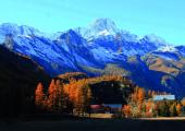
The itinerary for expert hikers ALTA VIA DELLE VALLI DI LANZO (AVL) is a high mountain crossing (2200-3200 m) that develops through the Southern Alpi Graie, along the border between Italy and France, from the slopes of Levanna Orientale (3555 m) passing near the majestic peaks, also 3500 m, to end at Rocciamelone (3538 m). The route has a total development of about 47 km (52 with the variant for the Colle della Piccola), subdivided in six stages. It develops almost entirely on paths adequately marked. Although the route does not present any particular mountaineering difficulties, it is classified as an EE (experienced hikers) because of the severe high mountain environment in which it progresses. Environment that is even more difficult in bad weather conditions and in the presence of snow or fog. Some parts of the route are particularly exposed. They require therefore, good skills, safe steps and no vertigo. Where possible, you can find supports for hikers, but everyone has to be careful, and always check both functionality and stability of these supports before securing to them. Appropriate preparation, suitable equipment and good physical training are therefore necessary for this route. You can start the itinerary north from the village of Forno Alpi Graie walking along the route South, and ending at Malciaussia; or you can start in the opposite direction. In both cases, you can interrupt your trip by means of the many connections downstream and by the different intermediate stages, such as, in particular, halfway to the Pian della Mussa. The stage places are in the refuges that are kept during the summer; while in winter they are always open and equipped with winter rooms. Some stage points there are mere bivouacs, always open as well. The optimal period for the journey is from late June to early September. The northern principal starting points are Forno Alpi Graie in the Municipality of Groscavallo, the southern ones are Malciaussia in the Municipality of Usseglio. An intermediate starting point is in Pian della Mussa in the Municipality of Balme. They all are about 60 km far from Turin.
Recommended period
Accessible to people with disabilities
Itinerary suitable for disabled people.
Interest points
Villa Pastrone, Santuario di Nostra Signora di Loreto, Vallone di Sea, Sentiero dell’oro di Pera Cagna, Sentiero Pian dei Morti, Sentiero del Gran Lago di Unghiasse, Cascata La Gorgia, La Casaforte Ruciàss, Ecomuseo delle Guide Alpine, Anello della Val Servin, Il Bosco - Museo per tutti, Museo Civico Alpino “Arnaldo Tazzetti”, Mulino dei Vulpòt, Sentiero della Decauville, Siti di interesse regionale Sagna del Vallone, Sito di interesse regionale Lac Falin, Sistema di laghi artificiali.
Dettagli
Profilo altimetrico
Dati tecnici
- Code
- AVL
- Classification
- Provincial - High altitude
- Country
- Italy
- Region
- Piemonte
- Valle d'Aosta
- Province
- Torino
- Attachments
- Devotional relevance
- No
- Historical relevance
- Yes
- Ultima data di aggiornamento
- 15/12/2023
Altre info
Accommodation facilities

Savoia
- Località
GROSCAVALLO (TO)

Pialpetta
- Località
GROSCAVALLO (TO)

Setugrino
- Località
GROSCAVALLO (TO)

Antico albergo camussot
- Località
BALME (TO)

Bivacco gandolfo
- Località
BALME (TO)

Bivacco molino
- Località
BALME (TO)

Citta' di cirie'
- Località
BALME (TO)

Gastaldi
- Località
BALME (TO)

Gloria
- Località
BALME (TO)

La masina'
- Località
BALME (TO)

Les montagnards
- Località
BALME (TO)

Bivacco san camillo
- Località
USSEGLIO (TO)

Casa alpina san vincenzo
- Località
USSEGLIO (TO)

Cibrario
- Località
USSEGLIO (TO)

Furnasa
- Località
USSEGLIO (TO)

Grand usseglio
- Località
USSEGLIO (TO)

Rocciamelone
- Località
USSEGLIO (TO)

Tazzetti
- Località
USSEGLIO (TO)

Vulpot
- Località
USSEGLIO (TO)
Tappe
Tappe attività
-
0Alta Via delle Valli di Lanzo (AVL)Lunghezza47.10 kmTempo1 day 16 hoursDifficoltàDifficult Hiking
-
1Alta Via delle Valli di Lanzo: Stage 1 Frazione Forno Alpi Graie - Rifugio DavisoLunghezza6.10 kmTempo3 hours 30 minutesDifficoltàHiking
-
1AAlta Via delle Valli di Lanzo: Stage 1A Forno Alpi Graie - Rifugio DavisoLunghezza10.90 kmTempo7 hoursDifficoltàDifficult Hiking
-
2Alta Via delle Valli di Lanzo: Stage 2 Rifugio Daviso - Bivacco Gias NuovoLunghezza6.00 kmTempo4 hours 30 minutesDifficoltàEquipped Difficult Hiking
-
2AAlta Via delle Valli di Lanzo: Stage 2A Collegamento Bivacco Soardi-FasseroLunghezza0.80 kmTempo40 minutesDifficoltàEquipped Difficult Hiking
-
3Alta Via delle Valli di Lanzo: Stage 3 Bivacco Gias Nuovo - Rifugio Città di CirièLunghezza9.00 kmTempo6 hoursDifficoltàEquipped Difficult Hiking
-
3AAlta Via delle Valli di Lanzo: Stage 3A Bivacco Gias Nuovo - Bivacco MolinoLunghezza5.40 kmTempo5 hoursDifficoltàDifficult Hiking
-
3BAlta Via delle Valli di Lanzo: Stage 3B Bivacco Molino - Rifugio Città di CirièLunghezza9.90 kmTempo5 hoursDifficoltàDifficult Hiking
-
4Alta Via delle Valli di Lanzo: Stage 4 Rifugio Città di Ciriè - Rifugio CibrarioLunghezza11.60 kmTempo6 hours 30 minutesDifficoltàDifficult Hiking
-
5Alta Via delle Valli di Lanzo: Stage 5 Rifugio Cibrario - Rifugio TazzettiLunghezza8.00 kmTempo5 hours 30 minutesDifficoltàHiking
-
5AAlta Via delle Valli di Lanzo: Stage 5A Rifugio Tazzetti - Monte RocciameloneLunghezza13.50 kmTempo4 hoursDifficoltàDifficult Hiking
-
6Alta Via delle Valli di Lanzo: Stage 6 Rifugio Tazzetti - Lago di MalciaussiaLunghezza5.30 kmTempo3 hoursDifficoltàHiking
