- Lenght
- 9.14 km
- Tempo
- 3 hours 30 minutes
- Tappa
- Max altitude
- 870 m
- Ascent elevation gain
- 510 m
- Descent elevation loss
- 420 m
- Difficulty
- Hiking
- Itinerary index
- No
Informazioni
Punto di partenza
Pagno
Via Roma,18
12030 Pagno CN
Italy
Punto di arrivo
Brondello
Via Provinciale
12030 Brondello CN
Italy
Come arrivare
Autostrada A6 TORINO - SAVONA, uscita: casello di Marene; svoltare a sinistra ed immettersi sulla S.S. 662 in direzione Savigliano, proseguire fino a Saluzzo;
autostrada A21 TORINO – ALESSANDRIA – PIACENZA, uscita Asti est – proseguire poi per Alba- Bra- uscita Marene- Savigliano- Saluzzo.
A Saluzzo, via Pagno, SP 47 per la Valle Bronda.
Da Torino e Cuneo: Atibus, orari sul sito www.buscompany.it/Ati, linee Torino-Saluzzo, Cuneo-Saluzzo.
Da Saluzzo: Autolinee Allasia, orari sul sito www.autolineeallasia.com.
Descrizione
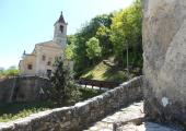
Just above the square of Pagno turn right into Via S. Grato along the "Sentiero 1 Garia" which leaves the road in the steepest section, taking it up again just above; continue along the route of stage 1 until the fork below the chapel of S. Grato. The dirt road that starts from here on the left follows the intervalley ridge and reaches the Chapel of S. Eusebio (680m - equipped area). A series of hairpin bends lead to a fork at a large turn; keep the main road continuing to the right up to the fork towards the Chapel of St. Michele. At an altitude of 830m the route crosses the paved road: leave the VBT (Bronda Valley Trek) to follow Via Traversere downhill until the fork on the left towards Case Bodrero (Bodrero Houses); the path descends rapidly, reaches the road, then the SP 47 and soon the center of Brondello.
Recommended period
Accessible to people with disabilities
Support points
Strutture ricettive della Valle Bronda ( http://www.vallidelmonviso.it/valle/valle-bronda/ )
Interest points
L' Antica Abbazia dei SS. Pietro e Colombano.
La Cappella di San Grato, punto panoramico.
La Cappella di S. Eusebio.
La Torre di Brondello.
Dettagli
Profilo altimetrico
Dati tecnici
- Code
- VBT
- Classification
- Provincial - Mid and Low Altitude
- Local Tourist Agency (LTA) reference
- ATL del Cuneese - valli alpine e città d'arte
- Country
- Italy
- Region
- Piemonte
- Province
- Cuneo
- Devotional relevance
- Sì
- Historical relevance
- Yes
- Ultima data di aggiornamento
- 15/12/2023
Altre info
Accommodation facilities
Related apps

Trekviso
Escursionismo Piemonte: Terre del Monviso Itinerari escursionistici nelle valli del Cuneese: Po, Bronda, Varaita, Maira
Tappe
Tappe attività
-
0Valle Bronda TrekkingLunghezza31.16 kmTempo11 hours 30 minutesDifficoltàHiking
-
1Stage 1 - Borgo Testa Nera (Castellar) - PagnoLunghezza8.00 kmTempo2 hours 30 minutesDifficoltàHiking
-
2Valle Bronda Trekking - Stage 2: Pagno - BrondelloLunghezza9.14 kmTempo3 hours 30 minutesDifficoltàHiking
-
2AValle Bronda Trekking - Stage 2A: Martiniana Po - Brondello (Fork altitude 835m)Lunghezza8.45 kmTempo3 hoursDifficoltàHiking
-
2BStage 3A: Brondello - Fork altitude 1035mLunghezza6.10 kmTempo3 hours 50 minutesDifficoltàHiking
-
3Valle Bronda Trekking - Stage 3: Brondello - PagnoLunghezza14.00 kmTempo5 hours 30 minutesDifficoltàHiking
-
3AValle Bronda Trekking: 3A - BRONDELLO - Fork altitude 1035m.Lunghezza6.40 kmTempo2 hoursDifficoltàHiking
