- Lenght
- 31.16 km
- Tempo
- 11 hours 30 minutes
- Max altitude
- 1165 m
- Ascent elevation gain
- 1640 m
- Descent elevation loss
- 1600 m
- Difficulty
- Hiking
- Itinerary index
- Yes
Informazioni
Punto di partenza
Borgo Testa Nera
Imbocco pista ciclabile
12030 Castellar CN
Italy
Punto di arrivo
Borgo Testa Nera
Imbocco pista ciclabile
12030 Castellar CN
Italy
Come arrivare
Highway A6 TORINO - SAVONA, exit Marene; turn left for S.S. 662 towards Savigliano, keep on until Saluzzo;
highway A21 TORINO – ALESSANDRIA – PIACENZA, exit Asti est – keep on for Alba- Bra- exit Marene- Savigliano- Saluzzo.
In Saluzzo, via Pagno, SP 47 for Valle Bronda.
From Torino and Cuneo: Atibus, timetables on www.buscompany.it/Ati, lines Torino-Saluzzo, Cuneo-Saluzzo.
From Saluzzo: Autolinee Allasia, timetables on www.autolineeallasia.com.
Descrizione
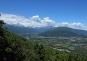
The Bronda Valley Trek represents an innovation compared to the most famous and renowned loop hikes in the province of Cuneo, but the "Cenerentola" ("Cinderella") offers everyone, in the horseshoe-shaped journey along its wooded ridges, the possibility of enjoying relaxing views, getting to know its ancient and precious artistic heritage and smelling the intense scent of the forest. A valley of modest dimensions and altitudes, located at the gates of Saluzzo, wedged between the beginning of the Po Valley on one side and the Varaita Valley on the other, crossed by the Bronda stream. An authentic treasure chest of art and history starting from the country chapel of San Ponzio, the Castellar Castle dating back to the 14th century built on a spur, the Clock Tower overlooking Brondello with the ancient medieval arched stone bridge. The proposed route leads the hiker first on the sunny side and then on the more shady one of the valley, through a path constantly at high altitudes on the intervalley ridges, from which it descends only to reach the reception facilities located in the three villages of Castellar, Pagno and Brondello. A loop hike which is walkable for most of the year and suitable for everyone given the type of bottom, its course and the length of the well marked individual stages. The VBT also represents a worthy mountain-bike loop hike given the many dirt roads and mule tracks that will certainly meet the expectations of all bikers.
Recommended period
Accessible to people with disabilities
Support points
Valle Bronda touristic facilities, on http://www.vallidelmonviso.it/valle/valle-bronda/
Interest points
Old SS. Pietro e Colombano Abbey in Pagno.Brondello' Tower, Castellar's Chastle.
Dettagli
Profilo altimetrico
Dati tecnici
- Code
- VBT
- Classification
- Provincial - Mid and Low Altitude
- Local Tourist Agency (LTA) reference
- ATL del Cuneese - valli alpine e città d'arte
- Country
- Italy
- Region
- Piemonte
- Province
- Cuneo
- Attachments
- Devotional relevance
- Sì
- Historical relevance
- Yes
- Ultima data di aggiornamento
- 15/12/2023
Altre info
Accommodation facilities

Beatrice
- Località
SALUZZO (CN)

Chiaro di luna
- Località
SALUZZO (CN)

Antica cascina costa
- Località
PAGNO (CN)

La casa del vescovo
- Località
PAGNO (CN)

La torre
- Località
BRONDELLO (CN)
Related apps

Trekviso
Escursionismo Piemonte: Terre del Monviso Itinerari escursionistici nelle valli del Cuneese: Po, Bronda, Varaita, Maira
Tappe
Tappe attività
-
0Valle Bronda TrekkingLunghezza31.16 kmTempo11 hours 30 minutesDifficoltàHiking
-
1Stage 1 - Borgo Testa Nera (Castellar) - PagnoLunghezza8.00 kmTempo2 hours 30 minutesDifficoltàHiking
-
2Valle Bronda Trekking - Stage 2: Pagno - BrondelloLunghezza9.14 kmTempo3 hours 30 minutesDifficoltàHiking
-
2AValle Bronda Trekking - Stage 2A: Martiniana Po - Brondello (Fork altitude 835m)Lunghezza8.45 kmTempo3 hoursDifficoltàHiking
-
2BStage 3A: Brondello - Fork altitude 1035mLunghezza6.10 kmTempo3 hours 50 minutesDifficoltàHiking
-
3Valle Bronda Trekking - Stage 3: Brondello - PagnoLunghezza14.00 kmTempo5 hours 30 minutesDifficoltàHiking
-
3AValle Bronda Trekking: 3A - BRONDELLO - Fork altitude 1035m.Lunghezza6.40 kmTempo2 hoursDifficoltàHiking
