- Lenght
- 10.80 km
- Tempo
- 3 hours 30 minutes
- Tappa
- Ascent elevation gain
- 550 m
- Difficulty
- Hiking
- Itinerary index
- No
Informazioni
Punto di partenza
Frazione Crot (Posto Tappa GTA)
10070 Usseglio TO
Italy
Punto di arrivo
Lago di Malciaussia
10070 Usseglio TO
Italy
Come arrivare
Descrizione
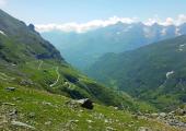
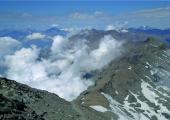
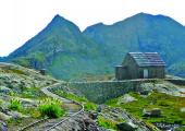
Starting from Usseglio, Hamlet Crot (1298 m), you reach the Hamlet Margone (1457 m) going along the ordinary road network. From the central square of the village you can see the signs that lead, towards the path n. 118 that goes up north until the track n. 111B (1803 m),to the path Decauville or Tracciolino that retraces the railway, built by ENEL at the beginning ‘900, to manage the hydraulic works of hydroelectric reservoirs. This route has a particularly easy walkability, thanks to its light and constant slope, but it is necessary to remember the presence of a tunnel dug in the rock, where it could be useful to be equipped with a front lamp, and three crossing stretches of small ridges on rock plates. The two most exposed crossings are equipped with safety cables to support hikers while passing. It is good practice to pay attention to any rainfall that can quickly increase the water flow, or, in case of low temperatures, is possible the presence of ice. The section of this trail is one of the most impressive of the itinerary, thanks to the panorama and to its historical and cultural value. The itinerary ends by reaching the road just before the Lake Malciaussia (1805 m) and finally the plateau of Malciaussia with the large artificial lake surrounded by numerous peaks over the 3000 m of altitude, including Mount Rocciamelone. Here is also Refuge Vulpot, the last stop point in this trail.
Recommended period
Accessible to people with disabilities
Itinerary suitable for disabled people.
Support points
Hotel Ristorante La Furnasa Via XXIV Maggio 16, 10070 Usseglio +39 0123 83747 - +39 0123 83788 furnasa@libero.it www.ristorantehotelfurnasa.com.
Rifugio Escursionistico Vulpot Frazione Malciaussia, 10070 Usseglio +39 0123 83771 rifugiovulpot@gmail.com www.rifugiovulpot.com. Apertura: da Giugno a Settembre.
Dettagli
Profilo altimetrico
Dati tecnici
- Code
- TKC
- Classification
- Provincial - Mid and Low Altitude
- Country
- Italy
- Region
- Piemonte
- Province
- Torino
- Devotional relevance
- No
- Historical relevance
- Yes
- Ultima data di aggiornamento
- 15/12/2023
Altre info
Tappe
Tappe attività
-
0Trek Calcante (TC)Lunghezza99.50 kmTempo1 day 15 hours 40 minutesDifficoltàHiking
-
1Trek Calcante: Stage 1 Lanzo T.se Ponte del Diavolo - TravesLunghezza14.00 kmTempo5 hoursDifficoltàHiking
-
2Trek Calcante: Stage 2 Traves - Frazione TornettiLunghezza18.40 kmTempo7 hours 40 minutesDifficoltàHiking
-
2ATrek Calcante: Stage 2A Colle Cialmetta (Bivacco) - Cappella della ConsolataLunghezza12.70 kmTempo6 hoursDifficoltàHiking
-
2BTrek Calcante: Stage 2B Cappella della Consolata - Alpe LongimalaLunghezza7.60 kmTempo4 hoursDifficoltàHiking
-
2CTrek Calcante: Stage 2C Alpe Longimala - Frazione TornettiLunghezza18.60 kmTempo7 hoursDifficoltàHiking
-
3Trek Calcante: Stage 3 Frazione Tornetti - Frazione Crot (Posto Tappa GTA)Lunghezza16.90 kmTempo6 hours 30 minutesDifficoltàHiking
-
4Trek Calcante: Stage 4 Frazione Crot (Posto Tappa GTA) - Lago di MalciaussiaLunghezza10.80 kmTempo3 hours 30 minutesDifficoltàHiking


