Galleria foto
- Lenght
- 36.00 km
- Tempo
- 23 hours 30 minutes
- Ascent elevation gain
- 4750 m
- Difficulty
- Hiking
- Itinerary index
- Yes
Informazioni
Punto di partenza
Borgata Trambiè
10070 Cantoira TO
Italy
Punto di arrivo
Rifugio Città di Ciriè
10070 Balme TO
Italy
Come arrivare
Access east: From Cantoira you have to reach Trambiè, where there is a public swimming pool near the Stura torrent; then you have to cross the stone and wooden bridge to take path n. 307 which leads to the Sanctuary of Santa Cristina.
Medium access:From Ceres we reach the Village of Bracchiello by footpath n. 241 to continue the route in the west or east direction. From Ala di Stura on the path n. 238 that starts from the town you can reach Alpe d’Attia. You can decide whether to continue your itinerary west or east.
Access West: From the Common of Balme, we reach Pian della Mussa, where near the Città di Ciriè Refuge starts the path n. 226 which allows us to follow the route towards the West to the East. It should be remembered that if we proceed in this direction of travel, we will find some passages that are more difficult in descent, especially in the trunks in the high mountains along the slopes of Uja di Mondrone and lakes Ru and Mercurin.
Descrizione
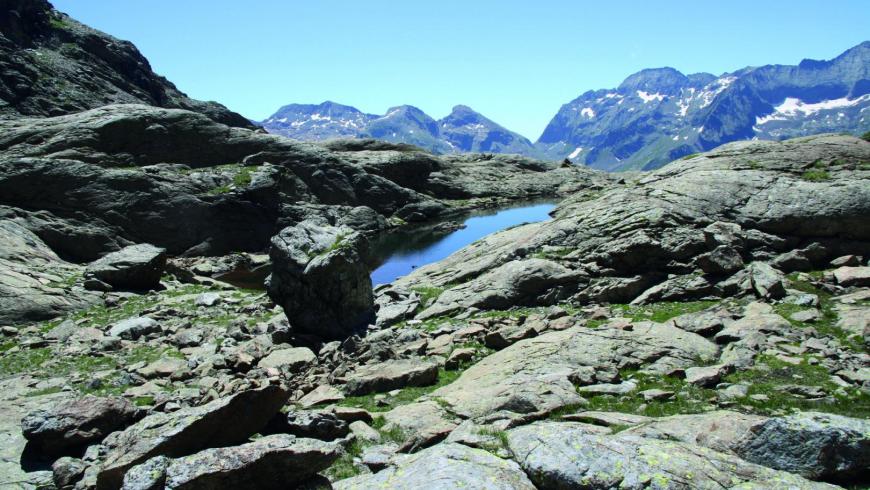
The hiking itinerary TOUR DELL’UJA (TU) is so named because it develops along the sunny side of the Val d’Ala, and maintains the top of the Uja di Mondrone as an evocative reference element in the panorama. You will touch the pyramid at the top of it in the last stage. Starting from Cantoira, the route immediately turns towards the peak of the Sanctuary of Santa Cristina, a religious bastion that marks the entrance of Val d’Ala and Val Grande di Lanzo. Then you start to walk longitudinally towards the head of the valley at Pian della Mussa. It is a very varied trek characterized by a gradual ascent starting from the shady side of the beech forest of Cantoira and the woods of Ceres, and then to arrive to the pastures of Ala di Stura and reach the rocky slopes of Uja di Mondrone in Balme, and eventually rest in the pastures of Pian della Mussa. Stage places offer very different opportunities. In the first stages there are the small tourist structures and typical agritourism in the territory, once climbed higher you can take advantage of the support of the operators, previously contacted, available to reach the hiker to accompany him in the valley at their own facilities through the rural roads that reach the pastures. In the last two stages it is possible to enjoy a bivouac always open and available to hikers who are travelling in high mountain, and finally the refuges and hotels of Pian della Mussa. The paths all well signed, and consist on path or footpath and partly on a white road leading to the mountain pastures and on forest tracks. You can walk all these tracks without a equipment in the optimal period from May/June to October, but the length and height difference of some stages require a good training. The recommended direction to travel is from east to west and therefore in a progressive increasing altitude, to face uphill some passages that could instead be more difficult downhill especially if the weather conditions are not optimal. The route offers the possibility to connect and vary the route, at the starting point Cantoira, in the 3 Vallate. This can become an alternative extension, while on the territory of Balme with the GTA and with the Alta Via delle Valli di Lanzo and then, for those who want to extend to the west, until the Tour della Bessanese and France.
Recommended period
Accessible to people with disabilities
Itinerary suitable for disabled people.
Interest points
Santuario di Santa Cristina, Ecomuseo Antica Miniera di Talco Brunetta, Sentiero del Minatore, Miniera di talco della Brunetta, Ponte della Vana, Museo delle Genti delle Valli di Lanzo, Torre Campanaria XII° Sec, Anello di Santa Cristina, Viadotto in calcestruzzo armato della ferrovia Torino - Ceres, Madonna del Carmine del Ciavanis, Anello delle Cappelle Alpine Missirola – Urtirè, Piramidi d’erosione di Vonzo “Castei d’le Rive”, Cascata La Gorgia di Mondrone, I percorsi delle Meridiane, Sentiero Pian delle Masche, Cascata La Gorgia, La Casaforte Ruciàss, Ecomuseo delle Guide Alpine, Anello della Val Servin, Pian della Mussa.
Dettagli
Profilo altimetrico
Dati tecnici
- Code
- TDU
- Classification
- Provincial - Mid and Low Altitude
- Country
- Italy
- Region
- Piemonte
- Province
- Torino
- Attachments
- 3B_TU_ITALIANO.x33558.pdf
- Devotional relevance
- No
- Historical relevance
- Yes
- Ultima data di aggiornamento
- 15/12/2023
Altre info
Accommodation facilities

Structure qualification
Al cavallino
Località
CANTOIRA (TO)
Structure qualification
Cantoira
Località
CANTOIRA (TO)
Structure qualification
La roccia
Località
CANTOIRA (TO)
Structure qualification
Baita San Giacomo
Località
CERES (TO)
Structure qualification
Valli di LANZO
Località
CERES (TO)
Structure qualification
Albero fiorito
Località
CHIALAMBERTO (TO)
Structure qualification
Ala
Località
ALA DI STURA (TO)
Structure qualification
Villa San Giuseppe
Località
ALA DI STURA (TO)
Structure qualification
Grand hotel ala di stura
Località
ALA DI STURA (TO)
Structure qualification
La crestolina
Località
ALA DI STURA (TO)
Structure qualification
Lungimala
Località
ALA DI STURA (TO)
Structure qualification
Raggio di sole
Località
ALA DI STURA (TO)
Structure qualification
Antico albergo camussot
Località
BALME (TO)
Structure qualification
Bivacco gandolfo
Località
BALME (TO)
Structure qualification
Bivacco molino
Località
BALME (TO)
Structure qualification
Citta' di cirie'
Località
BALME (TO)
Structure qualification
Gastaldi
Località
BALME (TO)
Structure qualification
Gloria
Località
BALME (TO)
Structure qualification
La masina'
Località
BALME (TO)
Structure qualification
Les montagnards
Località
BALME (TO)
Structure qualification
Soggiorno alpino scuole pie
Località
BALME (TO)
Structure qualification
Stella alpina
Località
BALME (TO)
Tappe
Tappe attività
-
0Tour dell'Uja (TDU)Lunghezza36.00 kmTempo23 hours 30 minutesDifficoltàHiking
-
1Tour dell'Uja: Stage 1 Borgata Trambiè - Borgata BracchielloLunghezza11.60 kmTempo4 hours 30 minutesDifficoltàHiking
-
2Tour dell'Uja: Stage 2 Borgata Bracchiello - Alpe d’AttiaLunghezza8.30 kmTempo5 hoursDifficoltàHiking
-
3Tour dell'Uja: Stage 3 Alpe d’Attia - Bivacco MolinoLunghezza9.00 kmTempo5 hours 30 minutesDifficoltàHiking
-
4Tour dell'Uja: Stage 4 Bivacco Molino - Rifugio Città di CirièLunghezza8.30 kmTempo5 hoursDifficoltàHiking