Galleria foto
- Lenght
- 11.60 km
- Tempo
- 4 hours 30 minutes
- Tappa
Elenco risultati
- Ascent elevation gain
- 800 m
- Difficulty
- Hiking
- Itinerary index
- No
Informazioni
Punto di partenza
Borgata Trambiè
10070 Cantoira TO
Italy
Punto di arrivo
Borgata Bracchiello
10070 Ceres TO
Italy
Come arrivare
Descrizione
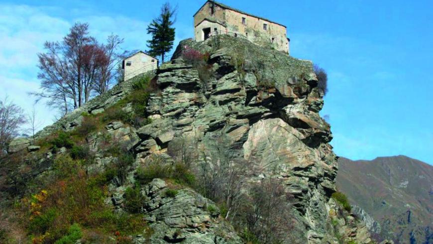
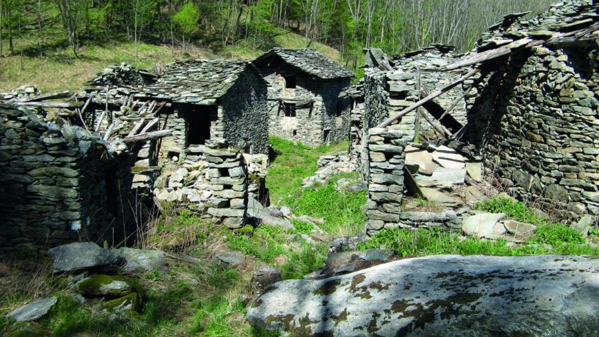
Starting from Trambiè, path n. 307 runs along the right bank of the Torrent Stura, goes up to the “dolmen” Combin, then goes into the forest to reach Piano Uccello (1102 m) by means of the traces of an ancient lake now drained. You will find a forest track that follows up to Senale village (1083 m) and then start again the ascent amid the beech wood until you meet the stone staircase that leads to the Sanctuary Santa Cristina (1340 m) and to a fabulous view of Val Grande. The descent to Pian di Ceres along track n. 242 allows the visit of the Chapel degli Angeli and the Chapel degli Appestati. On the next half-coast part of path n. 242A, you will reach the village of Monti di Voragno (973 m). If you continue half-coast along the path n. 260 towards Hamlet Belmonte and Case Belfè (1146 m), you will find the dirt road that descends to Hamlet Bracchiello (843 m), where the first stage ends and you can find hospitality in the accommodations of the place.
Recommended period
Accessible to people with disabilities
Itinerary suitable for disabled people.
Support points
Trattoria dei passeggeri Frazione Bracchiello, 10070 Ceres +39 3476758505 info@trattoriadeipasseggeri.it www.trattoriadeipasseggeri.it.
Interest points
A Ceres: la Cappella di Santa Cristina (trecentesca, abbellita nel '600, posta in cima ad una roccia scoscesa, è meta di escursioni anche per lo splendido panorama sulle Valli di Lanzo), la Cappella della Sacra Sindone (località Voragno, ricca di affreschi, risalenti probabilmente al XVII secolo, che testimoniano il passaggio della Santa Sindone nelle Valli di Lanzo), la Cappella Madonna degli Angeli (a Pian di Ceres è stata edificata, secondo la tradizione, al tempo della peste; gli affreschi sono opera del pittore Oldrado Perini e datati 1577, come riportato nell'iscrizione all'interno), il Museo delle Genti delle Valli di Lanzo.
Dettagli
Profilo altimetrico
Dati tecnici
- Code
- TDU
- Classification
- Provincial - Mid and Low Altitude
- Country
- Italy
- Region
- Piemonte
- Province
- Torino
- Devotional relevance
- No
- Historical relevance
- Yes
- Ultima data di aggiornamento
- 15/12/2023
Altre info

Tappe
Tappe attività
-
0Tour dell'Uja (TDU)Lunghezza36.00 kmTempo23 hours 30 minutesDifficoltàHiking
-
1Tour dell'Uja: Stage 1 Borgata Trambiè - Borgata BracchielloLunghezza11.60 kmTempo4 hours 30 minutesDifficoltàHiking
-
2Tour dell'Uja: Stage 2 Borgata Bracchiello - Alpe d’AttiaLunghezza8.30 kmTempo5 hoursDifficoltàHiking
-
3Tour dell'Uja: Stage 3 Alpe d’Attia - Bivacco MolinoLunghezza9.00 kmTempo5 hours 30 minutesDifficoltàHiking
-
4Tour dell'Uja: Stage 4 Bivacco Molino - Rifugio Città di CirièLunghezza8.30 kmTempo5 hoursDifficoltàHiking