- Lenght
- 9.30 km
- Tempo
- 6 hours
- Tappa
- Ascent elevation gain
- 1100 m
- Descent elevation loss
- 650 m
- Difficulty
- Equipped Difficult Hiking
- Itinerary index
- No
Informazioni
Punto di partenza
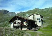
Refuge Avérole
73480 Bessans
France
Punto di arrivo
Rifugio Gastaldi
10070 Balme TO
Italy
Come arrivare
Descrizione
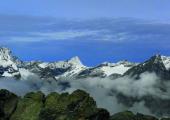
From Refuge d’Avérole, you go up on the grassy slope, and after having passed the cliff, you reach the right orographic riverside of Ruisseau du Veillet. You continue until you reach a clear frontal moraine, near which you have to cross the river. The path goes up the moraine, until you reach a small cliff made of rocky steps (2850 m) that crosses the right bank of the stream. This action may require a quite good attention in case of rain and widening of the river. The trace goes along the ridge on a very steep morainic soil. It then reaches the basin that dominates the remains of the Glacier Des Grandes Pareis. Here the trail disappears into the Clapier Blanc (3030 m). Looking north, you see a saddle behind which appears the summit of Mount Albaron. To reach it, the route continues first uphill up to an altitude of 3100 m, and then lowers slightly in a valley in the direction of some shale cliffs. The path then turns around the saddle (be careful of the visible markers, which are sometimes placed very high on the boulders). Once reached the cliffs, the trail becomes visible again and climbs up the slope. The signs lead to the ridge along the Punta Audras, until you reach the Passo del Collerin. Here begins the descent on the Italian side, along a steep slope of unstable debris. The descent, in case of snow, can be challenging, therefore it is advisable to have a suitable equipment (pickle and crampons). The steep canal goes down for about 200 meters, and leads to the glacier of Pian Gias (3000 m). Paying attention you can advance without crampons on this glacier, not too steep and mostly covered with debris. It is recommended to pay attention to the signs on the boulders, especially in case of fog. The descent continues half-way on the slope, remaining at the orographic right of the stream that comes out from the glacier. The stream goes down until it encounters the rocks under the ridge of the Rocce delle Russe (2800 m). Here it crosses the stream and goes around it following the moraine downhill. It then crosses the path that leads to Ciamarella where it passes the torrent on its right bank. Once reached the indicator pole, you leave the path you are walking on that descends to the Pian della Mussa, and follow the right one that, within 30 minutes leads you to the Gastaldi Refuge through a half-coast path.
Recommended period
Accessible to people with disabilities
Itinerary suitable for disabled people.
Support points
Rifugio Gastaldi (2659 m) Località Ciausinet, 10070 Balme +39 0123 565008 - +39 348 3691127 info@rifugiogastaldi.com www.rifugiogastaldi.com. Apertura: da Aprile a Settembre. Posti letto: 99.
Rifugio d’Avèrole (2190 m) Bessans, Haute-Maurienne +33 04 79059670 refugedaverole.ffcam.fr. Apertura: da Marzo a Maggio e dal Giugno a Settembre. Posti letto: 88.
Dettagli
Profilo altimetrico
Dati tecnici
- Code
- TDB
- Classification
- Provincial - High altitude
- Country
- Italy
- France
- Region
- Piemonte
- Auvergne-Rhône-Alpes
- Province
- Torino
- Devotional relevance
- No
- Historical relevance
- Yes
- Ultima data di aggiornamento
- 15/12/2023
Altre info
Accommodation facilities

Gastaldi
- Località
BALME (TO)
Tappe
Tappe attività
-
0Tour della Bessanese (TB)Lunghezza32.00 kmTempo17 hoursDifficoltàDifficult Hiking
-
1Tour della Bessanese: Stage 1 Refuge Gastaldi - Refuge CibarioLunghezza7.50 kmTempo4 hoursDifficoltàDifficult Hiking
-
2Tour della Bessanese: Stage 2 Refuge Cibario - Refuge d’AveroleLunghezza15.20 kmTempo7 hoursDifficoltàDifficult Hiking
-
3Tour della Bessanese: Stage 3 Refuge d’Averole - Refuge GastaldiLunghezza9.30 kmTempo6 hoursDifficoltàEquipped Difficult Hiking

