- Lenght
- 15.20 km
- Tempo
- 7 hours
- Tappa
- Ascent elevation gain
- 900 m
- Descent elevation loss
- 1300 m
- Difficulty
- Difficult Hiking
- Itinerary index
- No
Informazioni
Punto di partenza
Rifugio Cibrario
10070 Usseglio TO
Italy
Punto di arrivo
Refuge Avérole
73480 Bessans
Italy
Come arrivare
Descrizione
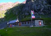
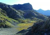
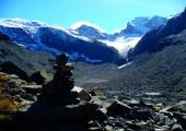
From the refuge, cross the Piano del Sabiunin to reach the moraine where the steep trail begins. It ascends 300 m in height and reaches the glacial basin of the former Glacier Bertà (2900 m). With a path in a slight ascent, along the plateau, you keep close to the rocky cliffs that descend from Testa Sula. Some turns lead directly to Colle Sulè (3073 m). From the pass the track goes down by means of a steep slope, and continue on a stony road up to 2800 m. Here you leave the path and start to ascend again (indicator pole) towards a melting pond. Around the pond, continue on grassy traits and traces of path until you cross an evident military mule track. You go up on the right along the mule track until you reach a pond and the building of the former Refuge Moise. From the back of the building, you continue with an evident mule track towards the eastern lakes that you leave at a distance on the right. At the height of the emissary of Lake Autaret, you cross the path from Malciaussia. You continue on the debris until you reach Colle dell’Autaret (3072 m). From the pass, you go down along the steep morainic front, and then continue half-coast, and cross the Torrent de la Lombard (2560 m). You continue along the left orographic riverside up to 2450 m, where just before Cabane des Bergers, the route turns on the right leaving the main path and goes towards a footbridge on the right bank of the stream. After having passed the bridge, the path climbs slightly up to the Pas de la Mule from which you go to the Plan de Revallon towards the Refuge d’Averole. You go up the slope towards Col d’Arnès and in few meters, you arrive at the refuge.
Recommended period
Accessible to people with disabilities
Itinerary suitable for disabled people.
Support points
Rifugio Cibrario (2616 m) 10070 Usseglio +39 011 9988830 rifugiocibrario@caileini.it www.caileini.it/rifugiocibrario/. Apertura: da Giugno a Settembre. Posti letto: 42.
Rifugio d’Avèrole (2190 m) Bessans, Haute-Maurienne +33 04 79059670 refugedaverole.ffcam.fr. Apertura: da Marzo a Maggio e dal Giugno a Settembre. Posti letto: 88.
Dettagli
Profilo altimetrico
Dati tecnici
- Code
- TDB
- Classification
- Provincial - High altitude
- Country
- Italy
- France
- Region
- Piemonte
- Auvergne-Rhône-Alpes
- Province
- Torino
- Devotional relevance
- No
- Historical relevance
- Yes
- Ultima data di aggiornamento
- 15/12/2023
Altre info
Accommodation facilities

Cibrario
- Località
USSEGLIO (TO)
Tappe
Tappe attività
-
0Tour della Bessanese (TB)Lunghezza32.00 kmTempo17 hoursDifficoltàDifficult Hiking
-
1Tour della Bessanese: Stage 1 Refuge Gastaldi - Refuge CibarioLunghezza7.50 kmTempo4 hoursDifficoltàDifficult Hiking
-
2Tour della Bessanese: Stage 2 Refuge Cibario - Refuge d’AveroleLunghezza15.20 kmTempo7 hoursDifficoltàDifficult Hiking
-
3Tour della Bessanese: Stage 3 Refuge d’Averole - Refuge GastaldiLunghezza9.30 kmTempo6 hoursDifficoltàEquipped Difficult Hiking


