Galleria foto
- Lenght
- 10.00 km
- Tempo
- 3 hours
- Tappa
Elenco risultati
- Difficulty
- Easy
- Itinerary index
- No
Informazioni
Punto di partenza
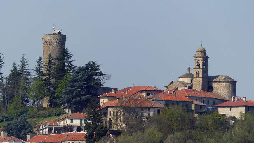
Roccaverano
14050 Roccaverano AT
Italy
Punto di arrivo
Monastero Bormida
14058 Monastero Bormida AT
Italy
Come arrivare
Auto: da Asti direzione Acqui Terme - Nizza Monferrato - Canelli. Da Milano casello Alessandria Sud direzione Acqui Terme - Nizza Monferrato - Canelli. Da Genova casello Ovada direzione Acqui Terme - Nizza Monferrato - Canelli.
Treno (www.trenitalia.com): linea Alessandria - Savona. Stazioni di accesso all'itinerario: Ponti, Montechiaro-Denice, Mombaldone-Roccaverano, Spigno e Merana.
Bus (www.gelosobus.it): linee Acqui T. – Asti; Asti – Canelli – Cortemilia; Cortemilia – Acqui Terme; Cortemilia – Asti; Loazzolo - Canelli.
Descrizione
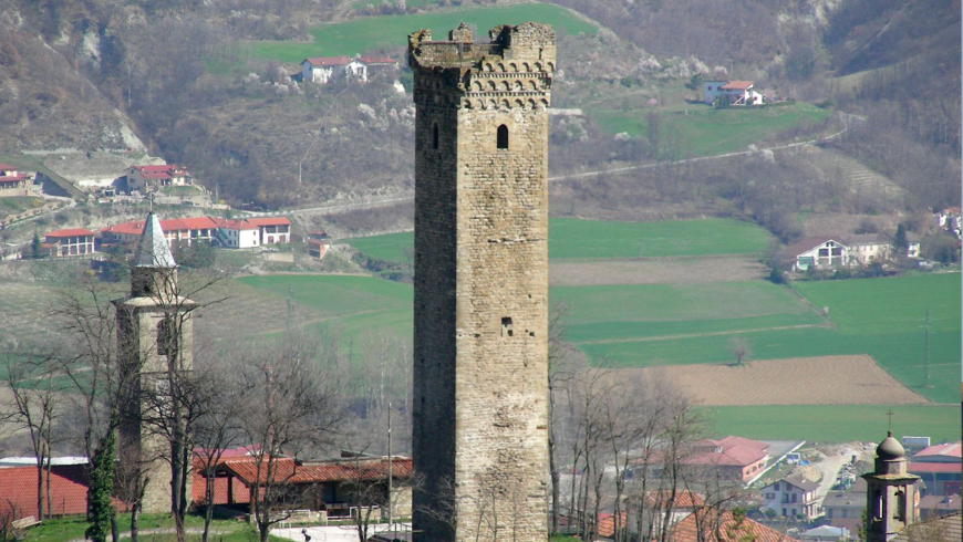
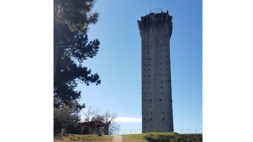
Continue downhill next to the bar, towards the closed Aurora restaurant, on asphalt, cross and take a short short cut to the hairpin bend below (obvious yellow signs) continue on the provincial road, reach the cemetery of San Giovanni with a small Romanesque church. At the fork in the road, take the provincial road 24C for Denice. When you reach another bifurcation stay on the left, after 50 m. take the path on the right uphill that leads to the woods and the 4th tower. Tower of Vengore, isolated on a small hump with adjoining picnic area and services. ( tot. Miles. 20,800, h 1. 45 by O. G. ). From the tower go down on the opposite side following the coloured (colored) path to the car park and continue on the right, cross the provincial road, take the downhill path, at the crossroads with cart road go left on a small road. After 30'; along a small road, on the right, there is a centuries-old oak tree of naturalistic interest, at the base 4. 00 m of circumference. Once arrived on asphalt continue to the right, view of the Bormida di Spigno valley, after 70 m . go right on a dirt road uphill, follow it halfway uphill, you arrive on a hillock with a view of the tower of Denice, from where you go down a path in the woods below and you arrive on a gravel cart road, on the left Roman houses. You walk along the border between the Province of Asti and Alexandria.
When you reach the asphalt go right, and after the votive chapel take the path on the left. Once on asphalt continue straight on towards Denice, at the crossroad stay on the left; after 30 m. take the dirt road on the right slightly uphill, Campassi area, follow the road uphill and downhill and at the fork stay on the right, then at the crossroads continue straight downhill until Santa Libera, small church with adjoining refuge for young people 18 p.(?) (owned by the Municipality of Monastero B to turn to for possible use), (tot. Miles. 26. 700), follow on asphalt uphill, after 30 m. take a small road on the right in front of the vineyard, then at the fork go left, shortly after you arrive on asphalt, continue right and after 50 m left downhill on a path, arrived on asphalt go right, then left again downhill until the wooden telephone pole, go left for 30 m. , leave asphalt and follow grassy road almost flat, after 200 m. back on asphalt, after 50 m. take right dirt road that leads between the houses on the outskirts of M. B. and continuing after a short stretch you will reach the medieval bridge of Monastero Bormida and parking on the right. 5th Tower in the medieval centre.
Along the route immediately after Località Garroni in the direction of Monastero B. da, before reaching Santa Libera, it is possible to deviate the route towards Denice: turn right near the C. la di Denice on path 572. After passing the Bric del Vallone on the left you reach Denice. From the centre of Denice continue on path 572 towards Montechiaro Piana. You rejoin Bonini at the sports ground and from there you continue on the road to Montechiaro Piana.
From the centre of Monastero B. da continue on path 500A until you reach S. Desiderio. It connects to path 571 of the itinerary of the Country Churches and Calanchi. After a few minutes you reach the centre of Ponti. Along this stretch there are the following points of support: Monastero Bormida village rest area, S. Desiderio rest area and Ponti rest area.
Recommended period
Accessible to people with disabilities
Support points
Area picnic e servizi presso torre di Vengore;
Rifugio presso Chiesetta di Santa Libera.
Interest points
Rovere secolare di interesse naturalistico;
Vista sulla torre di Denice.
Dettagli
Profilo altimetrico
Dati tecnici
- Code
- GCT
- Classification
- Provincial
- Cell phone coverage
Copertura 4G in tutti i comuni dell'itinerario. Attenzione alcune parti di itinerario non vicine a centri abitati sono sprovviste di copertura cellulare per brevi tratti.
- Country
- Italy
- Region
- Piemonte
- Province
- Alessandria
- Asti
- Devotional relevance
- No
- Historical relevance
- No
- Ultima data di aggiornamento
- 15/12/2023
Altre info
Accommodation facilities

Structure qualification
Isabella
Località
MONASTERO BORMIDA (AT)
Structure qualification
San desiderio
Località
MONASTERO BORMIDA (AT)
Structure qualification
IL grappolo In Langa
Località
MONASTERO BORMIDA (AT)
Structure qualification
Residenza aude'
Località
MONASTERO BORMIDA (AT)
Structure qualification
Sessanea
Località
MONASTERO BORMIDA (AT)
Tappe
Tappe attività
-
0Tour of the 5 towers in the Asti region of LangheLunghezza68.40 kmTempo18 hoursDifficoltàEasy
-
1Tour of the 5 towers in the Asti region of Langhe: Stage 1 Canelli – Monastero (Monastery) BormidaLunghezza18.00 kmTempo5 hoursDifficoltàEasy
-
2Tour of the 5 towers in the Asti region of Langhe: Stage 2 Monastero (Monastery) Bormida – RoccaveranoLunghezza17.00 kmTempo4 hours 30 minutesDifficoltàEasy
-
2ATour of the 5 towers in the Asti region of Langhe: Stage 2A Roccaverano - Monastero (Monastery) BormidaLunghezza10.00 kmTempo3 hoursDifficoltàEasy
-
3Tour of the 5 towers in the Asti region of Langhe: Stage 3 Roccaverano – MeranaLunghezza23.40 kmTempo5 hours 30 minutesDifficoltàEasy