- Lenght
- 17.00 km
- Tempo
- 4 hours 30 minutes
- Tappa
- Difficulty
- Easy
- Itinerary index
- No
Informazioni
Punto di partenza
Monastero Bormida
14058 Monastero Bormida AT
Italy
Punto di arrivo
Roccaverano
14050 Roccaverano AT
Italy
Come arrivare
Auto: da Asti direzione Acqui Terme - Nizza Monferrato - Canelli. Da Milano casello Alessandria Sud direzione Acqui Terme - Nizza Monferrato - Canelli. Da Genova casello Ovada direzione Acqui Terme - Nizza Monferrato - Canelli.
Treno (www.trenitalia.com): linea Alessandria - Savona. Stazioni di accesso all'itinerario: Ponti, Montechiaro-Denice, Mombaldone-Roccaverano, Spigno e Merana.
Bus (www.gelosobus.it): linee Acqui T. – Asti; Asti – Canelli – Cortemilia; Cortemilia – Acqui Terme; Cortemilia – Asti; Loazzolo - Canelli.
Descrizione
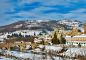
Departure from Monastero Bormida from the car park on the east side of the medieval bridge. Proceed to provincial road (Strada provinciale) 56, straight from the bridge, slightly uphill, pass the small church of S. Rocco on the left and take a slightly downhill grassy road on the right that continues along the Rio Tatorba, follow it until it crosses a dirt road, turn right, pass a concrete ford on the stream and go straight on uphill. When you reach Cascina Galli, turn left on asphalt for 30 m. , turn left behind the building on a dirt road that climbs uphill with hairpin bends into the woods and becomes a path on the ridge. Always among woods of chestnut trees, downy oaks and a lot of broom, reach Bric del Moro, continue on level ground on a panoramic stretch, at the fork turn left downhill, then always left on a small road, near a hairpin bend you can see a ruined house; now you walk near large Muscat vineyards. Continue on a flat road on the right out of the woods near open and cultivated fields. You have arrived in the locality of Grassi.
Take the little path on the left, and after a short downhill passage, continue on a protected and equipped path, along the edge of a gorge 120 m deep. When you reach the asphalt road go left through open fields in a wide valley, you are in B. Grassi, continue and at the crossroads turn left, then right again. At the top of the little climb between rows of trees leave the asphalt road and take a grassy road on the right (pay attention) uphill at a fence with a white - red chain, near the farmhouse, then flat again on the ridge. Continue left on a gravel road with hairpin bends, flank C. Bonina slightly uphill. Continue always on a small road with ups and downs, cross the courtyard of a farmhouse. At the junction with asphalted road turn left to Loc. Galli, after the above mentioned village reach the Madonna del Rosario Chapel and continue on the Galli road, when you reach the crossroads go left on a gravel road. When you arrive on the asphalted part after 20 m. take the path on the right with the indication S. Giorgio Scarampi next to cultivated fields. Arrived back on a asphalted road uphill, bend left for the town and reach the 1st Tower.
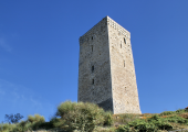
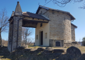
From the small square of San Giorgio Scarampi, remarkable point with a vast panorama, continue at the bottom of the square on the right downhill, with indication Olmo Gentile, on the provincial road. Reach the little church of S. Carlo Borromeo with annexed picnic area. At the intersection follow the road on the left for Roccaverano. After 250 m. leave the provincial road, continue to the right on an uphill dirt road, at the second hairpin bend, take the small path on the ridge next to the cultivated fields, continue downhill and take the asphalted road for 50 m, follow a grassy road on the left uphill through the woods, flank the cultivated field always on the right, cross the asphalted road and continue on a steep uphill road through the woods. On the Bric delle Forche near the monument in memory of the fallen with the towers of 11. 11. 2001 you can stop and admire the splendid 360° panorama. Once again on asphalted road go right for 50 m. then left on a slightly downhill dirt road. After long ups and downs you will reach the aqueduct cabin; go to the right, after 20 m. continue on a asphalted road towards Olmo Gentile: after the little church of Maria Addolorata you now reach the centre of Olmo Gentile and the 2nd tower. Before the houses there is the cemetery and the picnic area, games (playground) and services. Go back to the aqueduct cabin and take the steeply uphill road to the right of the building, arrived on the ridge, Pian Frascaro, continue on gentle ups and downs alongside fields and bush with further wonderful views over the Alps and neighbouring valleys in favourable weather (q. 740 m. ).
When you arrive on a paved road, go left for 50 m. , and take a small road on the left. Back on asphalt go left on the provincial road, at the junction stay on the left but after 300 m. go right to the town centre (center), after 50 m. go right, stepladder, then right continue in front of the former town hall and get to the main square of Roccaverano and bypassing the church reach the foot of the 3rd tower (if you want to climb the tower ask for the keys at the bar on the square).
Recommended period
Accessible to people with disabilities
Support points
Area di sosta Monastero Bormida paese;
Ex scuola Grassi di Bubbio;
Area pic-nic presso Chiesetta di S.Carlo Borromeo;
Area attrezzata per picnic, giochi e servizi di Olmo Gentile.
Interest points
Bric del Moro;
chiesetta di S. Rocco;
Capp. la Galli;
Bric dei Galli;
Punto panoramico da piazzetta di San Giorgio Scarampi;
Bric delle Forche (punto panoramico)
Cessole: Parrocchia NS Assunta e Santuario Mad. della Neve
Vesime: Castello, Palazzo comunale, Chiesa NS Assunta di S. Martino, Areoporto partigiano, Pieve di S. Maria
San Giorgio Scarampi: Parrocchia di S. Giorgio, Oratorio Immacolata Concezione
Olmo Gentile: Parrocchia di S. Martino
Roccaverano: Chiesa cimiteriale di S. Giovanni Battista e Parrocchia di S. Maria Annunziata
Dettagli
Profilo altimetrico
Dati tecnici
- Code
- GCT
- Classification
- Provincial
- Cell phone coverage
Copertura 4G in tutti i comuni dell'itinerario. Attenzione alcune parti di itinerario non vicine a centri abitati sono sprovviste di copertura cellulare per brevi tratti.
- Country
- Italy
- Region
- Piemonte
- Province
- Asti
- Devotional relevance
- No
- Historical relevance
- No
- Ultima data di aggiornamento
- 15/12/2023
Altre info
Accommodation facilities

Isabella
- Località
MONASTERO BORMIDA (AT)

San desiderio
- Località
MONASTERO BORMIDA (AT)

Il grappolo in langa
- Località
MONASTERO BORMIDA (AT)

Residenza aude'
- Località
MONASTERO BORMIDA (AT)

Sessanea
- Località
MONASTERO BORMIDA (AT)
Tappe
Tappe attività
-
0Tour of the 5 towers in the Asti region of LangheLunghezza68.40 kmTempo18 hoursDifficoltàEasy
-
1Tour of the 5 towers in the Asti region of Langhe: Stage 1 Canelli – Monastero (Monastery) BormidaLunghezza18.00 kmTempo5 hoursDifficoltàEasy
-
2Tour of the 5 towers in the Asti region of Langhe: Stage 2 Monastero (Monastery) Bormida – RoccaveranoLunghezza17.00 kmTempo4 hours 30 minutesDifficoltàEasy
-
2ATour of the 5 towers in the Asti region of Langhe: Stage 2A Roccaverano - Monastero (Monastery) BormidaLunghezza10.00 kmTempo3 hoursDifficoltàEasy
-
3Tour of the 5 towers in the Asti region of Langhe: Stage 3 Roccaverano – MeranaLunghezza23.40 kmTempo5 hours 30 minutesDifficoltàEasy


