- Lenght
- 5.90 km
- Tempo
- 1 hour 40 minutes
- Tappa
- Max altitude
- 315 m
- Descent elevation loss
- 25 m
- Difficulty
- Easy
- Itinerary index
- No
Informazioni
Punto di partenza
Castell'Alfero
14033 Castell'Alfero AT
Italy
Punto di arrivo
Chiesa della Natività di Frinco
Via Castello, 1
14030 Frinco AT
Italy
Come arrivare
Descrizione
The route, which goes from Castell’Alfero to Frinco, is 6 km and a half long. Estimated travel time: 1 hour and a half. The difference in level is 25 m.
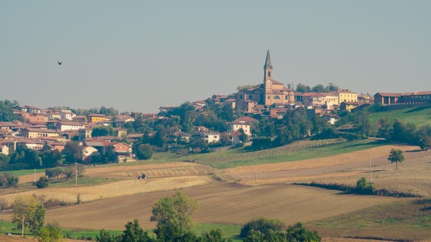
Castell’Alfero, located in Basso Monferrato, is a village known for being the place where Giovanni Battista de Rolandis, the man who conceived the Italian flag, was born; but also for Gianduja, the carnival mask that is the symbol of Piedmont. The village offers tourists and cyclotourists the opportunity to visit the castle of Earls Amico, the museum of peasant life named “Il Ciar”, the churches of Castell’Alfero and Callianetto, the small house of Gianduja, the rose garden “Sorpresa” with more than 500 ancient roses in Serra Perno.
You can also visit the small romanic church of Madonna della Neve, surrounded by nature and situated between Castell’Alfero and Frinco.
The point of departure of this stop is located at piazza Mazzini. Go down Via Amico and turn left into Via Moriasco. It is a paved road that leads to regione Valle passing through a grove with few houses on both sides. Take Via Valle, go straight ahead, go past a small bridge where Valle river flows underneath, and go up the slope towards località Boana for about 200 m. Turn left and go straight ahead towards Moncucco for about 850 m, until reaching the small inhabited area. Go past the houses, take the way in the grove, and go straight on for less than 1 km. You get near to the romanic church of Madonna della Neve, which is one of the most important churces in the area of Asti for its brickwork, its great sculptures, and its unique cylindrical bell tower.
Turn right. If you want to see the whole church you have to go straight and go up the slope for about 200 m though.
Back to the route, turn right and go down the slope for about 400 m in a path of groves until reaching a landscape of farmlands. Go down the road for about 350 m. There is a farmhouse on the left.
Take the dirt road that connected Castell’Alfero with Frinco before parallel Strada Provinciale 22 (Asti-Chivasso) was built.
Go down the road for about 2 km and a half, then turn right and go straight until you come to the intersection with Strada Provinciale 36. Turn left into Strada Provinciale 36 and get to the inhabited area of Frinco, in Via Vittorio Emanuele II, where the route ends.
One of the symbols of Frinco is the castle built around 1200. Unfortunately, the building has had a tormented past: in the ‘60s, “Morlini” company bought it and later put it up for auction after going bankrupt. Then, Pica Alfieri family bought it in 1992, but sold it to an estate agency, which went bankrupt in 2012. After years of abandonment, a part of it collapsed. Nowadays, the municipality is looking for funding which can be used to ensure the safety of the building.
Recommended period
Accessible to people with disabilities
Dettagli
Profilo altimetrico
Dati tecnici
- Code
- CCC
- Classification
- Provincial
- Country
- Italy
- Region
- Piemonte
- Province
- Asti
- Devotional relevance
- No
- Historical relevance
- No
- Ultima data di aggiornamento
- 15/12/2023
Altre info
Accommodation facilities

Tappe
Tappe attività
-
0Cammini delle alte colline ombrose e delle colline chiare (CCC)Lunghezza160.50 kmTempo1 day 13 hours 30 minutesDifficoltàEasy
-
1Cammini delle alte colline ombrose e delle colline chiare: Tappa 1: Chiesa della Natività di Frinco - Chiusano d'AstiLunghezza9.70 kmTempo2 hours 15 minutesDifficoltàEasy
-
2Cammini delle alte colline ombrose e delle colline chiare: Tappa 2: Chiusano d'Asti - SoglioLunghezza13.90 kmTempo3 hours 20 minutesDifficoltàEasy
-
3Cammini delle alte colline ombrose e delle colline chiare: Tappa 3: Soglio - CorsioneLunghezza11.20 kmTempo2 hours 40 minutesDifficoltàEasy
-
4Cammini delle alte colline ombrose e delle colline chiare: Tappa 4: Corsione - ToncoLunghezza11.50 kmTempo2 hours 50 minutesDifficoltàEasy
-
5Cammini delle alte colline ombrose e delle colline chiare: Tappa 5: Tonco - Frazione SanicoLunghezza11.80 kmTempo2 hours 45 minutesDifficoltàEasy
-
6Cammini delle alte colline ombrose e delle colline chiare: Tappa 6: Frazione Sanico - MoncalvoLunghezza8.10 kmTempo2 hoursDifficoltàEasy
-
6ACammini delle alte colline ombrose e delle colline chiare: Tappa 6A: Stazione di Penango - Grana, bivio Tappa 07Lunghezza6.60 kmTempo1 hour 35 minutesDifficoltàEasy
-
7Cammini delle alte colline ombrose e delle colline chiare: Tappa 7: Moncalvo - GranaLunghezza14.60 kmTempo3 hours 30 minutesDifficoltàEasy
-
8Cammini delle alte colline ombrose e delle colline chiare: Tappa 8: Grana - CasorzoLunghezza11.10 kmTempo2 hours 40 minutesDifficoltàEasy
-
9Cammini delle alte colline ombrose e delle colline chiare: Tappa 9: Casorzo - ViarigiLunghezza6.70 kmTempo1 hour 45 minutesDifficoltàEasy
-
9ACammini delle alte colline ombrose e delle colline chiare: Tappa 9A: Viarigi - Cuccaro MonferratoLunghezza13.30 kmTempo3 hours 10 minutesDifficoltàEasy
-
10Cammini delle alte colline ombrose e delle colline chiare: Tappa 10: Viarigi - ScurzolengoLunghezza13.00 kmTempo2 hours 50 minutesDifficoltàEasy
-
11Cammini delle alte colline ombrose e delle colline chiare: Tappa 11: Scurzolengo - CallianoLunghezza13.50 kmTempo3 hours 10 minutesDifficoltàEasy
-
12Cammini delle alte colline ombrose e delle colline chiare: Tappa 12: Calliano - Castell'AlferoLunghezza9.60 kmTempo2 hours 20 minutesDifficoltàEasy
-
13Cammini delle alte colline ombrose e delle colline chiare: Tappa 13: Castell'Alfero - Chiesa della Natività di FrincoLunghezza5.90 kmTempo1 hour 40 minutesDifficoltàEasy