- Lenght
- 6.70 km
- Tempo
- 1 hour 45 minutes
- Tappa
- Max altitude
- 315 m
- Descent elevation loss
- 30 m
- Difficulty
- Easy
- Itinerary index
- No
Informazioni
Punto di partenza
Casorzo
14032 Casorzo AT
Italy
Punto di arrivo
Viarigi
14030 Viarigi AT
Italy
Come arrivare
Descrizione
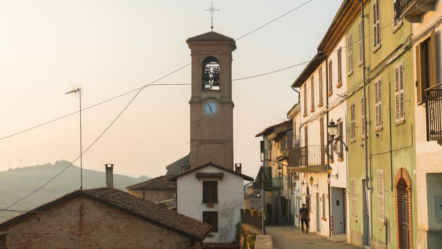
The point of departure of this stop is located in Casorzo, a village set on top of a hill at 275 m of altitude. It is situated on the border of the province of Alessandria, where the main features of the scenery are vineyards. In fact, its economy is primarily based on agricolture with a particular attention to the cultivation of the grapevine, basic to Malvasia wine production. The population of Casorzo has very ancient origins that date back to Celtic times; Plinio Casurciulli brought together some cheesemakers for defending the village. After him the names Casurcium or Casurtium.
The route is 7.850 m long. The point of departure is located in Via Mazzini, next to the church of San Sebastiano. The difference in level is 30 m. Estimated travel time: 1 hour and 50 minutes.
Heading west for about 500 m, you get to the intersection with via San Lodovico. Turn left and see the Casorzo winery that has led Malvasia of Casorzo to establish itself as one of the best Italian dessert wines.
Go down the road for about 600 m, then turn right at the intersection. You will be immersed into grapewine cultivations.
Keep going down this road surrounded by vineyards for about 1 km until reaching an ancient rural (but refurbished) house on the left. Go past the rural house, then go down the dirt road. The landscape slowly changes, alternating vineyards with fields. After about 350 m, turn left and go straight for about 400 m until you reach an intersection with a dirt road. Turn right. At first there are fields both on the right and the left side. Then, just farmlands on the left. After about 1 km, turn left and go down the dirt road surrounded by farmlands for about 500 m. Leave the dirt road, turn left and then go down for about 150 m in the shade of trees.
When you are at the intersection with Via Valfossato, turn right, pass through the farmlands and hazelnut groves for about 350 m until reaching an intersection with Strada Provinciale 14. After 300 m take the dirt road on the right.
After 100 m, turn left and go straight in the woods for about 400 m until reaching the cemetery of Viarigi. A cypresses street, also entrance of the cemetery, leads you to Via Cavour. When you are there go straight ahead for about 300 m until you reach an intersection. Turn left into Strada Provinciale 29 and go straight on for about 400 m. You will see the church of San Silverio on the right, and the post office on the left. At the end of the road you come to an intersection. Turn left and go straight ahead for about 200 m. At the end of the stop there is a spectacular landscape of farmlands that alternates with woods and hazelnut groves. In Viarigi there is also the famous Torre dei Segnali, brick-built 25 m high. This tower is the symbol of the village; it appears in the coat of arms of the municipality. Originally it was a lookout tower together with the towers of Montemagno and San Salvatore Monferrato. Old texts say that this one was used for communicating by fires, smokes, and flashes of sunlight.
Recommended period
Accessible to people with disabilities
Dettagli
Profilo altimetrico
Dati tecnici
- Code
- CCC
- Classification
- Provincial
- Country
- Italy
- Region
- Piemonte
- Province
- Asti
- Devotional relevance
- No
- Historical relevance
- No
- Ultima data di aggiornamento
- 15/12/2023
Tappe
Tappe attività
-
0Cammini delle alte colline ombrose e delle colline chiare (CCC)Lunghezza160.50 kmTempo1 day 13 hours 30 minutesDifficoltàEasy
-
1Cammini delle alte colline ombrose e delle colline chiare: Tappa 1: Chiesa della Natività di Frinco - Chiusano d'AstiLunghezza9.70 kmTempo2 hours 15 minutesDifficoltàEasy
-
2Cammini delle alte colline ombrose e delle colline chiare: Tappa 2: Chiusano d'Asti - SoglioLunghezza13.90 kmTempo3 hours 20 minutesDifficoltàEasy
-
3Cammini delle alte colline ombrose e delle colline chiare: Tappa 3: Soglio - CorsioneLunghezza11.20 kmTempo2 hours 40 minutesDifficoltàEasy
-
4Cammini delle alte colline ombrose e delle colline chiare: Tappa 4: Corsione - ToncoLunghezza11.50 kmTempo2 hours 50 minutesDifficoltàEasy
-
5Cammini delle alte colline ombrose e delle colline chiare: Tappa 5: Tonco - Frazione SanicoLunghezza11.80 kmTempo2 hours 45 minutesDifficoltàEasy
-
6Cammini delle alte colline ombrose e delle colline chiare: Tappa 6: Frazione Sanico - MoncalvoLunghezza8.10 kmTempo2 hoursDifficoltàEasy
-
6ACammini delle alte colline ombrose e delle colline chiare: Tappa 6A: Stazione di Penango - Grana, bivio Tappa 07Lunghezza6.60 kmTempo1 hour 35 minutesDifficoltàEasy
-
7Cammini delle alte colline ombrose e delle colline chiare: Tappa 7: Moncalvo - GranaLunghezza14.60 kmTempo3 hours 30 minutesDifficoltàEasy
-
8Cammini delle alte colline ombrose e delle colline chiare: Tappa 8: Grana - CasorzoLunghezza11.10 kmTempo2 hours 40 minutesDifficoltàEasy
-
9Cammini delle alte colline ombrose e delle colline chiare: Tappa 9: Casorzo - ViarigiLunghezza6.70 kmTempo1 hour 45 minutesDifficoltàEasy
-
9ACammini delle alte colline ombrose e delle colline chiare: Tappa 9A: Viarigi - Cuccaro MonferratoLunghezza13.30 kmTempo3 hours 10 minutesDifficoltàEasy
-
10Cammini delle alte colline ombrose e delle colline chiare: Tappa 10: Viarigi - ScurzolengoLunghezza13.00 kmTempo2 hours 50 minutesDifficoltàEasy
-
11Cammini delle alte colline ombrose e delle colline chiare: Tappa 11: Scurzolengo - CallianoLunghezza13.50 kmTempo3 hours 10 minutesDifficoltàEasy
-
12Cammini delle alte colline ombrose e delle colline chiare: Tappa 12: Calliano - Castell'AlferoLunghezza9.60 kmTempo2 hours 20 minutesDifficoltàEasy
-
13Cammini delle alte colline ombrose e delle colline chiare: Tappa 13: Castell'Alfero - Chiesa della Natività di FrincoLunghezza5.90 kmTempo1 hour 40 minutesDifficoltàEasy