Galleria foto
- Lenght
- 24.00 km
- Tempo
- 6 hours 30 minutes
- Tappa
Elenco risultati
- Max altitude
- 1350 m
- Ascent elevation gain
- 1333 m
- Descent elevation loss
- 1191 m
- Difficulty
- Hiking
- Itinerary index
- No
Informazioni
Punto di partenza
Chiesa della Madonnina o dell'Assunta
Piazza Vermenagna
12019 Vernante CN
Italy
Punto di arrivo
Roccavione
Via delle Fontane 16
12018 Roccavione CN
Italy
Come arrivare
Descrizione
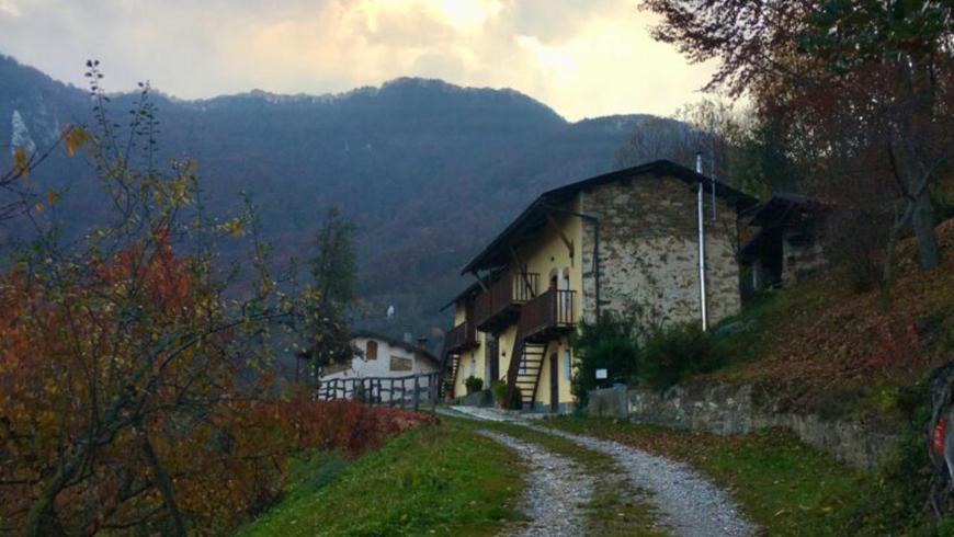
The path of the last stage starts from Piazza Vermenagna, near the Church of Our Lady of the Assumption and follows the path called "La Via di Teit", marked with the initials L26, which goes up the whole watershed ridge between Vallone Secco and Vallone Grande of Vernante. When you reach Tetto Colletto (1.226 m), turn right onto path L5 that goes to Tetti Cersè and then connects with the dirt road that leads to Colla di Prarosso (1.300 m). From Colla di Prarosso continue westward, ignoring the junction to Roaschia, heading towards Colla delle Goderie (1.276) from which you can go back directly to Robilante along the Vallone di Bralongia (L39). From Colla delle Goderie continue westward until you take the path to Tetti Sariund and Tetto Fasse (1.156 m), through beech woods where time seems to have stopped. Continuing downhill you reach T.to Murà (955 m), where you turn left towards T.to Bunassera and then to Fraz. Agnelli (841 m). In correspondence of the Church of S. Giacomo continue for a few tens of meters downhill on the paved municipal road to turn left, uphill towards T.to Cucca (903 m). Once past the partially ruined village, go around the sunny ridge and enter the municipal beech woods that, with a long upward traverse, lead to the clearing of T.to Violetta (968 m). From here you take the dirt road that first leads to the "Bosc Puma" and then continues through a series of villages interspersed with the mosaic of meadows and surrounding chestnut groves. The chestnut landscape will accompany the excursion until the end of the itinerary at the public gardens of Roccavione. The route links in this order: T.to Maigre, T.to Firens, T.to Centin, T.to Angelo Custode, T.to Griva, T.to Cioma.
Accessible to people with disabilities
Dettagli
Profilo altimetrico
Dati tecnici
- Code
- ADV
- Classification
- Provincial - Mid and Low Altitude
- Country
- Italy
- Region
- Piemonte
- Province
- Cuneo
- Devotional relevance
- No
- Historical relevance
- No
- Ultima data di aggiornamento
- 15/12/2023
Altre info

Tappe
Tappe attività
-
0Anello del Vermenagna (ADV)Lunghezza76.20 kmTempo11 hours 30 minutesDifficoltàHiking
-
1Anello del Vermenagna - Stage 1: Roccavione - VernanteLunghezza18.70 kmTempo5 hours 15 minutesDifficoltàHiking
-
1AAnello del Vermenagna - Stage 1A: Tetto Caia - Tetto TolaLunghezza2.60 kmTempo30 minutesDifficoltàHiking
-
2Anello del Vermenagna - Stage 2: Vernante - Limone PiemonteLunghezza14.50 kmTempo5 hoursDifficoltàHiking
-
3Vermenagna Ring - Stage 3: Limone Piemonte - Chiesa della Madonnina o dell'AssuntaLunghezza10.70 kmTempo3 hours 45 minutesDifficoltàHiking
-
3AAnello del Vermenagna - Stage 3A: Tetto Fustin - Tetto CollettoLunghezza5.70 kmTempo1 hourDifficoltàHiking
-
4Vermenagna Ring - Stage 4: Chiesa della Madonnina o dell'Assunta - RoccavioneLunghezza24.00 kmTempo6 hours 30 minutesDifficoltàHiking