- Lenght
- 18.70 km
- Tempo
- 5 hours 15 minutes
- Tappa
- Max altitude
- 990 m
- Ascent elevation gain
- 1043 m
- Descent elevation loss
- 892 m
- Difficulty
- Hiking
- Itinerary index
- No
Informazioni
Punto di partenza
Roccavione
Via delle Fontane 16
12018 Roccavione CN
Italy
Punto di arrivo
Vernante
Via Mistral
12019 Vernante CN
Italy
Come arrivare
Descrizione
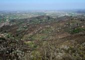
The first part of the route follows the old municipal road that connected Roccavione with Robilante, running along the sunny side of the valley. Once in Tetto Sales, leave the flat asphalt road to climb pleasantly through the chestnut groves until you reach the watershed ridge between the Vermenagna and Colla Valleys. The route follows the ridge and is very panoramic, with unique views both towards the upper valley and the plain behind. The route touches in succession 7 votive pillars characterized by different histories and rich in local culture. Numerous excursion alternatives join the route at high altitude, guaranteeing a great plasticity to the itinerary and offering easy connections with the valley bottom. After about 7 km you reach Colletto del Moro and the country church in Loc. Malandrè in Robilante. With an evocative half-hill route, you cross the whole territory of Robilante at high altitude, among meadows, chestnut groves, villages and charming beech woods. After about 14 km you arrive in the Vallone San Giovanni of Vernante until you reach Tetto Croce. From this point, the route of the Vermenagna Ring continues at high altitude, in the direction of the Ceresole Pass, but for those who want to stop in Vernante, it is necessary to take the descent towards the ruins of the Turusela Castle until reaching the town.
Accessible to people with disabilities
Dettagli
Profilo altimetrico
Dati tecnici
- Code
- ADV
- Classification
- Provincial - Mid and Low Altitude
- Country
- Italy
- Region
- Piemonte
- Province
- Cuneo
- Devotional relevance
- No
- Historical relevance
- No
- Ultima data di aggiornamento
- 22/10/2024
Altre info
Tappe
Tappe attività
-
0Anello del Vermenagna (ADV)Lunghezza76.20 kmTempo11 hours 30 minutesDifficoltàHiking
-
1Anello del Vermenagna - Stage 1: Roccavione - VernanteLunghezza18.70 kmTempo5 hours 15 minutesDifficoltàHiking
-
1Colle della Maddalena > BersezioLunghezza15.40 kmTempo5 hours 15 minutesDifficoltà
-
1AAnello del Vermenagna - Stage 1A: Tetto Caia - Tetto TolaLunghezza2.60 kmTempo30 minutesDifficoltàHiking
-
2Anello del Vermenagna - Stage 2: Vernante - Limone PiemonteLunghezza14.50 kmTempo5 hoursDifficoltàHiking
-
2La Routo-Tappa 2:Bersezio - FerrereLunghezza13.60 kmTempo4 hours 45 minutesDifficoltà
-
3Vermenagna Ring - Stage 3: Limone Piemonte - Chiesa della Madonnina o dell'AssuntaLunghezza10.70 kmTempo3 hours 45 minutesDifficoltàHiking
-
3La Routo-Tappa 3:Ferrere - PontebernardoLunghezza10.00 kmTempo3 hours 30 minutesDifficoltà
-
3AAnello del Vermenagna - Stage 3A: Tetto Fustin - Tetto CollettoLunghezza5.70 kmTempo1 hourDifficoltàHiking
-
4Vermenagna Ring - Stage 4: Chiesa della Madonnina o dell'Assunta - RoccavioneLunghezza24.00 kmTempo6 hours 30 minutesDifficoltàHiking
-
4La Routo-Tappa 4: Pontebernardo - SambucoLunghezza8.80 kmTempo3 hoursDifficoltàEscursionistico
-
5La Routo-tappa 5: Sambuco - VinadioLunghezza15.80 kmTempo5 hours 30 minutesDifficoltàEscursionistico
-
6La Routo-Tappa 6: Vinadio-DemonteLunghezza13.70 kmTempo4 hours 15 minutesDifficoltàFacile
-
6La Routo - Tappa 6: Vinadio-DemonteLunghezza13.70 kmTempo4 hours 15 minutesDifficoltàEscursionistico
-
7La Routo - Tappa 7: Demonte-ParaloupLunghezza16.30 kmTempo6 hoursDifficoltàTuristico
-
8La Routo-tappa 8: Paraloup - ValloriateLunghezza7.80 kmTempo3 hours 30 minutesDifficoltàEscursionistico
-
9La Routo-tappa 9: Valloriate-Borgo San DalmazzoLunghezza23.80 kmTempo7 hours 30 minutesDifficoltàEscursionistico
-
9ALa Routo-tappa 9A : Castelletto di Roccasparvera-VignoloLunghezzaTempoDifficoltàEscursionistico

