Galleria foto
- Lenght
- 10.70 km
- Tempo
- 3 hours 45 minutes
- Tappa
Elenco risultati
- Max altitude
- 1575 m
- Ascent elevation gain
- 640 m
- Descent elevation loss
- 835 m
- Difficulty
- Hiking
- Itinerary index
- No
Informazioni
Punto di partenza
Limone Piemonte
Limone Piemonte CN
Italy
Punto di arrivo
Chiesa della Madonnina o dell'Assunta
Piazza Vermenagna
12019 Vernante CN
Italy
Come arrivare
Descrizione
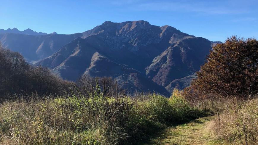
From the center of Limone, go north along the path that leads to the small church in Località S. Maurizio (1,066 m) and continue along the forest trail that leads to Colletto di Cagera (1.577 m), the highest point of the Vermenagna ring and of great scenic value. Continuing towards North-West, take the downhill path that leads to Vernate through the Sausa Valley. The upper part of the path is characterized by beech woods that, descending in altitude, give way to meadows, pastures and chestnut groves in a pleasant setting of rural settlements that have remained unchanged over time and have no road connections. When you reach Tetto Fustin you can turn towards Vernante and close the Stage, or you can take the Renetta Valley and climb to Tetto Colletto, to reach Colla di Prarosso (1,300 m), and from here decide whether to continue towards Robilante or Roaschia (Gesso Valley). The route of the third stage ends near the Church of the Madonnina or Assunta
Accessible to people with disabilities
Dettagli
Profilo altimetrico
Dati tecnici
- Code
- ADV
- Classification
- Provincial - Mid and Low Altitude
- Country
- Italy
- Region
- Piemonte
- Province
- Cuneo
- Devotional relevance
- No
- Historical relevance
- No
- Ultima data di aggiornamento
- 15/12/2023
Altre info

Tappe
Tappe attività
-
0Anello del Vermenagna (ADV)Lunghezza76.20 kmTempo11 hours 30 minutesDifficoltàHiking
-
1Anello del Vermenagna - Stage 1: Roccavione - VernanteLunghezza18.70 kmTempo5 hours 15 minutesDifficoltàHiking
-
1AAnello del Vermenagna - Stage 1A: Tetto Caia - Tetto TolaLunghezza2.60 kmTempo30 minutesDifficoltàHiking
-
2Anello del Vermenagna - Stage 2: Vernante - Limone PiemonteLunghezza14.50 kmTempo5 hoursDifficoltàHiking
-
3Vermenagna Ring - Stage 3: Limone Piemonte - Chiesa della Madonnina o dell'AssuntaLunghezza10.70 kmTempo3 hours 45 minutesDifficoltàHiking
-
3AAnello del Vermenagna - Stage 3A: Tetto Fustin - Tetto CollettoLunghezza5.70 kmTempo1 hourDifficoltàHiking
-
4Vermenagna Ring - Stage 4: Chiesa della Madonnina o dell'Assunta - RoccavioneLunghezza24.00 kmTempo6 hours 30 minutesDifficoltàHiking