Galleria foto
- Lenght
- 14.50 km
- Tempo
- 5 hours
- Tappa
Elenco risultati
- Max altitude
- 1500 m
- Ascent elevation gain
- 975 m
- Descent elevation loss
- 773 m
- Difficulty
- Hiking
- Itinerary index
- No
Informazioni
Punto di partenza
Vernante
Via Mistral
12019 Vernante CN
Italy
Punto di arrivo
Limone Piemonte
12015 Limone Piemonte CN
Italy
Come arrivare
Descrizione
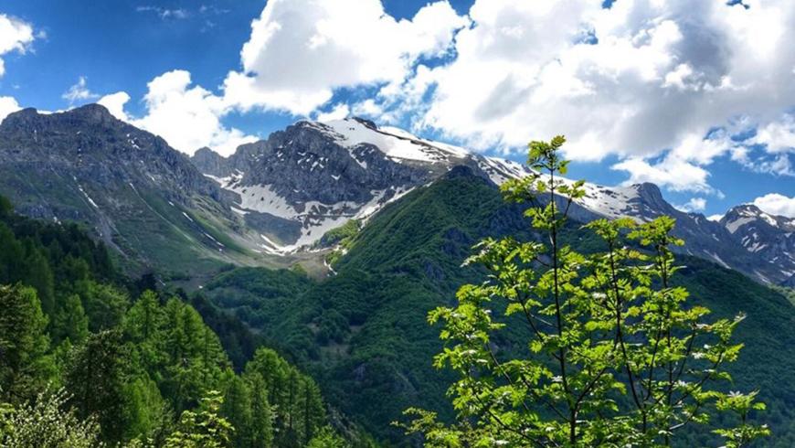
From the built-up area of Vernante, go up towards East, towards T.to Cesa, T.to Bodino, passing by Fontana Romana, from which you go down into Vallone Salet. Afterwards, go back to T.to Tola. After a short flat traverse, cross the Vallone di Santa Lucia and descend to T.to Rullin and T.to Polendo, immersed in a pleasant alternation of woods and pastures. Follow T.to Risso, T.to Cabilla, T.to Butel until you reach the Vallone di Ceresole and the Agriturismo L'Agrifoglio. The route continues southward touching the Vallone di San Bernardo with the homonymous rural church and the golf course. After the church, go east on the dirt track towards the southern slopes of Costa Testette of Bric Costa Rossa (2.404 m) up to Casali Brozer. Now the route becomes steeper and the trail leads to the 1.481 m Colletto dell'Almellina. Following the indications of trail L11, take the descent that leads to the village of Limone, skirting the pastureland basin of Cros
Accessible to people with disabilities
Dettagli
Profilo altimetrico
Dati tecnici
- Code
- ADV
- Classification
- Provincial - Mid and Low Altitude
- Country
- Italy
- Region
- Piemonte
- Province
- Cuneo
- Devotional relevance
- No
- Historical relevance
- No
- Ultima data di aggiornamento
- 22/10/2024
Altre info

Tappe
Tappe attività
-
0Anello del Vermenagna (ADV)Lunghezza76.20 kmTempo11 hours 30 minutesDifficoltàHiking
-
1Anello del Vermenagna - Stage 1: Roccavione - VernanteLunghezza18.70 kmTempo5 hours 15 minutesDifficoltàHiking
-
1AAnello del Vermenagna - Stage 1A: Tetto Caia - Tetto TolaLunghezza2.60 kmTempo30 minutesDifficoltàHiking
-
2Anello del Vermenagna - Stage 2: Vernante - Limone PiemonteLunghezza14.50 kmTempo5 hoursDifficoltàHiking
-
3Vermenagna Ring - Stage 3: Limone Piemonte - Chiesa della Madonnina o dell'AssuntaLunghezza10.70 kmTempo3 hours 45 minutesDifficoltàHiking
-
3AAnello del Vermenagna - Stage 3A: Tetto Fustin - Tetto CollettoLunghezza5.70 kmTempo1 hourDifficoltàHiking
-
4Vermenagna Ring - Stage 4: Chiesa della Madonnina o dell'Assunta - RoccavioneLunghezza24.00 kmTempo6 hours 30 minutesDifficoltàHiking