Galleria foto

- Lenght
- 76.20 km
- Tempo
- 11 hours 30 minutes
- Max altitude
- 1575 m
- Ascent elevation gain
- 3800 m
- Descent elevation loss
- 3800 m
- Difficulty
- Hiking
- Itinerary index
- Yes
Informazioni
Punto di partenza
Roccavione
Via delle Fontane 16
12018 Roccavione CN
Italy
Punto di arrivo
Roccavione
Via delle Fontane 16
12018 Roccavione CN
Italy
Come arrivare
Ferrovia (Linea Cuneo-Nizza)
Trasporti pubblici Autobus ATI (Linea Cuneo-Roccavione-Roaschia)
Consorzio GrandaBus numero verde 800.33.81.71 info@grandabus.it
http://Www.grandabus.it/Index.html
Descrizione
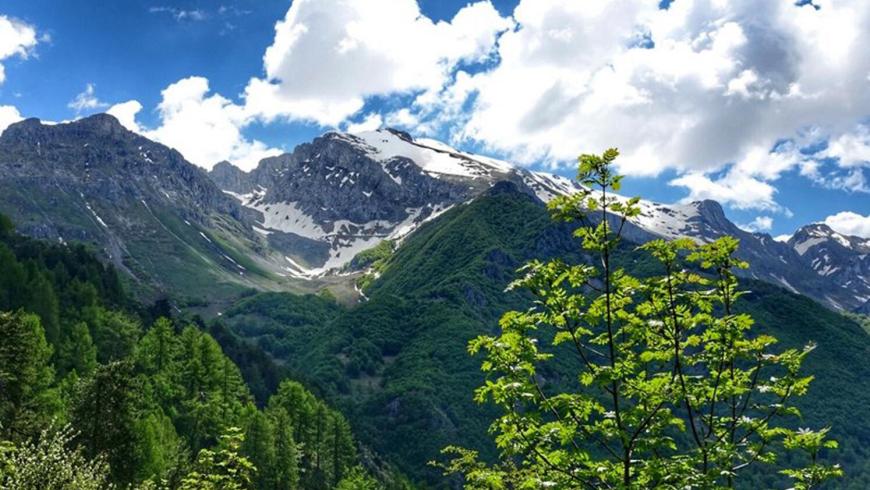
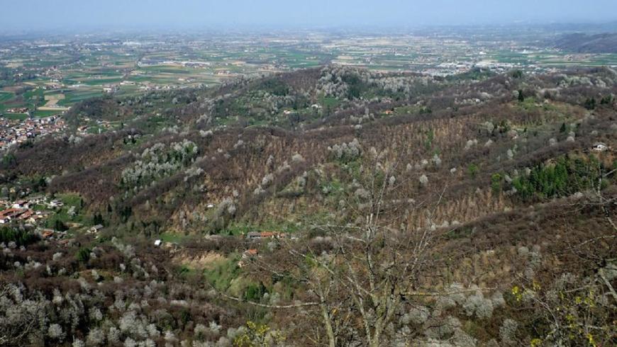
The "Vermenagna Ring" represents a fundamental connection between the lower valley and the transboundary Alpine ridge. By means of this itinerary, it is possible to reach France or connect to the ex-military road "Limone-Monesi" through Colle di Tenda, Colle della Perla, Passo della Boaria or through the adjacent municipalities. The Vermenagna Valley has a great potential for tourism and hiking, especially considering its geographical location and the fact that it is located between the two Protected Areas of the Maritime Alps and the Mercantour National Park in France. The route also has an interregional connection value as it links the trails of the lower Vermenagna Valley, or of the adjacent valleys, with the GTA (Great Crossing of the Alps) and can also represent a valid alternative to the latter, especially in case of snowfall at high altitudes or lack of managed accommodation facilities. On a local scale, the itinerary is configured as a link between the high and low valleys and with respect to the adjacent valleys. It also favors the interchange between train-car/camper-bike and bicycle. The entire Vermenagna Ring can be covered by mountain bike and, during the winter season, it can be covered entirely with snowshoes.
Accessible to people with disabilities
Dettagli
Profilo altimetrico
Dati tecnici
- Code
- ADV
- Classification
- Provincial - Mid and Low Altitude
- Country
- Italy
- Region
- Piemonte
- Province
- Cuneo
- Devotional relevance
- No
- Historical relevance
- No
- Ultima data di aggiornamento
- 15/12/2023
Tappe
Tappe attività
-
0Anello del Vermenagna (ADV)Lunghezza76.20 kmTempo11 hours 30 minutesDifficoltàHiking
-
1Anello del Vermenagna - Stage 1: Roccavione - VernanteLunghezza18.70 kmTempo5 hours 15 minutesDifficoltàHiking
-
1AAnello del Vermenagna - Stage 1A: Tetto Caia - Tetto TolaLunghezza2.60 kmTempo30 minutesDifficoltàHiking
-
2Anello del Vermenagna - Stage 2: Vernante - Limone PiemonteLunghezza14.50 kmTempo5 hoursDifficoltàHiking
-
3Vermenagna Ring - Stage 3: Limone Piemonte - Chiesa della Madonnina o dell'AssuntaLunghezza10.70 kmTempo3 hours 45 minutesDifficoltàHiking
-
3AAnello del Vermenagna - Stage 3A: Tetto Fustin - Tetto CollettoLunghezza5.70 kmTempo1 hourDifficoltàHiking
-
4Vermenagna Ring - Stage 4: Chiesa della Madonnina o dell'Assunta - RoccavioneLunghezza24.00 kmTempo6 hours 30 minutesDifficoltàHiking